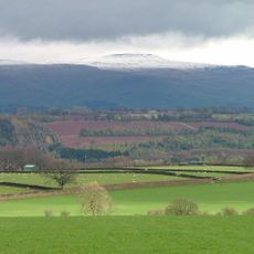
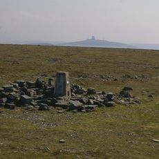
Great Dun Fell, Mountain summit in Cumbria, England
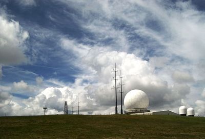
Great Dun Fell is a mountain in the Pennines that reaches 848 meters and can be accessed by a private road from Knock village. A radar station stands at the summit, making this a working facility rather than a purely natural destination.
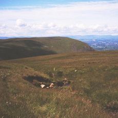
This mountain was a centre for lead mining during the Industrial Revolution, leaving deep channels carved into the slopes. These marks from mining activity remain visible today, revealing the industrial past that shaped the landscape.
The University of Manchester maintained a meteorological observatory on the mountain, conducting research on cloud formation and environmental pollution patterns.
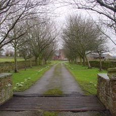
The road to the summit is private and begins at Knock village with an average slope of about 8 percent over 7.5 kilometres. Cyclists use this route despite its private status, so check access conditions before you go.
The radar installation at the peak contributes to air traffic control systems across Northern England and Southern Scotland, making it a critical infrastructure point.
Location: Cumbria
Elevation above the sea: 848 m
GPS coordinates: 54.68415,-2.45157
Latest update: December 7, 2025 20:48
Cross Fell
3.1 km
Cow Green Reservoir
9.4 km
Penrith Hoard
9 km
Burnhope Seat
9.2 km
Ashgill Force
9.6 km
Dufton Pike
5.7 km
St Margaret and St James' Church, Long Marton
9.3 km
Moorhouse and Cross Fell
5.7 km
Church of St Cuthbert
6.5 km
Appleby Fells
8.8 km
Church of St Edmund
8.9 km
Church of St Michael
9.5 km
Church of St Cuthbert
6.6 km
Church of St Lawrence
6.4 km
Church of St Luke
8.1 km
Howgill Castle
5.3 km
Sun Inn
9.4 km
Bridge To North West Of Newbiggin Hall
9 km
Newbiggin Hall
8.9 km
Kirkby Thore Hall
9.5 km
Foresters' Hall
9.6 km
Milestone To South Of Ladygill Bridge
8.3 km
5 Boundary Stones On Border With Cumbria
9.4 km
Milestone To East Of Ashgillside
9.6 km
Milestone 200 Metres East Of Wad Hazel Sike
9.5 km
Milestone To East Of Over Lee House
8.9 km
Milestone 120 Metres East Of Near Crookburn Sike
8.1 km
Milestone Half Way Between Darngill And Crookburn Bridges
7.7 kmVisited this place? Tap the stars to rate it and share your experience / photos with the community! Try now! You can cancel it anytime.
Discover hidden gems everywhere you go!
From secret cafés to breathtaking viewpoints, skip the crowded tourist spots and find places that match your style. Our app makes it easy with voice search, smart filtering, route optimization, and insider tips from travelers worldwide. Download now for the complete mobile experience.
A unique approach to discovering new places❞
— Le Figaro
All the places worth exploring❞
— France Info
A tailor-made excursion in just a few clicks❞
— 20 Minutes