Enable Location

We need your location to show you interesting places around you

Discover nearby places

Find interesting locations and hidden gems around you

Precise directions

Get accurate directions and distances to places

Your location is never shared with other users. It's only used when you tap the location button.

Bindon Hill

Log in to your account

Start exploring — it's free

Trusted by 66,601 travelers worldwide

Continue with Google
Continue with Apple
or

We will send you a code to connect

By continuing, you accept our Terms and Conditions and our Privacy Policy

Check your inbox

We've sent a pincode in your inbox. Please enter the code below.

Discussion Reviews 1 Photos
3.4k Popularity

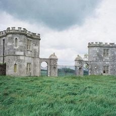
Bindon Hill, Iron Age earthwork in West Lulworth, England

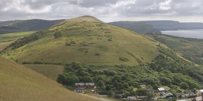
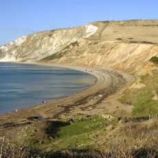
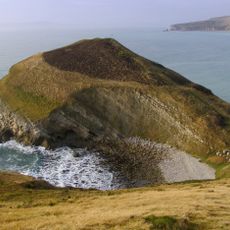
Bindon Hill is an Iron Age contour fort on a coastal ridge near West Lulworth, Dorset, where a long earthen rampart and outer ditch follow the natural shape of the hillside. The enclosed area inside the rampart is large open pasture, which tells us the space was used as much for keeping animals as for defense.

The fort was built during the Iron Age, a period when communities across southern England raised earthworks to protect both people and livestock from raids. Over time, the site fell out of active use but the rampart remained visible in the landscape, and later medieval writers described it as an old boundary.

The name Bindon likely comes from an Old English phrase meaning "peak valley," which reflects the shape of the ridge above the sea. Walkers on the South West Coast Path often pass close to the rampart without realizing they are walking beside one of the oldest land boundaries in this part of England.

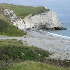
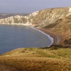
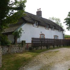
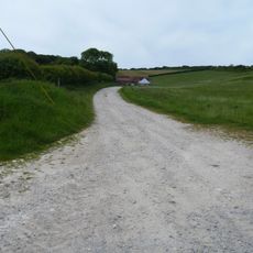
The site can be reached on foot from West Lulworth village or by walking along the South West Coast Path, which passes near the ridge. Parts of the surrounding area overlap with an active military range, so it is worth checking local notices before heading out.

The hill sits partly within an active gunnery range, which means that on some days red flags mark the plateau and access to certain sections is closed. This makes it one of the few scheduled monuments in England where a visitor's timing depends partly on military training schedules.

The community of curious travelers

AroundUs brings together thousands of curated places, local tips, and hidden gems, enriched daily by 60,000 contributors worldwide.

Start exploring
Location
Location
Elevation above the sea
168 m
Part of
Purbeck Hills
GPS coordinates
50.62160,-2.23554
Latest update
March 3, 2026 13:59
Reviews
Share your experience

No review yet

Discussions
Start a discussion...

No discussion yet

« Bindon Hill - Iron Age earthwork in West Lulworth, England » is provided by Around Us (aroundus.com). Images and texts are derived from Wikimedia project under a Creative Commons license. You are allowed to copy, distribute, and modify copies of this page, under the conditions set by the license, as long as this note is clearly visible.

Discover hidden gems everywhere you go!

From secret cafés to breathtaking viewpoints, skip the crowded tourist spots and find places that match your style. Our app makes it easy with voice search, smart filtering, route optimization, and insider tips from travelers worldwide. Download now for the complete mobile experience.

Around Us App Screenshot

A unique approach to discovering new places

Le Figaro

All the places worth exploring

France Info

A tailor-made excursion in just a few clicks

20 Minutes

Around Us
Travel Guide & Maps
Download

Send to your phone

QR Code
1

Open the camera app on your mobile.

2

Point at the QR code with your camera. A notification will appear.

3

Tap the notification to open the link.