Enable Location

We need your location to show you interesting places around you

Discover nearby places

Find interesting locations and hidden gems around you

Precise directions

Get accurate directions and distances to places

Your location is never shared with other users. It's only used when you tap the location button.

Bleaberry Fell

Log in to your account

Start exploring — it's free

Trusted by 62,474 travelers worldwide

Continue with Google
Continue with Apple
or

We will send you a code to connect

By continuing, you accept our Terms and Conditions and our Privacy Policy

Check your inbox

We've sent a pincode in your inbox. Please enter the code below.

Bleaberry Fell

Bleaberry Fell, Mountain summit in Cumbria, England

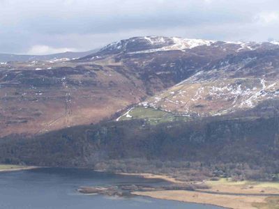
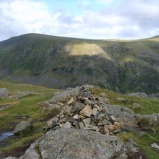
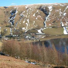
Bleaberry Fell is a mountain summit in the Lake District's central fells, rising to about 590 meters above sea level. The top features a small wind shelter and two notable rock outcrops that mark its highest points.

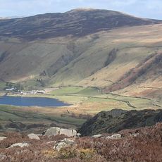
The mountain belongs to the ancient Central Fells region and has served as a natural boundary between Borrowdale and Thirlmere valleys for centuries. The area's position made it an important reference point for people moving between these neighboring valleys.

The summit is part of several British mountain classifications that have made it notable among hill walkers and outdoor enthusiasts across the country. These classifications connect it to wider British hiking traditions and keep the place relevant to modern visitors.

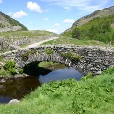
Multiple walking paths reach the summit from Great Wood car park in Borrowdale, taking one to two hours depending on your route choice. The path is easy to follow in dry conditions but becomes muddy and slippery after rain, so good footwear is essential.

The summit contains rare andesite lava formations that give it distinctive geological features often missed by casual walkers. These volcanic rocks are part of the Lake District's complex underground history formed millions of years ago.

The community of curious travelers

AroundUs brings together thousands of curated places, local tips, and hidden gems, enriched daily by 60,000 contributors worldwide.

Start exploring
Location
Elevation above the sea
590 m
GPS coordinates
54.56640,-3.10633
Latest update
December 14, 2025 09:41
« Bleaberry Fell - Mountain summit in Cumbria, England » is provided by Around Us (aroundus.com). Images and texts are derived from Wikimedia project under a Creative Commons license. You are allowed to copy, distribute, and modify copies of this page, under the conditions set by the license, as long as this note is clearly visible.

Discover hidden gems everywhere you go!

From secret cafés to breathtaking viewpoints, skip the crowded tourist spots and find places that match your style. Our app makes it easy with voice search, smart filtering, route optimization, and insider tips from travelers worldwide. Download now for the complete mobile experience.

Around Us App Screenshot

A unique approach to discovering new places

Le Figaro

All the places worth exploring

France Info

A tailor-made excursion in just a few clicks

20 Minutes

Around Us
Travel Guide & Maps
Download

Send to your phone

QR Code
1

Open the camera app on your mobile.

2

Point at the QR code with your camera. A notification will appear.

3

Tap the notification to open the link.