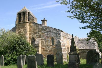
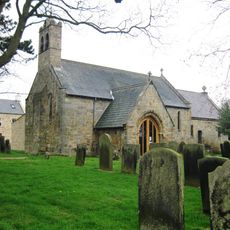
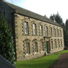
Church of St Michael and All Angels, Felton, Medieval parish church in Felton, England
The Church of St Michael and All Angels is situated on a wooded ridge between the River Coquet and Back Burn, blending architectural features from different centuries. The interior shows five arches on one side, the result of major 14th century modifications.
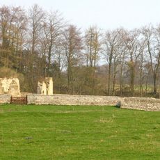
The church was founded around 1201 and underwent major transformation in the 14th century when walls were removed to make room for new arcades. These medieval changes remain visible in the structure today.
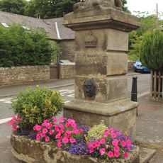
The name references the archangel Michael and all angels, a common dedication for medieval parish churches in England. The building has remained a gathering place for the community across centuries, hosting both worship and local activities that continue to shape daily life here.
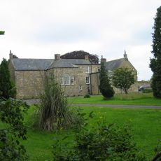
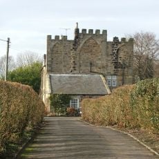
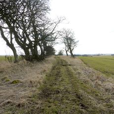
The church is accessible on foot from Felton village and sits on higher ground with open views over the surrounding landscape. Visitors should expect a sloping path and wear sturdy footwear.
Inside the church is a window featuring an eight-petalled flower pattern carved from a single stone block, showcasing the skill of medieval stoneworkers. This carved detail is an unusual example of geometric precision in religious architecture.
Location: Felton
Inception: 13 century
GPS coordinates: 55.29550,-1.71470
Latest update: December 14, 2025 17:02
Eshott Hall
3.2 km
Nelson Memorial
2.8 km
Embleton Hall
5.3 km
Linden Hall
4.6 km
Causey Park House
5.2 km
Swarland Old Hall
2.8 km
Devil's Causeway
6.1 km
Church of St Mary
5.2 km
Church of St John the Divine
4.8 km
Pant On North Of Junction With Church Street
5.1 km
Guyzance (or Brainshaugh) Chapel near Acklington
3.9 km
The Anglers Arms
4.7 km
Weldon Bridge, Over River Coquet And Wall To North-west
4.7 km
Felton War Memorial
243 m
Pill Box At Nu 233032
5.9 km
Old Felton Bridge
317 m
Newmoor Hall
5.1 km
Park Lodge
210 m
Milepost Opposite Peth Foot
250 m
Milepost 100 Metres South Of Rashercap
3.1 km
Milepost At Ngr Nz 1429667
5.3 km
Milepost On East Side Of Old Road Down To Weldon Bridge (Q.V.)
4.7 km
Pill Box At Nz 126 982
6 km
Lishman House
5.2 km
7 And 8, Guyzance Village
4.7 km
Milepost Approximately 25 Metres North West Of Bockenfield Bridge
2.6 km
Acton House And House At Rear
2.7 km
Milepost 500 Metres North Of Drive To Newton Hall
4.7 kmVisited this place? Tap the stars to rate it and share your experience / photos with the community! Try now! You can cancel it anytime.
Discover hidden gems everywhere you go!
From secret cafés to breathtaking viewpoints, skip the crowded tourist spots and find places that match your style. Our app makes it easy with voice search, smart filtering, route optimization, and insider tips from travelers worldwide. Download now for the complete mobile experience.
A unique approach to discovering new places❞
— Le Figaro
All the places worth exploring❞
— France Info
A tailor-made excursion in just a few clicks❞
— 20 Minutes