Enable Location

We need your location to show you interesting places around you

Discover nearby places

Find interesting locations and hidden gems around you

Precise directions

Get accurate directions and distances to places

Your location is never shared with other users. It's only used when you tap the location button.

Churnsike Lodge

Log in to your account

Start exploring — it's free

Trusted by 63,211 travelers worldwide

Continue with Google
Continue with Apple
or

We will send you a code to connect

By continuing, you accept our Terms and Conditions and our Privacy Policy

Check your inbox

We've sent a pincode in your inbox. Please enter the code below.

Churnsike Lodge
Discussion Reviews 1 Photos
1.3k Popularity

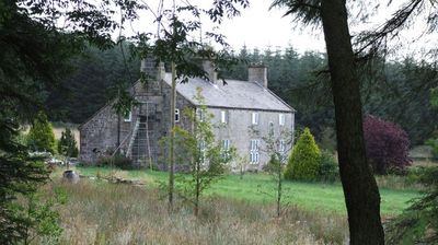
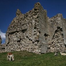
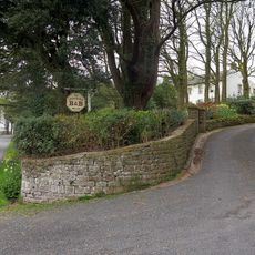
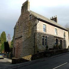
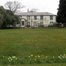
Churnsike Lodge, Victorian hunting lodge in Greystead, England.

Churnsike Lodge is a stone-built hunting lodge on the western edge of Kielder Forest, featuring a main house, stable block, and former gamekeeper quarters. The property comprises several connected structures that together form a typical Victorian hunting estate layout.

The Charlton family built this hunting lodge in 1850 as part of their Hesleyside estate, then sold it to the Chesters Estate in 1889. The property changed hands as part of the significant land ownership shifts in Victorian Northumberland.

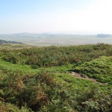
The estate was tied to the regional fox hunting traditions of Northumberland, which appear in local ballads and stories. Visitors today can sense the connection to this historical hunting culture of the area.

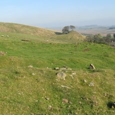
The property sits in a remote location and operates with sustainable systems including a biomass boiler and private water supply from a tested borehole. The isolated setting requires careful planning for access, as the area is far from larger towns.

The property faced demolition by the Forestry Commission in the 1980s but was later saved from this fate. Today it operates as a preserved holiday residence in this remote area of Northumberland.

The community of curious travelers

AroundUs brings together thousands of curated places, local tips, and hidden gems, enriched daily by 60,000 contributors worldwide.

Start exploring
Location
GPS coordinates
55.08700,-2.52800
Latest update
December 14, 2025 17:42
Around this place
Kielder Water
United Kingdom

Kielder Water

10.9 km
Bewcastle Cross
United Kingdom

Bewcastle Cross

10.1 km
Thirlwall Castle
United Kingdom

Thirlwall Castle

10.9 km
Bewcastle Roman Fort
United Kingdom

Bewcastle Roman Fort

10.3 km
Bewcastle Castle
United Kingdom

Bewcastle Castle

10.1 km
Milecastle 45
United Kingdom

Milecastle 45

10.6 km
Milecastle 47
United Kingdom

Milecastle 47

11.1 km
Milecastle 44
United Kingdom

Milecastle 44

10.4 km
Milecastle 46
United Kingdom

Milecastle 46

11.1 km
St. Mary Magdalene's Church, Gilsland
United Kingdom

St. Mary Magdalene's Church, Gilsland

10.2 km
Church of St Cuthbert
United Kingdom

Church of St Cuthbert

10.2 km
Bewcastle War Memorial
United Kingdom

Bewcastle War Memorial

10.2 km
Roman Army Museum
United Kingdom

Roman Army Museum

9.9 km
Raf Spadeadam: Blue Streak Rocket
United Kingdom

Raf Spadeadam: Blue Streak Rocket

8.3 km
RAF Spadeadam: Greymare Hill Missile Test Area
United Kingdom

RAF Spadeadam: Greymare Hill Missile Test Area

5.1 km
RAF Spadeadam: Priorlancy Rigg, Engine Test Area
United Kingdom

RAF Spadeadam: Priorlancy Rigg, Engine Test Area

8.5 km
The Hill
United Kingdom

The Hill

11 km
Dinmont House
United Kingdom

Dinmont House

11.1 km
Hadrian's Wall between Walltown Quarry East and Walltown Quarry West in wall mile 45
United Kingdom

Hadrian's Wall between Walltown Quarry East and Walltown Quarry West in wall mile 45

10.8 km
Hadrian's Wall between the track to Cockmount Hill and Walltown Quarry East in wall miles 43, 44 and 45
United Kingdom

Hadrian's Wall between the track to Cockmount Hill and Walltown Quarry East in wall miles 43, 44 and 45

10.6 km
1-4, Hall Terrace
United Kingdom

1-4, Hall Terrace

11.1 km
Orchard House
United Kingdom

Orchard House

10.7 km
Spa Villa
United Kingdom

Spa Villa

9.9 km
Ring cairn and shieling immediately west of Chatley Crags
United Kingdom

Ring cairn and shieling immediately west of Chatley Crags

11 km
Bewcastle Roman fort, high cross shaft in St Cuthbert's churchyard, and Bew Castle medieval shell keep castle
United Kingdom

Bewcastle Roman fort, high cross shaft in St Cuthbert's churchyard, and Bew Castle medieval shell keep castle

10.1 km
RAF Spadeadam: Component Test Area
United Kingdom

RAF Spadeadam: Component Test Area

8.2 km
Hadrians Wall Milecastle And Turrets Hadrians Wall, Milecastle And Turrets
United Kingdom

Hadrians Wall Milecastle And Turrets Hadrians Wall, Milecastle And Turrets

11.1 km
Hadrians Wall, Milecastles And Turrets
United Kingdom

Hadrians Wall, Milecastles And Turrets

10.5 km
Show the full map
Reviews
Share your experience

No review yet

Discussions
Start a discussion...

No discussion yet

« Churnsike Lodge - Victorian hunting lodge in Greystead, England » is provided by Around Us (aroundus.com). Images and texts are derived from Wikimedia project under a Creative Commons license. You are allowed to copy, distribute, and modify copies of this page, under the conditions set by the license, as long as this note is clearly visible.

Discover hidden gems everywhere you go!

From secret cafés to breathtaking viewpoints, skip the crowded tourist spots and find places that match your style. Our app makes it easy with voice search, smart filtering, route optimization, and insider tips from travelers worldwide. Download now for the complete mobile experience.

Around Us App Screenshot

A unique approach to discovering new places

Le Figaro

All the places worth exploring

France Info

A tailor-made excursion in just a few clicks

20 Minutes

Around Us
Travel Guide & Maps
Download

Send to your phone

QR Code
1

Open the camera app on your mobile.

2

Point at the QR code with your camera. A notification will appear.

3

Tap the notification to open the link.