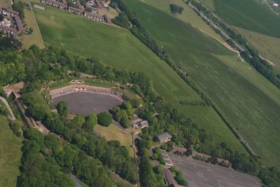
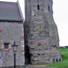
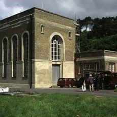
Fort Burgoyne, Military fort in Guston, England.
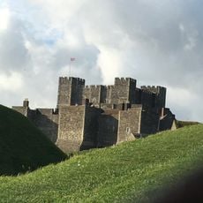
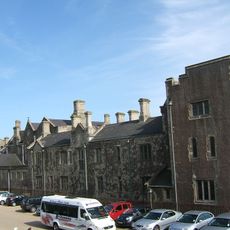
Fort Burgoyne is a military fort on high ground near Dover featuring stone walls, earth-covered casemates, and a central parade ground surrounded by defensive structures. The site preserves original gun positions along the ramparts and maintains its East and West Wing Batteries connected by underground passages.
Built between 1862 and 1869, the fort formed part of a coastal defense network protecting Dover's naval base during the Victorian era. Its construction was part of a broader strategic response to perceived threats from across the English Channel.
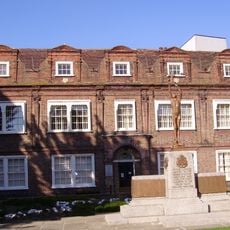
The fort carries the name of General Sir John Burgoyne, reflecting British military tradition of honoring distinguished commanders through place names. This naming choice connects visitors to the broader story of Victorian military leadership.
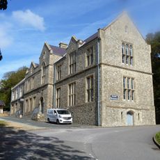
The fort is managed by the Land Trust and requires advance arrangements for visits due to ongoing conservation work and safety considerations. Visitors should contact ahead to arrange access and learn which areas are open to explore.
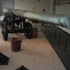
The fort retains around 35 original gun positions on its ramparts, showing its original defensive power. These preserved positions help visitors understand the strategic planning and firepower of this Victorian-era installation.
Location: Guston
Inception: 1861
Website: https://thelandtrust.org.uk/space/fort-burgoyne
GPS coordinates: 51.13550,1.32134
Latest update: December 12, 2025 14:23
Dover Castle
819 m
Dubris
789 m
Dover Museum
1.3 km
St Mary sub Castro, Dover
806 m
St Mary's Church, Dover
1.2 km
Swingate transmitting station
1 km
St James' Church, Dover
1.1 km
St Edmund's Chapel
1.2 km
St Paul's Church, Dover
933 m
Dubris Pharos
799 m
Church of St Peter and St Paul
1.1 km
Matthew Webb statue
1.3 km
Matthew Webb memorial
1.3 km
Castle Inn
1.2 km
War Memorial in the Churchyard of the Parish Church of St Mary the Virgin, Dover
1.2 km
St Martin's Church
1.3 km
Block No 36 Dining Hall And Tower
1 km
People Of Dover War Memorial
1.2 km
Dover Town Hall
1.2 km
Queen Elizabeths Pocket Pistol
898 m
Officers Barracks And Attached Basement Area Walls And Rails
922 m
Maison Dieu House
1.2 km
Former Regimental Institute
909 m
Castle Hill House, Including Attached Garden Wall With Gatepiers To South-East
1.1 km
Connaught Pumping Station
561 m
The Market Hall
1.3 km
House Adjoining Peverells Tower
753 m
Milestone, Guston, E of tree screen to Duke of York's Royal Military School, quarter mile S of A2 jct
744 mVisited this place? Tap the stars to rate it and share your experience / photos with the community! Try now! You can cancel it anytime.
Discover hidden gems everywhere you go!
From secret cafés to breathtaking viewpoints, skip the crowded tourist spots and find places that match your style. Our app makes it easy with voice search, smart filtering, route optimization, and insider tips from travelers worldwide. Download now for the complete mobile experience.
A unique approach to discovering new places❞
— Le Figaro
All the places worth exploring❞
— France Info
A tailor-made excursion in just a few clicks❞
— 20 Minutes