Enable Location

We need your location to show you interesting places around you

Discover nearby places

Find interesting locations and hidden gems around you

Precise directions

Get accurate directions and distances to places

Your location is never shared with other users. It's only used when you tap the location button.

Palatine Bridge, Salford

Log in to your account

Start exploring — it's free

Trusted by 62,067 travelers worldwide

Continue with Google
Continue with Apple
or

We will send you a code to connect

By continuing, you accept our Terms and Conditions and our Privacy Policy

Check your inbox

We've sent a pincode in your inbox. Please enter the code below.

Palatine Bridge, Salford

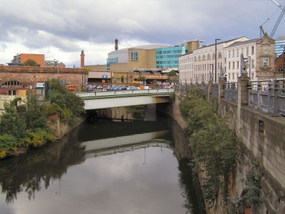
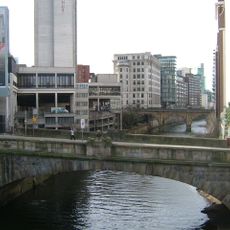
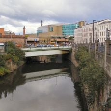
Palatine Bridge, Salford, Road bridge in Salford, England

The Palatine Bridge is a road bridge spanning the River Irwell in Salford, connecting Manchester Victoria to the opposite side. The structure uses twelve wrought-iron box girders and cast iron parapets characteristic of Victorian engineering design.

The bridge was completed in 1864 to improve the connection between the Lancashire and Yorkshire Railway and the city of Salford. The project emerged from negotiations between the railway company and the city council to provide better access to Victoria station.

Built to serve railway traffic, the bridge represents a practical Victorian solution for urban mobility. Today, pedestrians and vehicles cross it daily as part of the busy flow between the two areas.

The bridge has a noticeable gradient of about 1 in 30, which becomes apparent when walking, especially in wet conditions. With separate paths for pedestrians and vehicles, crossing is relatively straightforward and well-organized.

A landowner required special planning for the bridge's southern anchorage to increase property values in his area. This unusual condition significantly influenced the final design of the structure.

The community of curious travelers

AroundUs brings together thousands of curated places, local tips, and hidden gems, enriched daily by 60,000 contributors worldwide.

Start exploring
Location
Official opening
August 1864
GPS coordinates
53.48629,-2.24510
Latest update
December 13, 2025 11:47
« Palatine Bridge, Salford - Road bridge in Salford, England » is provided by Around Us (aroundus.com). Images and texts are derived from Wikimedia project under a Creative Commons license. You are allowed to copy, distribute, and modify copies of this page, under the conditions set by the license, as long as this note is clearly visible.

Discover hidden gems everywhere you go!

From secret cafés to breathtaking viewpoints, skip the crowded tourist spots and find places that match your style. Our app makes it easy with voice search, smart filtering, route optimization, and insider tips from travelers worldwide. Download now for the complete mobile experience.

Around Us App Screenshot

A unique approach to discovering new places

Le Figaro

All the places worth exploring

France Info

A tailor-made excursion in just a few clicks

20 Minutes

Around Us
Travel Guide & Maps
Download

Send to your phone

QR Code
1

Open the camera app on your mobile.

2

Point at the QR code with your camera. A notification will appear.

3

Tap the notification to open the link.