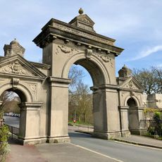
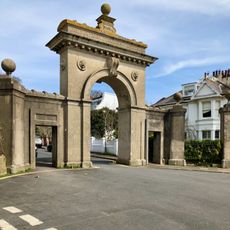
Queen's Park, Brighton, Grade II listed park and garden in Brighton, England
Queen's Park is a landscaped park in Brighton featuring ornamental gardens, walking routes, a central pond, and various facilities across its grounds. The space displays Victorian architectural details and includes tennis courts, play areas, and seating spots throughout.
The land was developed by Thomas Attree in 1825, and the park opened to the public in 1886. It was named to honor Queen Adelaide, consort of King William IV.
The park serves as a gathering place where neighbors and visitors spend time outdoors together and connect with one another. The landscaped areas encourage strolling, while play zones and green spaces offer something for different ages.
The park features pathways that are easy to walk and several areas with seating for rest. Visitors should note that sections are accessible for people with disabilities and a cafe is available for refreshments.
In 1923 a private aircraft piloted by retired Air Marshal Phillip Austin crash-landed on the park's pond, leaving behind an enduring local story. This unusual incident is still remembered and recounted by residents today.
GPS coordinates: 50.82470,-0.12556
Latest update: December 8, 2025 21:00
Amex House
543 m
Waste House
663 m
Pepper Pot
294 m
St John the Baptist's Church, Brighton
591 m
Greek Orthodox Church of the Holy Trinity, Brighton
424 m
St Mary the Virgin, Brighton
561 m
Church of the Annunciation, Brighton
595 m
St Luke's Church, Queen's Park, Brighton
340 m
Pelham Institute
525 m
Brighton and Hove National Spiritualist Church
484 m
Bristol Road Methodist Church
569 m
Brighton College Chapel
471 m
The Thurlow Arms
660 m
Memorial Drinking Fountain 60 Metres North East Of The Lake
71 m
Finsbury Road Board School
395 m
Old Fire Station
633 m
34 And 35, Mighell Street
473 m
9 and 10, Grand Parade
664 m
Classroom Dining Hall And Head Masters House Brighton College
498 m
Egremont Gate And Attached Wall And Railings
228 m
Park Street Gate And Attached Walls And Piers And Railings
188 m
Clock Tower 30 Metres West Of Number 15 East Drive (Number 15 East Drive Not Included)
95 m
23-30, High Street
570 m
Tram Shelter
299 m
St Lukes School
389 m
St Josephs Convent Of Mercy
629 m
Numbers 38 And 39 And Attached Walls And Piers
538 m
Numbers 12 And 13 And Attached Railings
666 mVisited this place? Tap the stars to rate it and share your experience / photos with the community! Try now! You can cancel it anytime.
Discover hidden gems everywhere you go!
From secret cafés to breathtaking viewpoints, skip the crowded tourist spots and find places that match your style. Our app makes it easy with voice search, smart filtering, route optimization, and insider tips from travelers worldwide. Download now for the complete mobile experience.
A unique approach to discovering new places❞
— Le Figaro
All the places worth exploring❞
— France Info
A tailor-made excursion in just a few clicks❞
— 20 Minutes