Enable Location

We need your location to show you interesting places around you

Discover nearby places

Find interesting locations and hidden gems around you

Precise directions

Get accurate directions and distances to places

Your location is never shared with other users. It's only used when you tap the location button.

Restenneth Priory

Log in to your account

Start exploring — it's free

Trusted by 62,248 travelers worldwide

Continue with Google
Continue with Apple
or

We will send you a code to connect

By continuing, you accept our Terms and Conditions and our Privacy Policy

Check your inbox

We've sent a pincode in your inbox. Please enter the code below.

Restenneth Priory

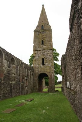
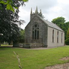
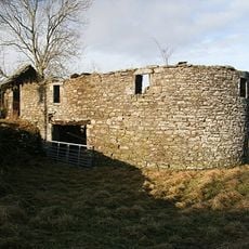
Restenneth Priory, Medieval monastery near Forfar, Scotland.

Restenneth Priory is an Augustinian monastic site near Forfar whose medieval structures survive as stone ruins. The most striking element is a tower about 14 meters (46 feet) tall with an octagonal spire, while the original choir and nave sections have largely disappeared except for their foundations.

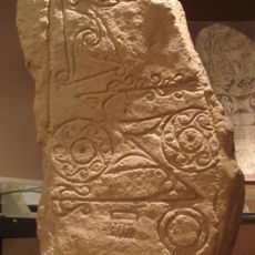
The priory dates back to the early Middle Ages when a Pictish king requested stonemasons from Northumbria to build a church at this location. In 1153 King Malcolm IV placed it under the authority of Jedburgh Abbey, formalizing its role as an Augustinian monastery.

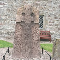
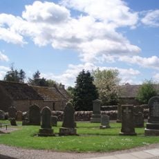
The priory served as a burial place for Scottish nobility and clergy who sought eternal rest within its walls. Visitors can still observe the traces of these graves scattered throughout the ruins.

The ruins sit beside the Angus Archives and are reached via a marked path from the parking area near Forfar. Visitors should expect uneven ground and exposed foundation stones, so sturdy shoes are advisable.

The lower sections of the tower may date to around 710, making it one of the earliest stone structures built in this region. This makes the site valuable for understanding how church building evolved during the transition from Pictish to early medieval Scottish periods.

The community of curious travelers

AroundUs brings together thousands of curated places, local tips, and hidden gems, enriched daily by 60,000 contributors worldwide.

Start exploring
Location
Location
Inception
12 century
GPS coordinates
56.65330,-2.84610
Latest update
December 14, 2025 09:46
Around this place
Aberlemno Sculptured Stones
United Kingdom

Aberlemno Sculptured Stones

5.6 km
Station Park
United Kingdom

Station Park

2.4 km
Finavon Castle
United Kingdom

Finavon Castle

5.1 km
Dunnichen Stone
United Kingdom

Dunnichen Stone

3.9 km
Meffan Institute
United Kingdom

Meffan Institute

2.8 km
County Buildings, Market Street, Forfar
United Kingdom

County Buildings, Market Street, Forfar

2.5 km
Forfar Town and County Hall
United Kingdom

Forfar Town and County Hall

2.8 km
Forfar, Market Street, Sheriff Court House
United Kingdom

Forfar, Market Street, Sheriff Court House

2.6 km
Forfar, Castle Street, Municipal Buildings
United Kingdom

Forfar, Castle Street, Municipal Buildings

2.8 km
Forfar, Montrose Road, Lowson Memorial Church
United Kingdom

Forfar, Montrose Road, Lowson Memorial Church

1.9 km
Girdle Stane
United Kingdom

Girdle Stane

4.9 km
Oathlaw Parish Church
United Kingdom

Oathlaw Parish Church

4.6 km
Forfar, St James' Road, St James's Church
United Kingdom

Forfar, St James' Road, St James's Church

2.6 km
Kinnettles Castle
United Kingdom

Kinnettles Castle

7.2 km
Forfar, 23 Osnaburg Street
United Kingdom

Forfar, 23 Osnaburg Street

2.8 km
Rescobie Parish Kirk And Churchyard
United Kingdom

Rescobie Parish Kirk And Churchyard

2.8 km
Justinhaugh Bridge
United Kingdom

Justinhaugh Bridge

5.8 km
Forfar, Academy Street, Chapelpark Primary School, Main Block
United Kingdom

Forfar, Academy Street, Chapelpark Primary School, Main Block

2.5 km
Turfbeg Railway Bridge
United Kingdom

Turfbeg Railway Bridge

3.8 km
Forfar, 71 East High Street, St John's Episcopal Church
United Kingdom

Forfar, 71 East High Street, St John's Episcopal Church

2.6 km
Ballindarg Bridge
United Kingdom

Ballindarg Bridge

7.6 km
Burnside Bridge
United Kingdom

Burnside Bridge

7.7 km
Auldbar Road, Balgavies, (former Station House) Including Stable, Signal Box, Platform, External Staircase, Railings And  Retain
United Kingdom

Auldbar Road, Balgavies, (former Station House) Including Stable, Signal Box, Platform, External Staircase, Railings And Retain

5.6 km
Holemill, Old Corn Mill
United Kingdom

Holemill, Old Corn Mill

7.9 km
Finavon Castle
United Kingdom

Finavon Castle

5 km
Aberlemno Parish Church, Churchyard
United Kingdom

Aberlemno Parish Church, Churchyard

5.6 km
Signal Box, Auldbar Road Station
United Kingdom

Signal Box, Auldbar Road Station

5.6 km
Guthrie Castle, Railway Bridge
United Kingdom

Guthrie Castle, Railway Bridge

7.8 km
Show the full map
« Restenneth Priory - Medieval monastery near Forfar, Scotland » is provided by Around Us (aroundus.com). Images and texts are derived from Wikimedia project under a Creative Commons license. You are allowed to copy, distribute, and modify copies of this page, under the conditions set by the license, as long as this note is clearly visible.

Discover hidden gems everywhere you go!

From secret cafés to breathtaking viewpoints, skip the crowded tourist spots and find places that match your style. Our app makes it easy with voice search, smart filtering, route optimization, and insider tips from travelers worldwide. Download now for the complete mobile experience.

Around Us App Screenshot

A unique approach to discovering new places

Le Figaro

All the places worth exploring

France Info

A tailor-made excursion in just a few clicks

20 Minutes

Around Us
Travel Guide & Maps
Download

Send to your phone

QR Code
1

Open the camera app on your mobile.

2

Point at the QR code with your camera. A notification will appear.

3

Tap the notification to open the link.