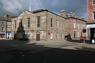
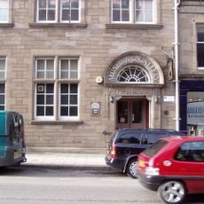
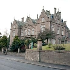
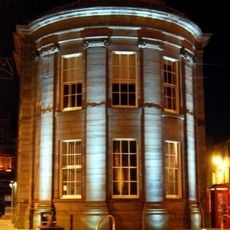
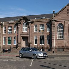
Forfar Town and County Hall, Municipal building in Forfar, Scotland
Forfar Town and County Hall is a civic building in Scotland with a distinctive facade featuring four sections, rounded windows on the ground floor and rectangular windows on the first floor. Today it functions as a meeting space and administrative center for the local authority.
The building was completed in 1788 according to designs by architect James Playfair and replaced an earlier medieval courthouse. The previous structure on this site had witnessed tragic events, including witchcraft trials in the 1600s.
The hall houses notable artworks on its walls, including portraits of important local figures and leaders. These paintings reflect the people who mattered most to the town over the centuries.
The building sits in the center of Forfar at a busy street intersection and is easy to reach on foot. It is an active government building, so visitor access may be limited depending on council activities and events.
The building hosted royal visits, including the Queen Mother in 1956 who received the town's freedom here. Later a reigning queen also lunched within its walls, marking the hall as a place of genuine significance to the monarchy.
Location: Angus
Location: Forfar
GPS coordinates: 56.64440,-2.88848
Latest update: December 14, 2025 18:20
Station Park
894 m
Finavon Castle
7.1 km
Dunnichen Stone
5.6 km
Meffan Institute
51 m
Restenneth Priory
2.8 km
St Orland's Stone
5.6 km
County Buildings, Market Street, Forfar
636 m
Forfar, Market Street, Sheriff Court House
616 m
Forfar, Castle Street, Municipal Buildings
22 m
Forfar, Montrose Road, Lowson Memorial Church
912 m
Girdle Stane
7.2 km
Oathlaw Parish Church
5.9 km
Forfar, St James' Road, St James's Church
239 m
Kinnettles Castle
4.7 km
Forfar, 23 Osnaburg Street
79 m
Rescobie Parish Kirk And Churchyard
5.5 km
Justinhaugh Bridge
6.5 km
Glamis Castle, North Bridge
7.3 km
Forfar, 71 East High Street, St John's Episcopal Church
199 m
Ballindarg Bridge
5 km
Turfbeg Railway Bridge
1.6 km
Forfar, Academy Street, Chapelpark Primary School, Main Block
309 m
Burnside Bridge
5.4 km
Earl Michael's Bridge, Glamis Castle
7.1 km
Glamis Castle, Walled Garden
7.1 km
Finavon Castle
7 km
Glamis Castle, Italian Garden
7.3 km
Reid Park bandstand
656 mVisited this place? Tap the stars to rate it and share your experience / photos with the community! Try now! You can cancel it anytime.
Discover hidden gems everywhere you go!
From secret cafés to breathtaking viewpoints, skip the crowded tourist spots and find places that match your style. Our app makes it easy with voice search, smart filtering, route optimization, and insider tips from travelers worldwide. Download now for the complete mobile experience.
A unique approach to discovering new places❞
— Le Figaro
All the places worth exploring❞
— France Info
A tailor-made excursion in just a few clicks❞
— 20 Minutes