St Peter's Church, Hargrave, Anglican church in Hargrave, England
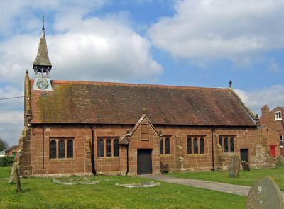
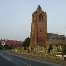
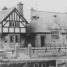
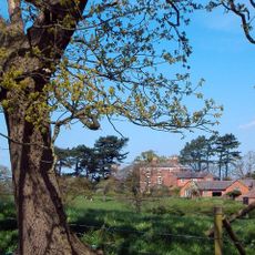
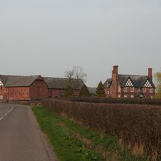
St Peter's Church in Hargrave is an Anglican church built from red sandstone with a five-bay nave, chancel, and bell turret at the west end displaying clocks on both the south and west faces. The Grade II* listed building features a distinctive reddish facade that stands out in the village landscape.
The church was established in 1627 by Thomas Moulson, who later became Lord Mayor of London in 1634, originally serving as both a chapel and school for the village. This dual purpose reflected its importance as a centre for both spiritual life and learning in the community.
The church is a protected heritage building and contains an octagonal font dating to its original construction alongside a reredos designed by architect John Douglas. These furnishings reflect the careful artistic attention given to the interior decoration over the centuries.
The church welcomes visitors and continues to host regular services, weddings, and baptisms as part of its ongoing role in the community. It is helpful to check ahead for service times or specific visiting hours to plan your visit appropriately.
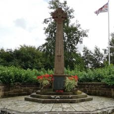
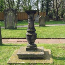
Two World War I soldiers are commemorated in graves within the churchyard, creating a direct link between this rural community and national military history. These quiet memorials tell of the local sacrifice during a global conflict.
Location: Hargrave
Location: Hargrave and Huxley
Inception: 1627
Architects: John Douglas
Website: https://stpetershargrave.org.uk
GPS coordinates: 53.15450,-2.77100
Latest update: December 14, 2025 18:03
Burton Hall
2.9 km
Hockenhull Platts
3.6 km
Hockenhull Hall
3.9 km
St Alban's Church, Tattenhall
3.6 km
St Peter's Church, Waverton
2.6 km
Lower Huxley Hall
1.2 km
Duddon Old Hall
3.9 km
Huxley Hoard
2.7 km
Saighton Lane Farm
3.9 km
Waverton school and schoolmaster's house
2.7 km
Golborne Old Hall
3.3 km
Golborne Bridge
3.9 km
Dutton's Bridge
2.6 km
Canal Bridge No 111 Williamsons Bridge
3.4 km
Tattenhall, Newton and Golborne Bellow War Memorial
3.9 km
Stapleford Hall
2.4 km
Garden wall and gateway at Burton Hall
2.9 km
Central and easternmost "Packhorse Bridges" and adjoining causeway
3.6 km
Westernmost of the 3 "Packhorse Bridges"
3.6 km
Boundary stone at north end of Golborne Bridge
3.9 km
Causeway over moat at Hatton Hall
1.7 km
Sundial in Church of St Alban's churchyard
3.6 km
Corn Barn 30 Metres North Of Golborne Old Hall
3.3 km
Hatton Hall moated site
1.8 km
Russia Hall
3.5 km
Hoofield Hall
3.1 km
Milepost, Yewtree Farm
4 km
Milepost, just N of railway bridge, nr Smithy Farm, S of road to Waverton
3.3 kmVisited this place? Tap the stars to rate it and share your experience / photos with the community! Try now! You can cancel it anytime.
Discover hidden gems everywhere you go!
From secret cafés to breathtaking viewpoints, skip the crowded tourist spots and find places that match your style. Our app makes it easy with voice search, smart filtering, route optimization, and insider tips from travelers worldwide. Download now for the complete mobile experience.
A unique approach to discovering new places❞
— Le Figaro
All the places worth exploring❞
— France Info
A tailor-made excursion in just a few clicks❞
— 20 Minutes