Stanmer Park, Grade II listed park and gardens in Brighton, England
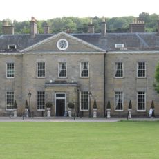
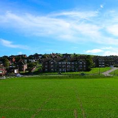
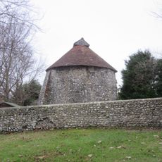
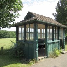
Stanmer Park is a Grade II listed park near Brighton featuring expansive woodlands, open meadows, and formal gardens arranged across the landscape. The grounds stretch from the rolling South Downs down toward the city, with a historic house at the center and numerous outbuildings scattered throughout.
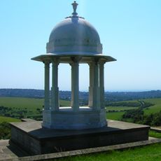
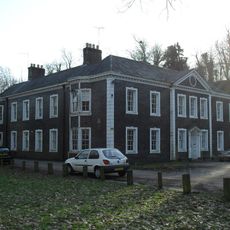
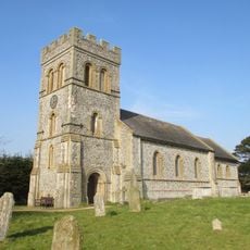
The estate was established in the 1720s when the family reshaped the landscape according to their vision. Over the following centuries, numerous buildings were added to the property and it remained a family residence until more recent times.
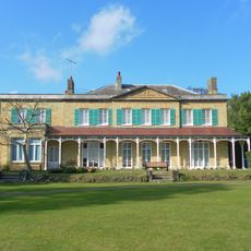
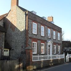
The park is named after the historic house at its heart, which shaped the entire estate's character for centuries. Walking through the grounds, you can sense how the landscape was carefully designed to reflect the status and taste of its former owners.
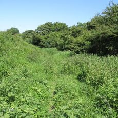
The grounds offer several walking routes of varying difficulty that wind through woodlands, across meadows, and past historic buildings. Different trails let you choose how long you want to stay and how much ground you want to cover.
One section of the park was originally designed as a vegetable garden to supply the household with fresh produce. Today it operates as a horticultural training site where students learn about plants and growing techniques in a working garden setting.
Location: Brighton and Hove
Location: Ditchling
Location: Falmer
Location: Westmeston
GPS coordinates: 50.86780,-0.10306
Latest update: December 8, 2025 19:44
Brighton Community Stadium
1.5 km
Chattri
3.6 km
Stanmer House
157 mEarthship Brighton
717 m
Hollingbury Castle
2 km
Stanmer Church
290 m
Patcham Place
3.5 km
All Saints Church, Patcham
3.4 km
Moulsecoomb Place Halls
2.6 km
Gardner Arts Centre
989 m
Southdown House
3.4 km
Bevendean Down
2.8 km
The Parish Church of St Lawrence, Falmer
2 km
The Swan Inn
1.8 km
Falmer House Including Moat Within Courtyard
1.1 km
St Mary Magdalene
689 m
Patcham Library
2.9 km
Hollingbury Library
1.9 km
Lower Lodge (north)
961 m
Dovecote at Patcham Court Farm, 80m north west of All Saints Church
3.4 km
The Home Farmhouse
328 m
Tram Shelter Opposite The Junction With Surrenden Road
2.8 km
106 And 108, Old London Road
3.4 km
A saucer barrow and three bowl barrows on Tegdown Hill
2.4 km
Hodshrove Viaduct
1.9 km
Arts A And B Including Courtyard Pool Gardner Arts Centre
966 m
Meeting House Including Kerbstones Surrounding Moat
1.1 km
Mathematical And Physical Sciences I Including Staircase To South And East To West Wing Attached To East Pevensey Building
1.2 kmVisited this place? Tap the stars to rate it and share your experience / photos with the community! Try now! You can cancel it anytime.
Discover hidden gems everywhere you go!
From secret cafés to breathtaking viewpoints, skip the crowded tourist spots and find places that match your style. Our app makes it easy with voice search, smart filtering, route optimization, and insider tips from travelers worldwide. Download now for the complete mobile experience.
A unique approach to discovering new places❞
— Le Figaro
All the places worth exploring❞
— France Info
A tailor-made excursion in just a few clicks❞
— 20 Minutes