Hollingbury Castle
Hollingbury Castle, Iron Age partial contour fort in Hollingbury, Brighton and Hove, England.
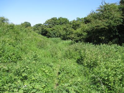
Hollingbury Castle is an Iron Age hillfort in Brighton and Hove built on a sloping hillside with a partial contour design. A single earthen bank and ditch form a squared shape with rounded corners, and the main entrances face east and west.
The site was built during the Iron Age but excavations in 1931 revealed traces of an even older enclosure with post structures and timber-reinforced walls. Later in medieval times the location served as a beacon point.
The name comes from Anglo-Saxon times and means 'Hollings hill'. Today the remains tell of its role as a defensive stronghold and later as a beacon point for communication across the land.
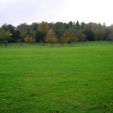
The location sits next to a golf course and is accessible through several public walking paths. Sturdy footwear is recommended as the ground is hilly and paths can be uneven.
Between 1967 and 1969 five round houses from the early 6th century BC were discovered in the southwestern corner, offering glimpses into early Iron Age domestic life. These finds show the settlement served multiple generations as a residential space.
Location: East Sussex
Location: Brighton and Hove
Part of: Hillfort, the possible remains of a Romano-Celtic temple and a group of three bowl barrows at Hollingbury
GPS coordinates: 50.85540,-0.12300
Latest update: December 11, 2025 18:03
Stanmer Park
2 km
Stanmer House
2.1 km
Earthship Brighton
2 km
Stanmer Church
2.2 km
All Saints Church, Patcham
2.3 km
Moulsecoomb Place Halls
1 km
Tower House
2.3 km
St Augustine's Church, Brighton
2.2 km
St John the Evangelist's Church, Preston Village, Brighton
2.3 km
St Mary's Church, Preston Park
2 km
Southdown House
2.2 km
Bevendean Down
2 km
Brighton Extra Mural Cemetery Cemetery Chapel
2.1 km
Clock Tower In Preston Park
2.3 km
Jewish Cemetery Chapel
2 km
St Mary Magdalene
1.3 km
Hollingbury Library
705 m
Woodvale Cemetery Tomb Of John Frederick Ginnett
2.2 km
Patcham Library
1.7 km
Lower Lodge (north)
2.2 km
Wellhouse To Preston Manor
2.3 km
106 And 108, Old London Road
2.2 km
Tram Shelter Opposite The Junction With Surrenden Road
862 m
Cliveden Lodge
2.2 km
The Home Farmhouse
2.2 km
Woodvale Cemetery North Lodge
2.1 km
Hodshrove Viaduct
992 m
Downs Junior School And Attached Walls And Gate Piers
2 kmVisited this place? Tap the stars to rate it and share your experience / photos with the community! Try now! You can cancel it anytime.
Discover hidden gems everywhere you go!
From secret cafés to breathtaking viewpoints, skip the crowded tourist spots and find places that match your style. Our app makes it easy with voice search, smart filtering, route optimization, and insider tips from travelers worldwide. Download now for the complete mobile experience.
A unique approach to discovering new places❞
— Le Figaro
All the places worth exploring❞
— France Info
A tailor-made excursion in just a few clicks❞
— 20 Minutes