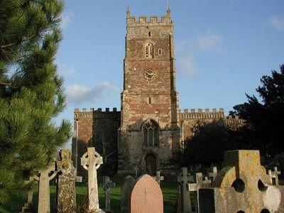
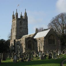
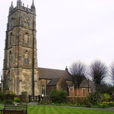
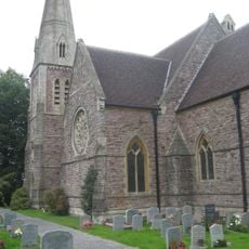
St Mary's Church, Portbury, Medieval parish church in Portbury, England
St Mary's Church in Portbury is a parish church with Norman-era origins and a substantial porch built in the 15th century. The building features stone slate roofs covering the chancel and vestry, with original architectural elements preserved throughout.
The church was founded during the Norman period and underwent expansion in the 15th century with the addition of a substantial porch. Within the building lies the Berkeley Chantry chapel, which contains early burials of the Berkeley family from around the 1190s.
The church maintains strong connections with St Mary's V.A. Primary School, combining educational and religious activities for the local community.
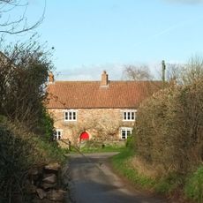
The building is open to visitors and serves as an active place of worship, so checking visiting times beforehand is advisable. It sits in a quiet village setting and is straightforward to find if you follow local road signs.
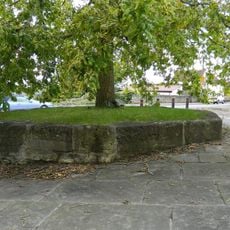
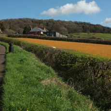
The churchyard contains ancient yew trees, with one specimen having grown there for roughly 900 years. These old trees are woven into the fabric of the site and link this place to generations of local history.
Location: Portbury
Inception: 12 century
GPS coordinates: 51.47560,-2.71730
Latest update: December 14, 2025 17:42
Noah's Ark Zoo Farm
3 km
Avonmouth Bridge
2.2 km
Charlton House, Wraxall
2 km
All Saints Church, Wraxall
3.7 km
Portbury Ashlands
2.5 km
Church of St Peter, Portishead
3.7 km
Church of St George
1.2 km
Portishead Pier to Black Nore SSSI
3.7 km
Church of St Mary
3.2 km
Church of St Bartholomew
2.3 km
Numbers 7 To 26 (Consecutive) And The Royal Hotel
3 km
Kings Weston Roman Villa
3.8 km
The White Lion Public House And Section Of Former Sea Wall To North End Of West Front
3.7 km
Royal Hotel
3.5 km
The Black Horse
3.3 km
Part of a minor Romano-British villa at Long Cross
3.8 km
Pill Viaduct
2.3 km
Administrative Block, And 2 Flats To Ham Green Hospital
3 km
Guidestone At Junction Of Clapton Lane And Clevedon Road
3.6 km
Remains Of Village Cross At National Grid Reference St 4910 7190 At Junction With Clevedon Road Remains Of Village Cross At National Grid Reference St 4910 7190 At Junction With Wraxall Hall
3.7 km
Clevedon Lodge
3.1 km
Aviary Immediately North West Of Tyntesfield House
3.9 km
Chaplains House
3.7 km
North Retaining Walls, Steps And 2 Summer Houses, To The Rose Garden
3.8 km
Home Farm Buildings
3.7 km
Wraxall Church Of England Primary School
3.8 km
Happerton Farmhouse
2.1 km
South Retaining Walls, Piers And Central Steps To The Rose Garden
3.8 kmVisited this place? Tap the stars to rate it and share your experience / photos with the community! Try now! You can cancel it anytime.
Discover hidden gems everywhere you go!
From secret cafés to breathtaking viewpoints, skip the crowded tourist spots and find places that match your style. Our app makes it easy with voice search, smart filtering, route optimization, and insider tips from travelers worldwide. Download now for the complete mobile experience.
A unique approach to discovering new places❞
— Le Figaro
All the places worth exploring❞
— France Info
A tailor-made excursion in just a few clicks❞
— 20 Minutes