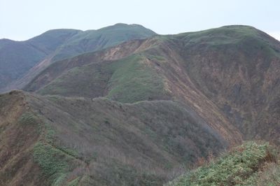
Mount Mahiru, Mountain summit in Misato, Japan
Mount Mahiru rises to 1059 meters (3475 feet) and sits between the municipalities of Misato and Nishiwaga in northeastern Japan. Multiple hiking trails approach the summit from different starting points, with the main route taking about four hours to reach the top.
The mountain has served as a boundary marker between Akita and Iwate Prefectures since the establishment of modern Japanese prefectures. Its location made it an important geographical reference point for the region over centuries.
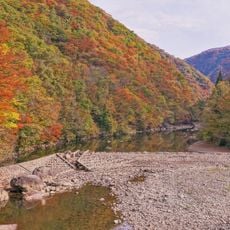
The mountain is valued by hikers for its seasonal transformations and marks a symbolic point in the landscape of northeastern Japan. Visitors notice how the vegetation and light change throughout the year, giving the peak different moods at different times.
The best time to visit is during the warmer months when the trails are snow-free and easy to walk. Start your hike early in the day to complete the four-hour journey while there is still daylight.
Among hikers, this peak holds a place on one of the classic routes through northeastern Japan's mountain landscape. Many visitors are surprised by the clear views from the summit on good days, revealing surrounding mountain chains and valleys.
The community of curious travelers
AroundUs brings together thousands of curated places, local tips, and hidden gems, enriched daily by 60,000 contributors worldwide.