Enable Location

We need your location to show you interesting places around you

Discover nearby places

Find interesting locations and hidden gems around you

Precise directions

Get accurate directions and distances to places

Your location is never shared with other users. It's only used when you tap the location button.

Log in to your account

Start exploring — it's free

Trusted by 62,379 travelers worldwide

Continue with Google
Continue with Apple
or

We will send you a code to connect

By continuing, you accept our Terms and Conditions and our Privacy Policy

Check your inbox

We've sent a pincode in your inbox. Please enter the code below.

Кулиные болота

Кулиные болота, Sumpf in Russland

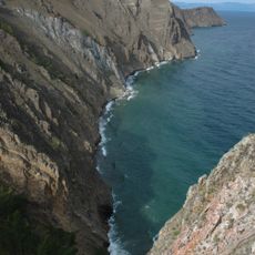
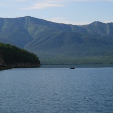
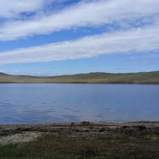
Kuli Marshes are a swampland located on the Chivyrkui Isthmus near the Holy Nose Peninsula within the Transbaikal National Park. Around 120 thermal vents punctuate the landscape over roughly 40 square kilometers, continuously releasing hot mineral-rich water from the earth.

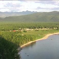
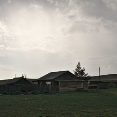
The area formed millions of years ago through volcanic activity that triggered the release of hot mineral water from underground. A small settlement named Kuli once existed here, but residents abandoned it when volcanic gases became a hazard, particularly for livestock.

These marshes are experienced as a place where the earth itself seems alive and active. Visitors witness steam rising from the ground and hear the gentle sound of hot water flowing, creating a sense of connection to the raw forces of nature.

The area is accessible only by unpaved roads and is best visited during warmer months to avoid difficult weather conditions. Wear appropriate clothing to protect against moisture and wind, and exercise caution around the thermal vents as toxic gases escape from the ground.

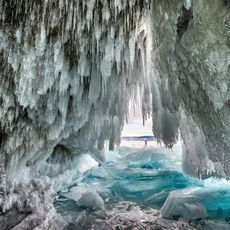
Even during harsh winter freezing, the hot springs continue to bubble vigorously, creating surreal images as steam rises from the snow-covered ground. This dramatic contrast between cold and heat reveals the unstoppable geothermal forces beneath this remote terrain.

The community of curious travelers

AroundUs brings together thousands of curated places, local tips, and hidden gems, enriched daily by 60,000 contributors worldwide.

Start exploring
GPS coordinates
53.61670,108.96860
Latest update
February 9, 2026 08:19
Around this place
Lake Baikal
Russian Federation

Lake Baikal

72.8 km
Barguzin Nature Reserve
Russian Federation

Barguzin Nature Reserve

72.2 km
Baikal-Lena nature reserve
Russian Federation

Baikal-Lena nature reserve

97.9 km
Zabaykalsky
Russian Federation

Zabaykalsky

19.8 km
Russian Federation

Multilayer settlement "Sunny Mys"

166 km
At͡sagatskiĭ dat͡san
Russian Federation

At͡sagatskiĭ dat͡san

185.3 km
Aninsky datsan
Russian Federation

Aninsky datsan

160.5 km
Selenginsky Monastery
Russian Federation

Selenginsky Monastery

205.5 km
Egituysky datsan
Russian Federation

Egituysky datsan

176 km
Sretensky Convent
Russian Federation

Sretensky Convent

161.1 km
Arangatuy
Russian Federation

Arangatuy

8.1 km
Frolikha Adventure Coastline Track
Russian Federation

Frolikha Adventure Coastline Track

201.9 km
Hanhoi
Russian Federation

Hanhoi

130.1 km
Ice cave on Olkhon island
Russian Federation

Ice cave on Olkhon island

107.2 km
Svetlaya Polyana
Russian Federation

Svetlaya Polyana

40.9 km
Спасская церковь (Турунтаево)
Russian Federation

Спасская церковь (Турунтаево)

181.4 km
Улан-Нур
Russian Federation

Улан-Нур

171.2 km
Спасо-Преображенская церковь (Баргузин)
Russian Federation

Спасо-Преображенская церковь (Баргузин)

44.4 km
Сретенская церковь
Russian Federation

Сретенская церковь

161 km
Nativity of Christ Church
Russian Federation

Nativity of Christ Church

55 km
Lesovozny
Russian Federation

Lesovozny

203.4 km
Дом Бутлицкого (Баргузин)
Russian Federation

Дом Бутлицкого (Баргузин)

44.2 km
Торговое здание купца Лозовского (Баргузин)
Russian Federation

Торговое здание купца Лозовского (Баргузин)

44.3 km
Здание банка (Баргузин)
Russian Federation

Здание банка (Баргузин)

44.2 km
Дом Сиротина (Баргузин)
Russian Federation

Дом Сиротина (Баргузин)

44.1 km
Церковь Богоявления (Ильинка)
Russian Federation

Церковь Богоявления (Ильинка)

201 km
Дом, в котором жил в ссылке большевик К. Грабовский (Баргузин)
Russian Federation

Дом, в котором жил в ссылке большевик К. Грабовский (Баргузин)

44.1 km
Cape Burkhan
Russian Federation

Cape Burkhan

117.5 km
Show the full map
« Кулиные болота - Sumpf in Russland » is provided by Around Us (aroundus.com). Images and texts are derived from Wikimedia project under a Creative Commons license. You are allowed to copy, distribute, and modify copies of this page, under the conditions set by the license, as long as this note is clearly visible.

Discover hidden gems everywhere you go!

From secret cafés to breathtaking viewpoints, skip the crowded tourist spots and find places that match your style. Our app makes it easy with voice search, smart filtering, route optimization, and insider tips from travelers worldwide. Download now for the complete mobile experience.

Around Us App Screenshot

A unique approach to discovering new places

Le Figaro

All the places worth exploring

France Info

A tailor-made excursion in just a few clicks

20 Minutes

Around Us
Travel Guide & Maps
Download

Send to your phone

QR Code
1

Open the camera app on your mobile.

2

Point at the QR code with your camera. A notification will appear.

3

Tap the notification to open the link.