Enable Location

We need your location to show you interesting places around you

Discover nearby places

Find interesting locations and hidden gems around you

Precise directions

Get accurate directions and distances to places

Your location is never shared with other users. It's only used when you tap the location button.

Dam of the Lower Iset Pond

Log in to your account

Start exploring — it's free

Trusted by 61,974 travelers worldwide

Continue with Google
Continue with Apple
or

We will send you a code to connect

By continuing, you accept our Terms and Conditions and our Privacy Policy

Check your inbox

We've sent a pincode in your inbox. Please enter the code below.

Dam of the Lower Iset Pond

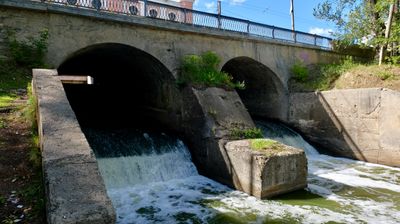
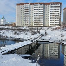
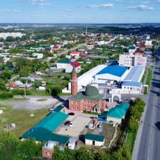
Dam of the Lower Iset Pond, Dam from 1790 in Chkalovski district, Russia

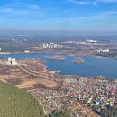
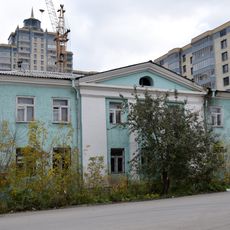
The Dam of the Lower Iset Pond is a 224-meter structure along the Iset River that creates a large water reservoir with extended shorelines. The water body has varying depths and banks of different elevations along its course.

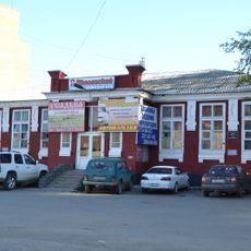
The structure was built in 1790 to supply water to a mint facility that operated at the site. When that facility burned down in 1795, the location was eventually repurposed for steel production.

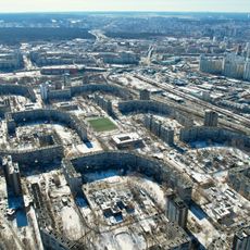
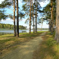
The reservoir shores hosted educational groups where young people gathered for sailing and group activities, becoming important places in local community life. These spaces held meaning for generations of residents who spent time here.

The dam provides good vantage points for exploring the reservoir and surrounding area from the shore. The varying bank heights affect which areas are easily accessible and where you should take care.

An aircraft made an emergency landing on the frozen water in 1961 and collided with a nearby building during the incident. This rare event left marks on the local history of the area.

The community of curious travelers

AroundUs brings together thousands of curated places, local tips, and hidden gems, enriched daily by 60,000 contributors worldwide.

Start exploring
Inception
1790
Length
224 m
GPS coordinates
56.74862,60.69227
Latest update
December 9, 2025 20:24
Around this place
Химмаш (Екатеринбург)
Russian Federation

Химмаш (Екатеринбург)

1.2 km
Uktus
Russian Federation

Uktus

4.6 km
Majakovsky Park in Yekaterinburg
Russian Federation

Majakovsky Park in Yekaterinburg

7.8 km
Елизавет
Russian Federation

Елизавет

4.2 km
Komsomolsky District
Russian Federation

Komsomolsky District

9.4 km
Nizhneisetskiy orphanage
Russian Federation

Nizhneisetskiy orphanage

201 m
Pavel Bazhov Memorial House-Museum
Russian Federation

Pavel Bazhov Memorial House-Museum

9.1 km
Church of the Transfiguration, Yekaterinburg
Russian Federation

Church of the Transfiguration, Yekaterinburg

4.5 km
Botanical Garden of the Urals Branch of the Russian Academy of Sciences
Russian Federation

Botanical Garden of the Urals Branch of the Russian Academy of Sciences

7.6 km
Institute of Electrophysics
Russian Federation

Institute of Electrophysics

9.1 km
Ramadan Mosque
Russian Federation

Ramadan Mosque

372 m
Temple of the Kazan icon of the Mother of God
Russian Federation

Temple of the Kazan icon of the Mother of God

309 m
Nizhneisetskiy pond
Russian Federation

Nizhneisetskiy pond

1.2 km
Yekaterinburg Narrow Gauge Railway Museum
Russian Federation

Yekaterinburg Narrow Gauge Railway Museum

8.3 km
BI-1 Monument in Yekaterinburg
Russian Federation

BI-1 Monument in Yekaterinburg

6.7 km
Church of Saint Elisabeth, Yekaterinburg
Russian Federation

Church of Saint Elisabeth, Yekaterinburg

4.9 km
Malyi istok
Russian Federation

Malyi istok

7.9 km
Palace of Culture Khimmash
Russian Federation

Palace of Culture Khimmash

600 m
Uktussky bridge
Russian Federation

Uktussky bridge

4.1 km
Institute of Thermal Physics UB RAS
Russian Federation

Institute of Thermal Physics UB RAS

9.1 km
Church Of Michael The Archangel, Ekaterinburg
Russian Federation

Church Of Michael The Archangel, Ekaterinburg

8.9 km
Trinity Church of the same faith
Russian Federation

Trinity Church of the same faith

9.5 km
Lower Iset Works Direction Building
Russian Federation

Lower Iset Works Direction Building

122 m
Sports and Technology Club, Yekaterinburg
Russian Federation

Sports and Technology Club, Yekaterinburg

379 m
Памятник воспитанникам Нижнеисетского детского дома, погибшим на фронтах Великой Отечественной войны
Russian Federation

Памятник воспитанникам Нижнеисетского детского дома, погибшим на фронтах Великой Отечественной войны

175 m
Vostochnaya Street, 31a
Russian Federation

Vostochnaya Street, 31a

8.9 km
Пантелеимоновская церковь (Екатеринбург)
Russian Federation

Пантелеимоновская церковь (Екатеринбург)

6.8 km
Комсомольский сквер
Russian Federation

Комсомольский сквер

1.4 km
Show the full map
« Dam of the Lower Iset Pond - Dam from 1790 in Chkalovski district, Russia » is provided by Around Us (aroundus.com). Images and texts are derived from Wikimedia project under a Creative Commons license. You are allowed to copy, distribute, and modify copies of this page, under the conditions set by the license, as long as this note is clearly visible.

Discover hidden gems everywhere you go!

From secret cafés to breathtaking viewpoints, skip the crowded tourist spots and find places that match your style. Our app makes it easy with voice search, smart filtering, route optimization, and insider tips from travelers worldwide. Download now for the complete mobile experience.

Around Us App Screenshot

A unique approach to discovering new places

Le Figaro

All the places worth exploring

France Info

A tailor-made excursion in just a few clicks

20 Minutes

Around Us
Travel Guide & Maps
Download

Send to your phone

QR Code
1

Open the camera app on your mobile.

2

Point at the QR code with your camera. A notification will appear.

3

Tap the notification to open the link.