Enable Location

We need your location to show you interesting places around you

Discover nearby places

Find interesting locations and hidden gems around you

Precise directions

Get accurate directions and distances to places

Your location is never shared with other users. It's only used when you tap the location button.

Log in to your account

Start exploring — it's free

Trusted by 62,384 travelers worldwide

Continue with Google
Continue with Apple
or

We will send you a code to connect

By continuing, you accept our Terms and Conditions and our Privacy Policy

Check your inbox

We've sent a pincode in your inbox. Please enter the code below.

Fort Union

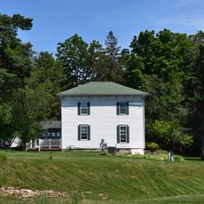
Fort Union, Military fort in Dodgeville, Wisconsin, United States.

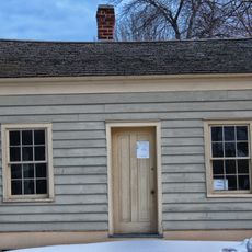
Fort Union is a military installation in Dodgeville, Wisconsin, built during the 1830s to serve as a regional operations base. The fortification provided shelter and strategic positioning for troops managing the frontier during a period of territorial expansion.

Fort Union was founded in 1832 during the Black Hawk War under commander Henry Dodge, who established it as military headquarters for regional operations. The installation later became tied to broader economic activities in the area as settlement expanded.

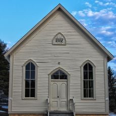
The fort represents the intersection between European settlers and Native American territories during the expansion period of the United States frontier.

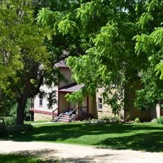
The fort site lies on private property and is not readily accessible to the public; information is available through the Wisconsin Historical Society. Contact ahead to confirm access conditions and any available interpretive resources before visiting.

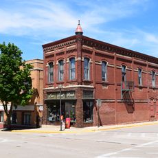
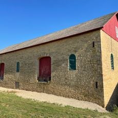
The site served both as a military base and as the center of Henry Dodge's lead mining operations in the area. This dual role linked military strategy directly with industrial extraction during the early settlement period.

The community of curious travelers

AroundUs brings together thousands of curated places, local tips, and hidden gems, enriched daily by 60,000 contributors worldwide.

Start exploring
Location
GPS coordinates
42.91630,-90.11807
Latest update
December 14, 2025 13:06
Around this place
House on the Rock
United States of America

House on the Rock

20.5 km
Taliesin
United States of America

Taliesin

25.4 km
Governor Dodge State Park
United States of America

Governor Dodge State Park

12.1 km
Blue Mound State Park
United States of America

Blue Mound State Park

24.9 km
Unity Chapel
United States of America

Unity Chapel

24.5 km
Yellowstone Lake State Park
United States of America

Yellowstone Lake State Park

20.5 km
House on the Rock Carousel
United States of America

House on the Rock Carousel

20.5 km
Belmont Mound State Park
United States of America

Belmont Mound State Park

25 km
Wyoming Valley School
United States of America

Wyoming Valley School

22.5 km
Hauge Log Church
United States of America

Hauge Log Church

24.3 km
Dodge Mining Camp Cabin
United States of America

Dodge Mining Camp Cabin

4.8 km
Hyde Chapel
United States of America

Hyde Chapel

21.2 km
Emanuel D. Adler House
United States of America

Emanuel D. Adler House

11 km
Plum Grove Primitive Methodist Church
United States of America

Plum Grove Primitive Methodist Church

9.9 km
Iowa County Courthouse
United States of America

Iowa County Courthouse

5.1 km
Iowa Street Historic District
United States of America

Iowa Street Historic District

5.1 km
Onon B. and Betsy Dahle House
United States of America

Onon B. and Betsy Dahle House

24.7 km
Old Rock School
United States of America

Old Rock School

6 km
David J. and Maggie Jones House
United States of America

David J. and Maggie Jones House

6.2 km
Thomas Stone Barn
United States of America

Thomas Stone Barn

18.9 km
Roberts House
United States of America

Roberts House

21.3 km
Harris House
United States of America

Harris House

21.1 km
Grove Street Historic District
United States of America

Grove Street Historic District

21 km
Cassidy Farmhouse
United States of America

Cassidy Farmhouse

22.1 km
Gulbrand and Bertha Jensvold House
United States of America

Gulbrand and Bertha Jensvold House

24.6 km
Spensley Farm
United States of America

Spensley Farm

8.6 km
Kittleson House
United States of America

Kittleson House

21.2 km
Dodge Theatre
United States of America

Dodge Theatre

5.1 km
Show the full map
« Fort Union - Military fort in Dodgeville, Wisconsin, United States » is provided by Around Us (aroundus.com). Images and texts are derived from Wikimedia project under a Creative Commons license. You are allowed to copy, distribute, and modify copies of this page, under the conditions set by the license, as long as this note is clearly visible.

Discover hidden gems everywhere you go!

From secret cafés to breathtaking viewpoints, skip the crowded tourist spots and find places that match your style. Our app makes it easy with voice search, smart filtering, route optimization, and insider tips from travelers worldwide. Download now for the complete mobile experience.

Around Us App Screenshot

A unique approach to discovering new places

Le Figaro

All the places worth exploring

France Info

A tailor-made excursion in just a few clicks

20 Minutes

Around Us
Travel Guide & Maps
Download

Send to your phone

QR Code
1

Open the camera app on your mobile.

2

Point at the QR code with your camera. A notification will appear.

3

Tap the notification to open the link.