Blue Mound State Park, State park in Iowa County, United States.
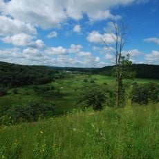
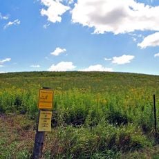
Blue Mound State Park spans across forested areas and open prairies, featuring high bluffs and diverse natural landscapes throughout its protected territory.
The establishment of this Wisconsin state park in 1959 marked a significant step in preserving natural spaces for public recreation in southern Wisconsin.
Indigenous peoples inhabited these lands before European settlement, leaving traces of their presence throughout the park's elevated grounds and natural formations.
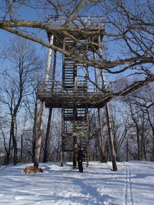
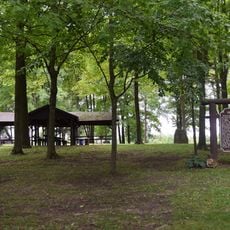
The park maintains numerous marked trails for hiking and camping facilities, with an observation tower providing views across the surrounding Wisconsin countryside.
Located at one of the highest points in southern Wisconsin, the park sits in an unglaciated region characterized by distinct geological formations.
Location: Iowa County
Location: Dane County
Inception: 1959
Website: https://dnr.wisconsin.gov/topic/parks/bluemound
GPS coordinates: 43.02810,-89.85280
Latest update: May 22, 2025 13:21
Wisconsin contains numerous natural areas and historic sites away from typical tourist routes. Geological features include Cave of the Mounds with limestone formations, Parfrey's Glen with an 800-foot gorge, and Pewit's Nest State Natural Area with sandstone cliffs. The Apostle Islands Ice Caves offer seasonal ice formations along the Lake Superior shoreline. Rock Island State Park and Schoolhouse Beach on Washington Island provide access to remote islands and coastal areas. Devil's Lake State Park and Blue Mound State Park feature trails through varied terrain.
Cave of the Mounds
3.2 km
Little Norway, Wisconsin
5.1 km
Fort Blue Mounds
2 km
Pleasant Valley Conservancy State Natural Area
9.4 km
Black Earth Rettenmund Prairie State Natural Area
14 km
Hauge Log Church
11.2 km
Brigham County Park
2.9 km
Herman B. and Anne Marie Dahle House
9.5 km
Hoff Department Store
9.6 km
Hyde Chapel
10.3 km
Heiney's Meat Market
14.9 km
John Sweet Donald Farmstead
15.4 km
Aslak Lie Cabin
15.1 km
Henry L. and Sarah Dahle House
9.9 km
Plum Grove Primitive Methodist Church
15.2 km
Onon B. and Betsy Dahle House
12.9 km
Thomas Stone Barn
6.1 km
Roberts House
3.7 km
Harris House
3.9 km
Grove Street Historic District
4 km
Cassidy Farmhouse
3 km
Eric and Jerome Skindrud Farm
13.4 km
Gulbrand and Bertha Jensvold House
13.2 km
Kittleson House
3.8 km
Black Earth Public Library
14.9 km
Mazomanie Free Library
17.1 km
Mount Horeb Public Library
10.9 km
Mount Horeb Union Cemetery
10.2 kmReviews
Visited this place? Tap the stars to rate it and share your experience / photos with the community! Try now! You can cancel it anytime.
Discover hidden gems everywhere you go!
From secret cafés to breathtaking viewpoints, skip the crowded tourist spots and find places that match your style. Our app makes it easy with voice search, smart filtering, route optimization, and insider tips from travelers worldwide. Download now for the complete mobile experience.
A unique approach to discovering new places❞
— Le Figaro
All the places worth exploring❞
— France Info
A tailor-made excursion in just a few clicks❞
— 20 Minutes