Enable Location

We need your location to show you interesting places around you

Discover nearby places

Find interesting locations and hidden gems around you

Precise directions

Get accurate directions and distances to places

Your location is never shared with other users. It's only used when you tap the location button.

Pleasant Valley Conservancy State Natural Area

Log in to your account

Start exploring — it's free

Trusted by 61,340 travelers worldwide

Continue with Google
Continue with Apple
or

We will send you a code to connect

By continuing, you accept our Terms and Conditions and our Privacy Policy

Check your inbox

We've sent a pincode in your inbox. Please enter the code below.

Pleasant Valley Conservancy State Natural Area

Pleasant Valley Conservancy State Natural Area, Natural conservation area in Dane County, United States

Description

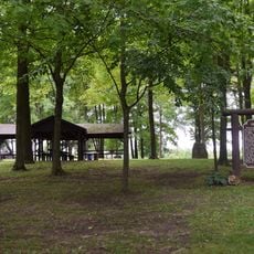
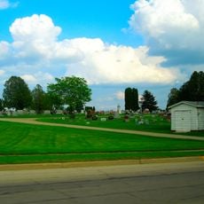
Pleasant Valley Conservancy is a protected natural area in Dane County spanning over 140 acres with diverse habitats including oak forests, prairie grasslands, wetlands, and marshy areas. Walking trails wind through these different ecosystems, allowing visitors to experience the landscape up close.

History

The site became a Wisconsin State Natural Area in 2007 following years of intensive restoration work to return the land to its original ecological condition. These efforts brought back native habitats and species to the property.

Culture

Local conservation groups lead regular programs where visitors can learn about native plants and ecosystem restoration through hands-on activities and guided walks. These educational efforts connect people directly to the land and its recovery.

Practical

Wear sturdy shoes since trails pass through varied terrain ranging from dry ground to marshy areas. Dogs are not allowed on the property to protect wildlife and sensitive habitats.

Did you know?

A spring-fed creek flows through the property and nourishes wetlands before joining East Blue Mounds Creek, playing a key role in the region's water system. This natural waterway adds another dimension to the protected landscape.

Location
Inception
2007
GPS coordinates
43.10530,-89.80690
Latest update
December 14, 2025 17:42

AroundUs brings together thousands of curated places, local tips, and hidden gems, enriched daily by 60,000 contributors worldwide. Discover all places nearby (Dane County).

Around this place
Cave of the Mounds
United States of America

Cave of the Mounds

9.7 km
Blue Mound State Park
United States of America

Blue Mound State Park

9.4 km
Little Norway, Wisconsin
United States of America

Little Norway, Wisconsin

8.8 km
Fort Blue Mounds
United States of America

Fort Blue Mounds

10 km
Black Earth Rettenmund Prairie State Natural Area
United States of America

Black Earth Rettenmund Prairie State Natural Area

4.7 km
Brigham County Park
United States of America

Brigham County Park

8.6 km
Herman B. and Anne Marie Dahle House
United States of America

Herman B. and Anne Marie Dahle House

11.9 km
Adam Dunlap Farmstead
United States of America

Adam Dunlap Farmstead

13 km
Hoff Department Store
United States of America

Hoff Department Store

12.2 km
Hyde Chapel
United States of America

Hyde Chapel

13.4 km
Heiney's Meat Market
United States of America

Heiney's Meat Market

6 km
Aslak Lie Cabin
United States of America

Aslak Lie Cabin

14.7 km
Henry L. and Sarah Dahle House
United States of America

Henry L. and Sarah Dahle House

12.6 km
John and Margarethe Kemp Cabin
United States of America

John and Margarethe Kemp Cabin

15.4 km
Frederick Schumann Farmstead
United States of America

Frederick Schumann Farmstead

17.4 km
Thomas Stone Barn
United States of America

Thomas Stone Barn

14.4 km
Roberts House
United States of America

Roberts House

12.2 km
Harris House
United States of America

Harris House

12.4 km
Friederich Kohlmann House
United States of America

Friederich Kohlmann House

16.3 km
Cassidy Farmhouse
United States of America

Cassidy Farmhouse

11.3 km
Grove Street Historic District
United States of America

Grove Street Historic District

12.4 km
Eric and Jerome Skindrud Farm
United States of America

Eric and Jerome Skindrud Farm

13.4 km
Kittleson House
United States of America

Kittleson House

12.3 km
Black Earth Public Library
United States of America

Black Earth Public Library

6 km
Mazomanie Free Library
United States of America

Mazomanie Free Library

7.9 km
Mount Horeb Public Library
United States of America

Mount Horeb Public Library

12.9 km
Rosemary Garfoot Public Library
United States of America

Rosemary Garfoot Public Library

13.1 km
Mount Horeb Union Cemetery
United States of America

Mount Horeb Union Cemetery

12.3 km
Show the full map
« Pleasant Valley Conservancy State Natural Area - Natural conservation area in Dane County, United States » is provided by Around Us (aroundus.com). Images and texts are derived from Wikimedia project under a Creative Commons license. You are allowed to copy, distribute, and modify copies of this page, under the conditions set by the license, as long as this note is clearly visible.

Discover hidden gems everywhere you go!

From secret cafés to breathtaking viewpoints, skip the crowded tourist spots and find places that match your style. Our app makes it easy with voice search, smart filtering, route optimization, and insider tips from travelers worldwide. Download now for the complete mobile experience.

Around Us App Screenshot

A unique approach to discovering new places

Le Figaro

All the places worth exploring

France Info

A tailor-made excursion in just a few clicks

20 Minutes

Around Us
Travel Guide & Maps
Download

Send to your phone

QR Code
1

Open the camera app on your mobile.

2

Point at the QR code with your camera. A notification will appear.

3

Tap the notification to open the link.