Enable Location

We need your location to show you interesting places around you

Discover nearby places

Find interesting locations and hidden gems around you

Precise directions

Get accurate directions and distances to places

Your location is never shared with other users. It's only used when you tap the location button.

Gov. Daniel Dunklin's Grave State Historic Site

Log in to your account

Start exploring — it's free

Trusted by 61,908 travelers worldwide

Continue with Google
Continue with Apple
or

We will send you a code to connect

By continuing, you accept our Terms and Conditions and our Privacy Policy

Check your inbox

We've sent a pincode in your inbox. Please enter the code below.

Gov. Daniel Dunklin's Grave State Historic Site

Gov. Daniel Dunklin's Grave State Historic Site, State historic site in Herculaneum, United States

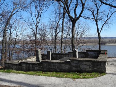
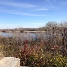
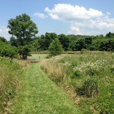
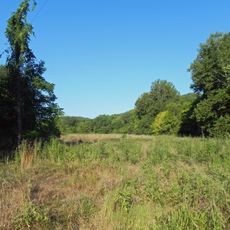
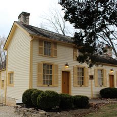
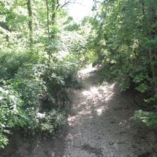
Gov. Daniel Dunklin's Grave State Historic Site is a memorial park in Herculaneum set on a limestone bluff overlooking the Mississippi River. The grounds contain graves and historical markers that document the life and tenure of this state leader.

The cemetery was established to preserve the burial site of a former governor who built Missouri's public education system. His tenure during the 1830s marked a period of institutional growth for the emerging state.

The site honors an early governor of Missouri through informational markers placed throughout the grounds. Visitors can learn about this leader's role in shaping the state's institutions and communities.

The site is accessible to visitors year-round and managed in connection with a nearby state historic site. The location on a bluff means you will want sturdy footwear for walking the grounds.

The site offers uncommon views of the Mississippi from a protected cemetery, setting it apart from typical historic sites. This blend of natural setting and historical protection creates a quiet experience away from conventional museum buildings.

The community of curious travelers

AroundUs brings together thousands of curated places, local tips, and hidden gems, enriched daily by 60,000 contributors worldwide.

Start exploring
Location
GPS coordinates
38.28110,-90.37780
Latest update
December 14, 2025 14:45
Around this place
Jefferson Barracks Military Post
United States of America

Jefferson Barracks Military Post

25.2 km
Fort de Chartres
United States of America

Fort de Chartres

29.2 km
Cliff Cave County Park
United States of America

Cliff Cave County Park

21.3 km
Illinois Caverns State Natural Area
United States of America

Illinois Caverns State Natural Area

21.7 km
River City Casino
United States of America

River City Casino

29.5 km
Mastodon State Historic Site
United States of America

Mastodon State Historic Site

11 km
Jefferson Barracks Bridge
United States of America

Jefferson Barracks Bridge

24.6 km
Sandy Creek Covered Bridge State Historic Site
United States of America

Sandy Creek Covered Bridge State Historic Site

12.3 km
United States of America

St. Louis Islamic Center

28.8 km
Kolmer Site
United States of America

Kolmer Site

27.2 km
Lunsford-Pulcher Archeological Site
United States of America

Lunsford-Pulcher Archeological Site

27 km
Young Conservation Area
United States of America

Young Conservation Area

29.9 km
Koch, Missouri
United States of America

Koch, Missouri

23.7 km
Fountain Creek Bridge
United States of America

Fountain Creek Bridge

16.7 km
Forest 44 Conservation Area
United States of America

Forest 44 Conservation Area

30.1 km
Stonebrook
United States of America

Stonebrook

11.5 km
Gustave Greystone-Meissner House
United States of America

Gustave Greystone-Meissner House

2.5 km
Joseph Sappington House
United States of America

Joseph Sappington House

28.6 km
Thomas C. Fletcher House
United States of America

Thomas C. Fletcher House

17.4 km
Windsor Harbor Road Bridge
United States of America

Windsor Harbor Road Bridge

9.3 km
Waterloo Historic District
United States of America

Waterloo Historic District

20.6 km
Gundlach-Grosse House
United States of America

Gundlach-Grosse House

23.9 km
Kimmswick Historic District
United States of America

Kimmswick Historic District

9.6 km
Central School Campus
United States of America

Central School Campus

22.3 km
Possum Woods Conservation Area
United States of America

Possum Woods Conservation Area

30 km
Louis J. and Harriet Rozier House
United States of America

Louis J. and Harriet Rozier House

22.4 km
Kidd Lake State Natural Area
United States of America

Kidd Lake State Natural Area

21.2 km
Zephaniah Sappington House
United States of America

Zephaniah Sappington House

29 km
Show the full map
« Gov. Daniel Dunklin's Grave State Historic Site - State historic site in Herculaneum, United States » is provided by Around Us (aroundus.com). Images and texts are derived from Wikimedia project under a Creative Commons license. You are allowed to copy, distribute, and modify copies of this page, under the conditions set by the license, as long as this note is clearly visible.

Discover hidden gems everywhere you go!

From secret cafés to breathtaking viewpoints, skip the crowded tourist spots and find places that match your style. Our app makes it easy with voice search, smart filtering, route optimization, and insider tips from travelers worldwide. Download now for the complete mobile experience.

Around Us App Screenshot

A unique approach to discovering new places

Le Figaro

All the places worth exploring

France Info

A tailor-made excursion in just a few clicks

20 Minutes

Around Us
Travel Guide & Maps
Download

Send to your phone

QR Code
1

Open the camera app on your mobile.

2

Point at the QR code with your camera. A notification will appear.

3

Tap the notification to open the link.