Enable Location

We need your location to show you interesting places around you

Discover nearby places

Find interesting locations and hidden gems around you

Precise directions

Get accurate directions and distances to places

Your location is never shared with other users. It's only used when you tap the location button.

Young Conservation Area

Log in to your account

Start exploring — it's free

Trusted by 61,906 travelers worldwide

Continue with Google
Continue with Apple
or

We will send you a code to connect

By continuing, you accept our Terms and Conditions and our Privacy Policy

Check your inbox

We've sent a pincode in your inbox. Please enter the code below.

Young Conservation Area

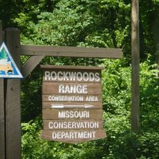
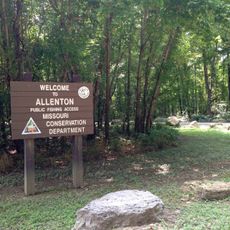
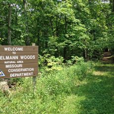
Young Conservation Area, Protected conservation area in Jefferson County, Missouri

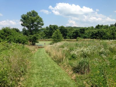
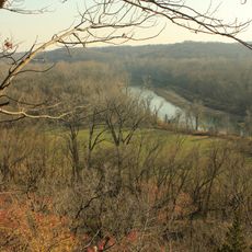
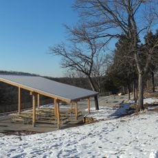
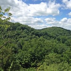
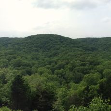
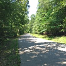
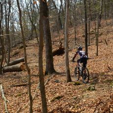
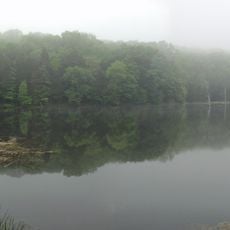
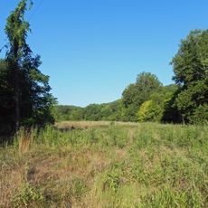
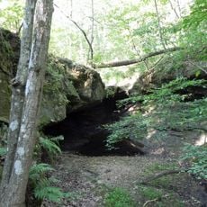
Young Conservation Area is a protected natural area in Jefferson County featuring oak-maple forests and hiking trails that wind along LaBarque Creek. The grounds include two fishing ponds and various pathways for exploring the landscape.

The Missouri Department of Conservation established this protected area in 1986 to preserve diverse wildlife habitats and native tree species. The creation of this preserve focused on protecting forest ecosystems that define the region.

The conservation area maintains educational resources and marked pathways that help visitors learn about local ecosystems and wildlife management practices.

The area is open daily from early morning through evening hours and is located west of Highway W for easy access. Multiple well-maintained trails offer straightforward routes for walking and wildlife watching.

LaBarque Creek within this area supports a notably high diversity of fish species found rarely in similar waterways elsewhere in the region. This waterway reflects the ecological richness hidden within the preserve.

The community of curious travelers

AroundUs brings together thousands of curated places, local tips, and hidden gems, enriched daily by 60,000 contributors worldwide.

Start exploring
Location
Inception
1986
GPS coordinates
38.43800,-90.65600
Latest update
December 14, 2025 11:23
Around this place
Six Flags St. Louis
United States of America

Six Flags St. Louis

8.5 km
Screamin' Eagle
United States of America

Screamin' Eagle

8.9 km
The Boss
United States of America

The Boss

8.9 km
Castlewood State Park
United States of America

Castlewood State Park

16.1 km
Route 66 State Park
United States of America

Route 66 State Park

9.5 km
Lone Elk County Park
United States of America

Lone Elk County Park

14.5 km
American Thunder
United States of America

American Thunder

8.5 km
Don Robinson State Park
United States of America

Don Robinson State Park

7.1 km
Ninja
United States of America

Ninja

8.7 km
Boomerang
United States of America

Boomerang

8.9 km
Sandy Creek Covered Bridge State Historic Site
United States of America

Sandy Creek Covered Bridge State Historic Site

20.1 km
Shaw Nature Reserve
United States of America

Shaw Nature Reserve

15.5 km
Tyson Research Center
United States of America

Tyson Research Center

12.7 km
Rockwoods Reservation
United States of America

Rockwoods Reservation

14.3 km
Greensfelder County Park
United States of America

Greensfelder County Park

10.8 km
Robertsville State Park
United States of America

Robertsville State Park

13.9 km
West Tyson County Park
United States of America

West Tyson County Park

10.9 km
Myron and Sonya Glassberg Family Conservation Area
United States of America

Myron and Sonya Glassberg Family Conservation Area

2.2 km
Rockwoods Range Conservation Area
United States of America

Rockwoods Range Conservation Area

9.6 km
Forest 44 Conservation Area
United States of America

Forest 44 Conservation Area

14.2 km
Grand Ole Carousel
United States of America

Grand Ole Carousel

8.7 km
Stonebrook
United States of America

Stonebrook

19 km
Allenton Access
United States of America

Allenton Access

4.1 km
Engelmann Woods Natural Area
United States of America

Engelmann Woods Natural Area

18.2 km
St. Albans General Store
United States of America

St. Albans General Store

18.8 km
St. Albans Farms Stone Barn
United States of America

St. Albans Farms Stone Barn

18.4 km
Mr. Freeze
United States of America

Mr. Freeze

8.7 km
LaBarque Creek Conservation Area
United States of America

LaBarque Creek Conservation Area

5 km
Show the full map
« Young Conservation Area - Protected conservation area in Jefferson County, Missouri » is provided by Around Us (aroundus.com). Images and texts are derived from Wikimedia project under a Creative Commons license. You are allowed to copy, distribute, and modify copies of this page, under the conditions set by the license, as long as this note is clearly visible.

Discover hidden gems everywhere you go!

From secret cafés to breathtaking viewpoints, skip the crowded tourist spots and find places that match your style. Our app makes it easy with voice search, smart filtering, route optimization, and insider tips from travelers worldwide. Download now for the complete mobile experience.

Around Us App Screenshot

A unique approach to discovering new places

Le Figaro

All the places worth exploring

France Info

A tailor-made excursion in just a few clicks

20 Minutes

Around Us
Travel Guide & Maps
Download

Send to your phone

QR Code
1

Open the camera app on your mobile.

2

Point at the QR code with your camera. A notification will appear.

3

Tap the notification to open the link.