Enable Location

We need your location to show you interesting places around you

Discover nearby places

Find interesting locations and hidden gems around you

Precise directions

Get accurate directions and distances to places

Your location is never shared with other users. It's only used when you tap the location button.

Rockwoods Reservation

Log in to your account

Join the adventure

Create your free account and start exploring (like 60k+ others)

We will send you a code to connect

or
Continue with Google
Continue with Apple
By continuing, you accept our Terms and Conditions and our Privacy Policy

Check your inbox

We've sent a pincode in your inbox. Please enter the code below.

Rockwoods Reservation

Rockwoods Reservation, Conservation area in St. Louis County, Missouri, US

Description

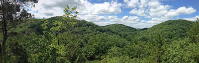
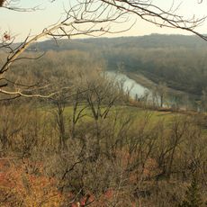
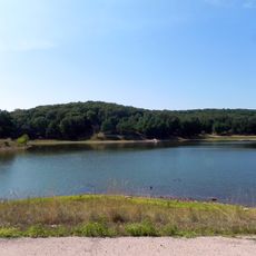
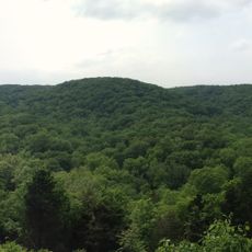
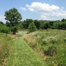
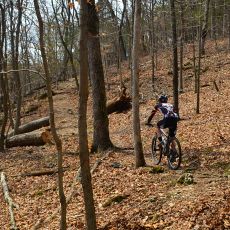
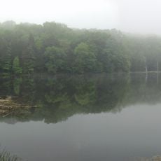
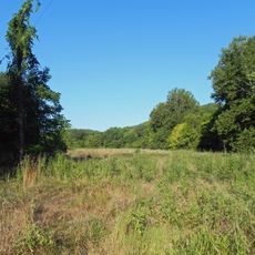
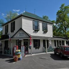
Rockwoods Reservation is a protected forest area in St. Louis County featuring limestone formations, natural springs, caves, and dense hardwood forests. Six marked trails wind through different sections, offering routes for hikers of varying interests and fitness levels.

History

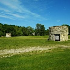
The Missouri Department of Conservation established this protected area in 1938 after decades of intensive limestone and clay extraction. The designation marked a shift from resource extraction to land restoration and natural habitat recovery.

Culture

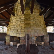
The trails reveal the region's industrial past, with marked stations explaining limestone quarrying and kiln operations that once shaped this landscape. Visitors walk through places where old workings blend with recovering forest, showing how people once used these resources.

Practical

The reservation is open daily from sunrise until 30 minutes after sunset, with main access via Woods Avenue and Glencoe Road. Plan your visit during daylight hours, as the area closes at dusk and remains inaccessible on Christmas and Independence Day.

Did you know?

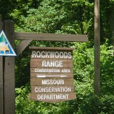
The reservation links with Greensfelder County Park and Rockwoods Range Conservation Area to form one continuous green space across the region. This connected forest network creates a sense of unbroken natural corridor for visitors exploring the area.

Location
GPS coordinates
38.56640,-90.66310
Latest update
December 12, 2025 14:24

AroundUs brings together thousands of curated places, local tips, and hidden gems, enriched daily by 60,000 contributors worldwide. Discover all places nearby (Missouri).

Around this place
Six Flags St. Louis
United States of America

Six Flags St. Louis

6.1 km
Screamin' Eagle
United States of America

Screamin' Eagle

5.7 km
The Boss
United States of America

The Boss

5.8 km
Castlewood State Park
United States of America

Castlewood State Park

10.8 km
Route 66 State Park
United States of America

Route 66 State Park

9.2 km
Babler State Park
United States of America

Babler State Park

6.6 km
Lone Elk County Park
United States of America

Lone Elk County Park

11.2 km
American Thunder
United States of America

American Thunder

6.1 km
Ninja
United States of America

Ninja

5.8 km
Boomerang
United States of America

Boomerang

5.7 km
Daniel Boone Bridge
United States of America

Daniel Boone Bridge

13.5 km
Tyson Research Center
United States of America

Tyson Research Center

11.3 km
Greensfelder County Park
United States of America

Greensfelder County Park

3.7 km
Manchester United Methodist Church
United States of America

Manchester United Methodist Church

13.7 km
Young Conservation Area
United States of America

Young Conservation Area

14.3 km
West Tyson County Park
United States of America

West Tyson County Park

8.7 km
Myron and Sonya Glassberg Family Conservation Area
United States of America

Myron and Sonya Glassberg Family Conservation Area

14.2 km
Rockwoods Range Conservation Area
United States of America

Rockwoods Range Conservation Area

5.8 km
Forest 44 Conservation Area
United States of America

Forest 44 Conservation Area

12.4 km
Grand Ole Carousel
United States of America

Grand Ole Carousel

5.9 km
Allenton Access
United States of America

Allenton Access

10.3 km
Isaac McCormick House
United States of America

Isaac McCormick House

14.9 km
Engelmann Woods Natural Area
United States of America

Engelmann Woods Natural Area

10 km
St. Albans General Store
United States of America

St. Albans General Store

9.6 km
St. Albans Farms Stone Barn
United States of America

St. Albans Farms Stone Barn

8.4 km
Burkhardt Historic District
United States of America

Burkhardt Historic District

13.1 km
Mr. Freeze
United States of America

Mr. Freeze

5.9 km
Dr. Edmund A. Babler Memorial State Park Historic District
United States of America

Dr. Edmund A. Babler Memorial State Park Historic District

6.8 km
Show the full map
« Rockwoods Reservation - Conservation area in St. Louis County, Missouri, US » is provided by Around Us (aroundus.com). Images and texts are derived from Wikimedia project under a Creative Commons license. You are allowed to copy, distribute, and modify copies of this page, under the conditions set by the license, as long as this note is clearly visible.

Discover hidden gems everywhere you go!

From secret cafés to breathtaking viewpoints, skip the crowded tourist spots and find places that match your style. Our app makes it easy with voice search, smart filtering, route optimization, and insider tips from travelers worldwide. Download now for the complete mobile experience.

Around Us App Screenshot

A unique approach to discovering new places

Le Figaro

All the places worth exploring

France Info

A tailor-made excursion in just a few clicks

20 Minutes

Around Us
Travel Guide & Maps
Download

Send to your phone

QR Code
1

Open the camera app on your mobile.

2

Point at the QR code with your camera. A notification will appear.

3

Tap the notification to open the link.