Enable Location

We need your location to show you interesting places around you

Discover nearby places

Find interesting locations and hidden gems around you

Precise directions

Get accurate directions and distances to places

Your location is never shared with other users. It's only used when you tap the location button.

Log in to your account

Start exploring — it's free

Trusted by 63,083 travelers worldwide

Continue with Google
Continue with Apple
or

We will send you a code to connect

By continuing, you accept our Terms and Conditions and our Privacy Policy

Check your inbox

We've sent a pincode in your inbox. Please enter the code below.

Laurel Creek Gorge Bridge
Discussion Reviews Photo
2.2k Popularity

Laurel Creek Gorge Bridge, Steel plate girder bridge in Madison County, North Carolina

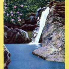
The Laurel Creek Gorge Bridge is a steel structure that spans a deep mountain gorge, supported by substantial concrete pillars anchored far below. The crossing carries six lanes of traffic over both a creek and a state highway, connecting the valleys on either side of the ridge.

The bridge opened in early 2002 and immediately became a vital transportation link between two major population centers in the mountain region. Its completion reduced travel time and improved commercial traffic flow across the ridge.

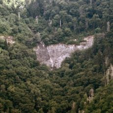
The bridge section forms part of a designated scenic highway, allowing travelers to experience the mountainous landscapes of North Carolina.

The roadway features an automated deicing system that engages during winter to keep the surface safe for vehicles. Drivers should be aware that mountain weather can shift quickly and visibility may be reduced during rain or fog.

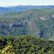
This crossing ranks among the tallest bridges in the state and rewards travelers with sweeping views down into the gorge below. Many visitors stop at pullouts to take in the depth and scale of the landscape beneath them.

The community of curious travelers

AroundUs brings together thousands of curated places, local tips, and hidden gems, enriched daily by 60,000 contributors worldwide.

Start exploring
Location
Inception
2002
Official opening
2002
GPS coordinates
35.91704,-82.55788
Latest update
December 13, 2025 12:40
Around this place
Western North Carolina
United States of America

Western North Carolina

18.3 km
Mitchell Falls
United States of America

Mitchell Falls

29.4 km
Zebulon B. Vance Birthplace
United States of America

Zebulon B. Vance Birthplace

24.7 km
Glassmine Falls
United States of America

Glassmine Falls

28.8 km
Douglas Falls
United States of America

Douglas Falls

27.4 km
Celo Knob
United States of America

Celo Knob

28.8 km
Walker Falls
United States of America

Walker Falls

25.7 km
Lamar Alexander Rocky Fork State Park
United States of America

Lamar Alexander Rocky Fork State Park

14.9 km
Bald Creek Historic District
United States of America

Bald Creek Historic District

12.2 km
Jeff White House
United States of America

Jeff White House

13.5 km
Reynolds House
United States of America

Reynolds House

30.5 km
John Wesley McElroy House
United States of America

John Wesley McElroy House

23.1 km
Mars Hill High School
United States of America

Mars Hill High School

9.2 km
Dr. John G. & Nannie H. Barrett Farm
United States of America

Dr. John G. & Nannie H. Barrett Farm

25.7 km
Madison County Courthouse
United States of America

Madison County Courthouse

17.5 km
Yancey Collegiate Institute Historic District
United States of America

Yancey Collegiate Institute Historic District

23.8 km
California Creek Missionary Baptist Church
United States of America

California Creek Missionary Baptist Church

6.3 km
Yancey County Courthouse
United States of America

Yancey County Courthouse

23.2 km
Marshall Main Street Historic District
United States of America

Marshall Main Street Historic District

17.5 km
James H. White House
United States of America

James H. White House

17.4 km
A.R. Brown House
United States of America

A.R. Brown House

28.2 km
Joseph P. Eller House
United States of America

Joseph P. Eller House

20.8 km
Sunnybank
United States of America

Sunnybank

24.7 km
Citizens Bank Building
United States of America

Citizens Bank Building

23.2 km
Brigman-Chambers House
United States of America

Brigman-Chambers House

24.3 km
Waterfall on West Prong Hickey Fork
United States of America

Waterfall on West Prong Hickey Fork

16.8 km
Carter-Swain House
United States of America

Carter-Swain House

15.3 km
Craggy Gardens Visitor Center
United States of America

Craggy Gardens Visitor Center

29 km
Show the full map
Reviews
Share your experience

No review yet

Discussions
Start a discussion...

No discussion yet

« Laurel Creek Gorge Bridge - Steel plate girder bridge in Madison County, North Carolina » is provided by Around Us (aroundus.com). Images and texts are derived from Wikimedia project under a Creative Commons license. You are allowed to copy, distribute, and modify copies of this page, under the conditions set by the license, as long as this note is clearly visible.

Discover hidden gems everywhere you go!

From secret cafés to breathtaking viewpoints, skip the crowded tourist spots and find places that match your style. Our app makes it easy with voice search, smart filtering, route optimization, and insider tips from travelers worldwide. Download now for the complete mobile experience.

Around Us App Screenshot

A unique approach to discovering new places

Le Figaro

All the places worth exploring

France Info

A tailor-made excursion in just a few clicks

20 Minutes

Around Us
Travel Guide & Maps
Download

Send to your phone

QR Code
1

Open the camera app on your mobile.

2

Point at the QR code with your camera. A notification will appear.

3

Tap the notification to open the link.