Palisade Head, Rock formation in Beaver Bay Township, United States
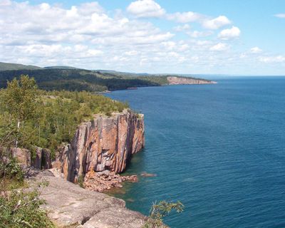
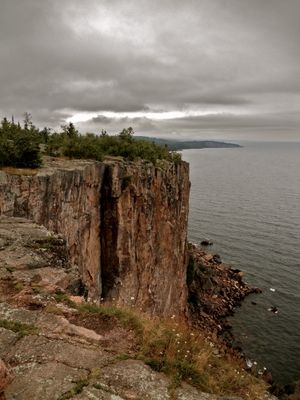
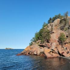
The rhyolite cliff rises 300 feet (91 meters) above Lake Superior's surface, forming a prominent outcrop of volcanic rock with near-vertical faces that feature flat viewing platforms at multiple levels.
European cartographers first documented the formation in the late seventeenth century while charting Lake Superior's coastline, and commercial fishermen during the 1800s used the cliff as a navigation aid before modern beacons were introduced.
Rock climbers from across the Midwest seek out the steep rock faces, which rank among the most challenging natural climbing routes on Lake Superior's north shore and have attracted skilled mountaineers for decades.
A half-mile paved access road leads from Highway 61 to the parking area, from which a short walking path reaches the viewing points. Visitors should exercise caution during high winds and stay back from the edges.
The cliff served as the launch point for a successful rescue operation in 1969 when a fisherman was retrieved from Lake Superior's icy waters after his boat capsized in a winter storm.
The community of curious travelers
AroundUs brings together thousands of curated places, local tips, and hidden gems, enriched daily by 60,000 contributors worldwide.