Washington Avenue Historic District

Log in to your account

AroundUs is a community-driven map of interesting places, built by curious explorers like you. It grows with every review, story, and photo you share.
Connect to save your favorite spots, contribute locations, and create personalized routes.
By continuing, you accept our Terms and Conditions and our Privacy Policy
Add to collection
Map
Suggest a change
Share

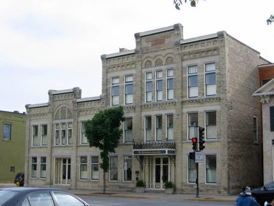
Washington Avenue Historic District, Historic district in Cedarburg, United States

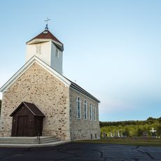
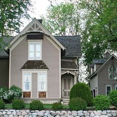
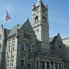
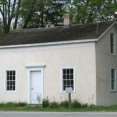
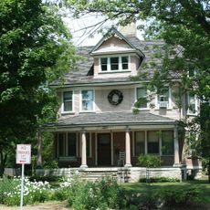
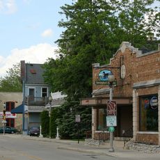
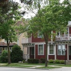
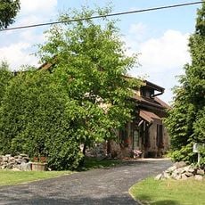
Washington Avenue Historic District is a preserved district in Cedarburg containing around 80 buildings spread across 28 acres, featuring structures built from local limestone and fieldstone between the 1840s and 1900s. The buildings display various architectural styles and sizes, ranging from simple residences to institutional and commercial structures from that era.

The district developed during the 19th century as German immigrants settled in the region and built using local limestone resources. It gained official recognition in 1986 through listing on the National Register of Historic Places, acknowledging its importance to Cedarburg's architectural preservation.

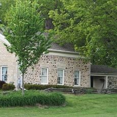
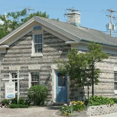
The German Free School from 1854 shows the educational traditions of early settlers through its stone walls and simple design. The building sits among other historic structures, reflecting how the community valued learning and cultural continuity.

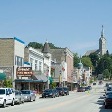
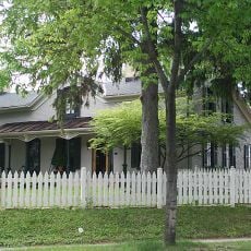
The district is best explored on foot, allowing visitors to examine the buildings and their stonework details up close. Several historic bed and breakfast establishments operate within the preserved structures, providing lodging options for those wishing to stay overnight.

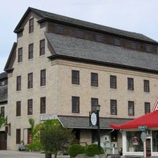
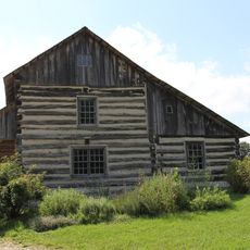
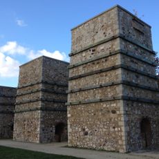
The Cedarburg Brewery Complex dating from the 1840s stands as one of the earliest breweries in southeastern Wisconsin, featuring distinctive limestone walls about 18 inches (46 centimeters) thick, covered with Cream City bricks. The thick construction was essential for maintaining proper brewing temperatures during production.

Location: Wisconsin

GPS coordinates: 43.30028,-87.98778

Latest update: December 14, 2025 11:05

Photos
Around this place
Cedarburg Covered Bridge
United States of America

Cedarburg Covered Bridge

4.4 km
Lion's Den Gorge Nature Preserve
United States of America

Lion's Den Gorge Nature Preserve

9.3 km
St. Mary's Roman Catholic Church
United States of America

St. Mary's Roman Catholic Church

14 km
Cedarburg Mill
United States of America

Cedarburg Mill

424 m
Port Washington Light
United States of America

Port Washington Light

14 km
Grafton Flour Mill
United States of America

Grafton Flour Mill

3.7 km
Kevich Light
United States of America

Kevich Light

8.4 km
St. Augustine Catholic Church and Cemetery
United States of America

St. Augustine Catholic Church and Cemetery

10.3 km
Port Washington Downtown Historic District
United States of America

Port Washington Downtown Historic District

13.8 km
Jonathan Clark House
United States of America

Jonathan Clark House

3.8 km
John Reichert Farmhouse
United States of America

John Reichert Farmhouse

3.3 km
Cedarburg Bog
United States of America

Cedarburg Bog

9.8 km
Old Ozaukee County Courthouse
United States of America

Old Ozaukee County Courthouse

13.6 km
Concordia Mill
United States of America

Concordia Mill

2.2 km
Wayside House
United States of America

Wayside House

935 m
Edward Dodge House
United States of America

Edward Dodge House

13.6 km
Christian Turck House
United States of America

Christian Turck House

8.2 km
Edwin J. Nieman Sr. House
United States of America

Edwin J. Nieman Sr. House

5 km
Isham Day House
United States of America

Isham Day House

8.5 km
William F. Jahn Farmstead
United States of America

William F. Jahn Farmstead

7 km
Bigelow School
United States of America

Bigelow School

4.4 km
Cedarburg Woolen Co. Worsted Mill
United States of America

Cedarburg Woolen Co. Worsted Mill

3.7 km
Columbia Historic District
United States of America

Columbia Historic District

292 m
Harry W. Bolens House
United States of America

Harry W. Bolens House

12.7 km
Main Street Historic District
United States of America

Main Street Historic District

8 km
Green Bay Road Historic District
United States of America

Green Bay Road Historic District

7.7 km
Jacob Voigt House
United States of America

Jacob Voigt House

8.1 km
Milwaukee Falls Lime Company
United States of America

Milwaukee Falls Lime Company

2.7 km
Show the full map
Reviews

Visited this place? Tap the stars to rate it and share your experience / photos with the community! Try now! You can cancel it anytime.

« Washington Avenue Historic District - Historic district in Cedarburg, United States » is provided by Around Us (aroundus.com). Images and texts are derived from Wikimedia project under a Creative Commons license. You are allowed to copy, distribute, and modify copies of this page, under the conditions set by the license, as long as this note is clearly visible.

Discover hidden gems everywhere you go!

From secret cafés to breathtaking viewpoints, skip the crowded tourist spots and find places that match your style. Our app makes it easy with voice search, smart filtering, route optimization, and insider tips from travelers worldwide. Download now for the complete mobile experience.

Around Us App Screenshot

A unique approach to discovering new places

Le Figaro

All the places worth exploring

France Info

A tailor-made excursion in just a few clicks

20 Minutes