Chest opened
+${chestReward.xp} XP
Explorer
NOUVEAU ×${chestReward.collectible.quantity}
tapez pour fermer
Chest locked

Open chests in the app

Around Us is built for your phone — chests unlock when you walk, explore and capture nearby places.

Enable Location

We need your location to show you interesting places around you

Discover nearby places

Find interesting locations and hidden gems around you

Precise directions

Get accurate directions and distances to places

Your location is never shared with other users. It's only used when you tap the location button.

Log in to your account

Start exploring — it's free

Trusted by 72,891 travelers worldwide

Continue with Google
Continue with Apple
or

We will send you a code to connect

By continuing, you accept our Terms and Conditions and our Privacy Policy

Check your inbox

We've sent a pincode in your inbox. Please enter the code below.

Discussion Reviews Photo
3.4k Popularity

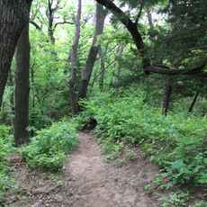
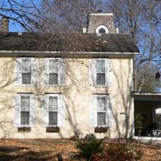
Wabash Trace, National Recreation Trail in Iowa, US

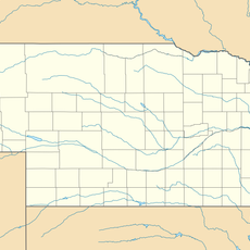
The Wabash Trace is a trail in southwest Iowa that links nine towns through farmland, rolling hills, and creek crossings. The surface alternates between concrete and crushed limestone, with bridges, parking areas, and water stations spread across towns along the route.

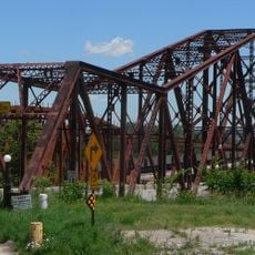
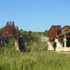
The trail follows an old railroad corridor that fell out of use and was converted into a recreational path through years of community and volunteer work. The effort began around 30 years ago and gradually brought the nine towns along the route closer together.

Thursday evening rides between Council Bluffs and Mineola draw cyclists and local residents together for social gatherings that connect people across the trail communities.

The trail is accessible from several towns along the route, where parking and drinking water are available. Summer temperatures in Iowa can be high, so spring and fall tend to be more comfortable times to visit.

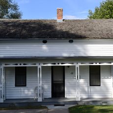
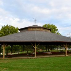
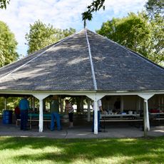
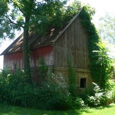
At Imogene, an old grain bin was converted into a trailhead with restrooms, picnic tables, and a camping area. This repurposed structure is one of the more unexpected stops along the route.

The community of curious travelers

AroundUs brings together thousands of curated places, local tips, and hidden gems, enriched daily by 60,000 contributors worldwide.

Start exploring
Location
GPS coordinates
40.87560,-95.42920
Latest update
March 3, 2026 13:57
Around this place
Josiah B. and Sara Moore House
United States of America

Josiah B. and Sara Moore House

39 km
Waubonsie State Park
United States of America

Waubonsie State Park

31.5 km
Plattsmouth Bridge
United States of America

Plattsmouth Bridge

39.3 km
St. Patrick Church
United States of America

St. Patrick Church

658 m
Pony Creek Park
United States of America

Pony Creek Park

37.1 km
Todd House
United States of America

Todd House

21 km
Fremont County Courthouse
United States of America

Fremont County Courthouse

23.1 km
Page County Courthouse
United States of America

Page County Courthouse

36.5 km
William P. Hepburn House
United States of America

William P. Hepburn House

35.9 km
Clarinda Carnegie Library
United States of America

Clarinda Carnegie Library

36.2 km
Tabor Congregational Church
United States of America

Tabor Congregational Church

20.8 km
Red Oak Public Library
United States of America

Red Oak Public Library

22.3 km
Edmund B. Osborne House
United States of America

Edmund B. Osborne House

23 km
Chautauqua Park
United States of America

Chautauqua Park

23.5 km
Women's Christian Temperance Union Public Fountain
United States of America

Women's Christian Temperance Union Public Fountain

13.1 km
Red Oak Firehouse and City Jail
United States of America

Red Oak Firehouse and City Jail

22.4 km
Hamburg Public Library
United States of America

Hamburg Public Library

35.6 km
Chautauqua Pavilion
United States of America

Chautauqua Pavilion

24.6 km
Goldenrod Schoolhouse
United States of America

Goldenrod Schoolhouse

37.2 km
United States of America

Young Cemetery Cabin

40.7 km
Alfred Hebard House
United States of America

Alfred Hebard House

23 km
W.T.S. White House and Carriage House
United States of America

W.T.S. White House and Carriage House

36.2 km
Jason and Elizabeth Baylor Rector House
United States of America

Jason and Elizabeth Baylor Rector House

28.5 km
Plattsmouth Railroad Bridge
United States of America

Plattsmouth Railroad Bridge

39.4 km
Gottfried Gustav Pitz Barn
United States of America

Gottfried Gustav Pitz Barn

40 km
Distrito electoral de Liberty
United States of America

Distrito electoral de Liberty

39.7 km
Naomi Institute
United States of America

Naomi Institute

36.1 km
Hunter School
United States of America

Hunter School

20.4 km
Show the full map
Reviews
Share your experience

No review yet

Discussions
Start a discussion...

No discussion yet

« Wabash Trace - National Recreation Trail in Iowa, US » is provided by Around Us (aroundus.com). Images and texts are derived from Wikimedia project under a Creative Commons license. You are allowed to copy, distribute, and modify copies of this page, under the conditions set by the license, as long as this note is clearly visible.

Discover hidden gems everywhere you go!

From secret cafés to breathtaking viewpoints, skip the crowded tourist spots and find places that match your style. Our app makes it easy with voice search, smart filtering, route optimization, and insider tips from travelers worldwide. Download now for the complete mobile experience.

Around Us App Screenshot

A unique approach to discovering new places

Le Figaro

All the places worth exploring

France Info

A tailor-made excursion in just a few clicks

20 Minutes

Around Us
Travel Guide & Maps
Download

Send to your phone

QR Code
1

Open the camera app on your mobile.

2

Point at the QR code with your camera. A notification will appear.

3

Tap the notification to open the link.