Enable Location

We need your location to show you interesting places around you

Discover nearby places

Find interesting locations and hidden gems around you

Precise directions

Get accurate directions and distances to places

Your location is never shared with other users. It's only used when you tap the location button.

Waubonsie State Park

Log in to your account

Start exploring — it's free

Trusted by 62,501 travelers worldwide

Continue with Google
Continue with Apple
or

We will send you a code to connect

By continuing, you accept our Terms and Conditions and our Privacy Policy

Check your inbox

We've sent a pincode in your inbox. Please enter the code below.

Waubonsie State Park

Waubonsie State Park, Nature reserve in Fremont County, Iowa, US.

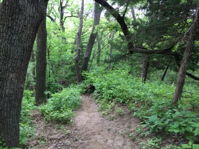
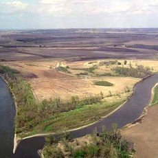
Waubonsie State Park is a nature reserve in Fremont County covering about 1,990 acres with steep ridges, dense forests, and prairie lands that form part of the distinctive Loess Hills formation. These landscapes create different natural environments throughout the park.

The land was first acquired in 1926 as a nature conservation project for the Loess Hills region. A significant expansion occurred in 2005 when the park incorporated the 646-acre Wa-Shawtee Girl Scout camp.

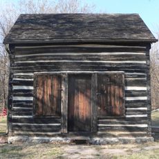
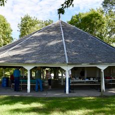
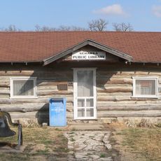
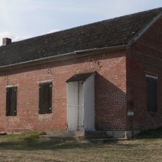
The park carries the name of Potawatomi Chief Wabaunsee and preserves structures built by the Civilian Conservation Corps during the 1930s. These buildings reflect how communities worked to shape and protect natural lands during that era.

The park provides 40 campsites with modern facilities, 7 miles of hiking trails, and 8 miles of paths for horseback riding. Trail markings are clear and visitors can find routes suited to different activity levels.

The park contains yucca plants typically found in desert environments, showing the diverse plant life of the region. Visitors can also see geological formations called cat steps created by soil displacement on hillsides.

The community of curious travelers

AroundUs brings together thousands of curated places, local tips, and hidden gems, enriched daily by 60,000 contributors worldwide.

Start exploring
Location
Inception
1926
GPS coordinates
40.67220,-95.68830
Latest update
December 12, 2025 09:01
Around this place
Arbor Lodge State Historical Park and Arboretum
United States of America

Arbor Lodge State Historical Park and Arboretum

16.4 km
Mayhew Cabin
United States of America

Mayhew Cabin

15.3 km
McKissick Island
United States of America

McKissick Island

14.4 km
Captain Meriwether Lewis
United States of America

Captain Meriwether Lewis

31.1 km
Brownville Bridge
United States of America

Brownville Bridge

30.6 km
Otoe County Courthouse
United States of America

Otoe County Courthouse

14.4 km
Todd House
United States of America

Todd House

25.3 km
Fremont County Courthouse
United States of America

Fremont County Courthouse

9 km
Grand Army of the Republic Memorial Hall
United States of America

Grand Army of the Republic Memorial Hall

14.2 km
Morton-James Public Library
United States of America

Morton-James Public Library

14.3 km
Tabor Congregational Church
United States of America

Tabor Congregational Church

25.4 km
Harmony School, School District No. 53
United States of America

Harmony School, School District No. 53

20.5 km
Boscobel
United States of America

Boscobel

16 km
Women's Christian Temperance Union Public Fountain
United States of America

Women's Christian Temperance Union Public Fountain

28.6 km
George F. Lee Octagon Houses
United States of America

George F. Lee Octagon Houses

14.8 km
St. Benedict's Catholic Church
United States of America

St. Benedict's Catholic Church

12.9 km
John W. Bennett House
United States of America

John W. Bennett House

31.3 km
Hamburg Public Library
United States of America

Hamburg Public Library

7.8 km
Chautauqua Pavilion
United States of America

Chautauqua Pavilion

10.1 km
Nehawka Public Library
United States of America

Nehawka Public Library

30.8 km
Jason and Elizabeth Baylor Rector House
United States of America

Jason and Elizabeth Baylor Rector House

7 km
Jasper A. Ware House
United States of America

Jasper A. Ware House

16.2 km
River Inn Resort
United States of America

River Inn Resort

31.3 km
Distrito electoral de Liberty
United States of America

Distrito electoral de Liberty

24.9 km
Naomi Institute
United States of America

Naomi Institute

31.8 km
Nebraska City Bridge
United States of America

Nebraska City Bridge

12 km
Arbor Day Farm
United States of America

Arbor Day Farm

16.5 km
Nebraska City Bridge
United States of America

Nebraska City Bridge

12 km
Show the full map
« Waubonsie State Park - Nature reserve in Fremont County, Iowa, US » is provided by Around Us (aroundus.com). Images and texts are derived from Wikimedia project under a Creative Commons license. You are allowed to copy, distribute, and modify copies of this page, under the conditions set by the license, as long as this note is clearly visible.

Discover hidden gems everywhere you go!

From secret cafés to breathtaking viewpoints, skip the crowded tourist spots and find places that match your style. Our app makes it easy with voice search, smart filtering, route optimization, and insider tips from travelers worldwide. Download now for the complete mobile experience.

Around Us App Screenshot

A unique approach to discovering new places

Le Figaro

All the places worth exploring

France Info

A tailor-made excursion in just a few clicks

20 Minutes

Around Us
Travel Guide & Maps
Download

Send to your phone

QR Code
1

Open the camera app on your mobile.

2

Point at the QR code with your camera. A notification will appear.

3

Tap the notification to open the link.