Enable Location

We need your location to show you interesting places around you

Discover nearby places

Find interesting locations and hidden gems around you

Precise directions

Get accurate directions and distances to places

Your location is never shared with other users. It's only used when you tap the location button.

Log in to your account

Start exploring — it's free

Trusted by 61,869 travelers worldwide

Continue with Google
Continue with Apple
or

We will send you a code to connect

By continuing, you accept our Terms and Conditions and our Privacy Policy

Check your inbox

We've sent a pincode in your inbox. Please enter the code below.

Hardin Village Site

Hardin Village Site, Archaeological site in Greenup County, Kentucky, United States.

Description

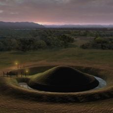
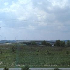
Hardin Village Site is an archaeological settlement in Greenup County along the Ohio River terrace, spanning several hectares across the landscape. It features clusters of longhouses arranged without a central plaza, and multiple excavations since the 1930s have revealed between 301 and 445 burials.

History

Native Americans occupied this settlement from the early 1600s until around 1625, representing a significant period of occupation before European contact reached the region. This timeframe captures a critical phase of pre-contact indigenous life along the Ohio River.

Culture

The residents made tools from mussel shells and shaped animal bones into various implements. They also created pottery featuring designs influenced by Mississippian cultures.

Practical

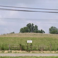
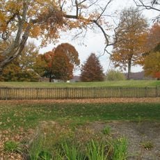
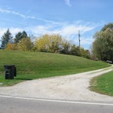
The site is situated on a river terrace with relatively flat terrain, making it accessible for visitors who want to explore the area. Since this is an excavated location, you will not see much above-ground structure, but the ground layout shows where the former dwellings once stood.

Did you know?

The longhouses were built using single set post construction with internal partitions that divided the space into separate living areas for multiple families. This design reveals how different households managed to live together under one roof.

Location
GPS coordinates
38.74190,-82.91490
Latest update
December 14, 2025 14:40

AroundUs brings together thousands of curated places, local tips, and hidden gems, enriched daily by 60,000 contributors worldwide. Discover all places nearby (Kentucky).

Around this place
Spartan Municipal Stadium
United States of America

Spartan Municipal Stadium

5.7 km
Lower Shawneetown
United States of America

Lower Shawneetown

9.7 km
Shawnee State Park
United States of America

Shawnee State Park

24.6 km
U.S. Grant Bridge
United States of America

U.S. Grant Bridge

7.5 km
Shawnee State Forest
United States of America

Shawnee State Forest

19.4 km
Sciotoville Bridge
United States of America

Sciotoville Bridge

2.8 km
Greenup Lock and Dam
United States of America

Greenup Lock and Dam

11.6 km
Carl Perkins Bridge
United States of America

Carl Perkins Bridge

9.1 km
Tremper Mound and Works
United States of America

Tremper Mound and Works

10.6 km
Biggs Site
United States of America

Biggs Site

1.9 km
Jesse Stuart Memorial Bridge
United States of America

Jesse Stuart Memorial Bridge

11.7 km
Portsmouth Public Library
United States of America

Portsmouth Public Library

6.5 km
Boneyfiddle Commercial District
United States of America

Boneyfiddle Commercial District

7.2 km
Philip Moore Stone House
United States of America

Philip Moore Stone House

10.3 km
Johnson Road Covered Bridge
United States of America

Johnson Road Covered Bridge

26.5 km
Bennett's Mill Covered Bridge
United States of America

Bennett's Mill Covered Bridge

12.4 km
Otway Covered Bridge
United States of America

Otway Covered Bridge

27.4 km
Anderson Brothers Department Store
United States of America

Anderson Brothers Department Store

7.2 km
Odd Fellows Hall
United States of America

Odd Fellows Hall

7.5 km
Evangelical Church of Christ
United States of America

Evangelical Church of Christ

7.3 km
Bigelow United Methodist Church
United States of America

Bigelow United Methodist Church

7.4 km
Olive Furnace
United States of America

Olive Furnace

24.8 km
Wurtland Union Church
United States of America

Wurtland Union Church

24.3 km
Greenup Masonic Lodge
United States of America

Greenup Masonic Lodge

19.5 km
Methodist Episcopal Church South
United States of America

Methodist Episcopal Church South

19.7 km
Columbia Music Arena
United States of America

Columbia Music Arena

7 km
Horseshoe Mound
United States of America

Horseshoe Mound

5.4 km
Portsmouth Earthworks, Group A
United States of America

Portsmouth Earthworks, Group A

9.7 km
Show the full map
« Hardin Village Site - Archaeological site in Greenup County, Kentucky, United States » is provided by Around Us (aroundus.com). Images and texts are derived from Wikimedia project under a Creative Commons license. You are allowed to copy, distribute, and modify copies of this page, under the conditions set by the license, as long as this note is clearly visible.

Discover hidden gems everywhere you go!

From secret cafés to breathtaking viewpoints, skip the crowded tourist spots and find places that match your style. Our app makes it easy with voice search, smart filtering, route optimization, and insider tips from travelers worldwide. Download now for the complete mobile experience.

Around Us App Screenshot

A unique approach to discovering new places

Le Figaro

All the places worth exploring

France Info

A tailor-made excursion in just a few clicks

20 Minutes

Around Us
Travel Guide & Maps
Download

Send to your phone

QR Code
1

Open the camera app on your mobile.

2

Point at the QR code with your camera. A notification will appear.

3

Tap the notification to open the link.