Delaplane Historic District

Log in to your account

AroundUs is a community-driven map of interesting places, built by curious explorers like you. It grows with every review, story, and photo you share.
Connect to save your favorite spots, contribute locations, and create personalized routes.
Continue with Google
Continue with Apple
Continue with X
Continue with Facebook
Continue with email
By continuing, you accept our Terms and Conditions and our Privacy Policy
Create an account
Add to collection
Map
Suggest a change
Share

Delaplane Historic District, Historic district in Delaplane, Virginia.

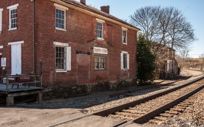
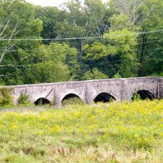
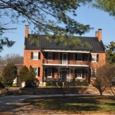
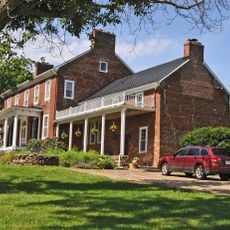
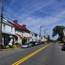
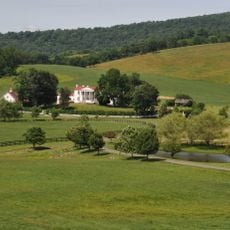
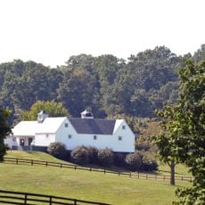
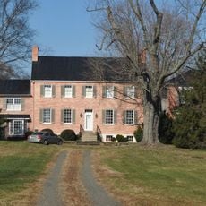
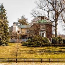
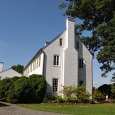
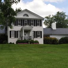
Delaplane Historic District is a historic district in Fauquier County, Virginia, extending along Delaplane Grade Road and Rokeby Road with classical-style buildings. The area sits within a valley of rolling farmland, and the Norfolk Southern rail line still runs through the center today.

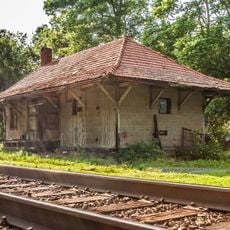
The district developed at the crossing of Winchester-Dumfries Road and the Manassas Gap Railroad, which made the location known as Piedmont Station in earlier times. In 1861, a Confederate brigade under General Thomas Jackson used the rail line here to transport troops, which marked the first large-scale movement of soldiers by train.

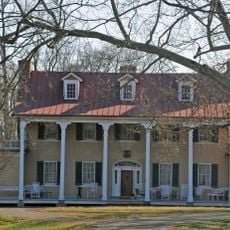
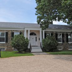
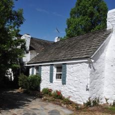
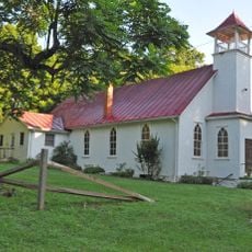
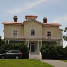
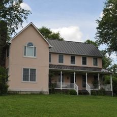
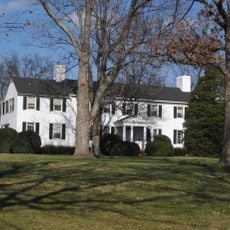
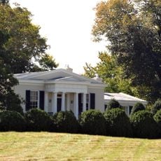
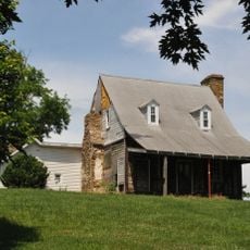
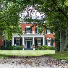
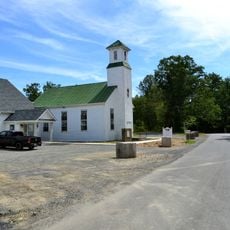
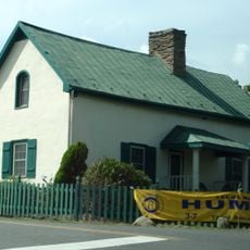
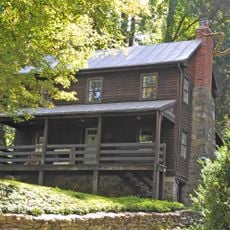
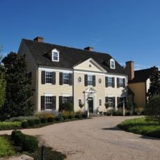
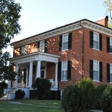
The district displays residential and commercial buildings from the late 1800s and early 1900s that shape how this rural area looks today. These structures represent different architectural styles that evolved in rural Virginia communities over time.

The district is visible from public roads, though most buildings sit on private property that cannot be entered. An active rail line runs through the center, so visitors should stay alert when exploring the area.

The place was originally called Piedmont Station and served as a major junction point on a historic railroad line. The road and rail layout remains largely unchanged from that earlier time, giving the area a sense of continuity despite modern changes around it.

Location: Fauquier County

Architectural style: Greek Revival architecture

GPS coordinates: 38.91580,-77.92000

Latest update: December 14, 2025 16:44

Photos
Around this place
Sky Meadows State Park
United States of America

Sky Meadows State Park

8.4 km
Welbourne
United States of America

Welbourne

13.3 km
Blue Ridge Farm
United States of America

Blue Ridge Farm

6.4 km
Goose Creek Stone Bridge
United States of America

Goose Creek Stone Bridge

11.4 km
Rose Hill Farm
United States of America

Rose Hill Farm

10.8 km
Belle Grove
United States of America

Belle Grove

7.8 km
Rectortown Historic District
United States of America

Rectortown Historic District

5.2 km
Marshall Historic District
United States of America

Marshall Historic District

7.9 km
Ashville Historic District
United States of America

Ashville Historic District

6.8 km
Oakley
United States of America

Oakley

8.4 km
John Marshall's Leeds Manor Rural Historic District
United States of America

John Marshall's Leeds Manor Rural Historic District

7.2 km
Cleremont Farm
United States of America

Cleremont Farm

15.3 km
Crooked Run Valley Rural Historic District
United States of America

Crooked Run Valley Rural Historic District

5.4 km
Ashleigh
United States of America

Ashleigh

1.5 km
Yew Hill-Robert Ashby's Tavern-Shacklett's Tavern
United States of America

Yew Hill-Robert Ashby's Tavern-Shacklett's Tavern

1.4 km
Markham Historic District
United States of America

Markham Historic District

6.8 km
Burrland Farm Historic District
United States of America

Burrland Farm Historic District

14.5 km
Green Garden
United States of America

Green Garden

10.6 km
Morgantown Historic District
United States of America

Morgantown Historic District

9.2 km
Hume Historic District
United States of America

Hume Historic District

11.6 km
Crednal
United States of America

Crednal

13.7 km
Mill House
United States of America

Mill House

12.6 km
Upperville Historic District
United States of America

Upperville Historic District

9.1 km
Green Pastures (Middleburg, Virginia)
United States of America

Green Pastures (Middleburg, Virginia)

11.4 km
Old Denton
United States of America

Old Denton

10.8 km
Woodside
United States of America

Woodside

2.1 km
Cromwell's Run Rural Historic District
United States of America

Cromwell's Run Rural Historic District

5.4 km
Morven
United States of America

Morven

8.3 km
Show the full map
Reviews

Visited this place? Tap the stars to rate it and share your experience / photos with the community! Try now! You can cancel it anytime.

« Delaplane Historic District - Historic district in Delaplane, Virginia » is provided by Around Us (aroundus.com). Images and texts are derived from Wikimedia project under a Creative Commons license. You are allowed to copy, distribute, and modify copies of this page, under the conditions set by the license, as long as this note is clearly visible.

Discover hidden gems everywhere you go!

From secret cafés to breathtaking viewpoints, skip the crowded tourist spots and find places that match your style. Our app makes it easy with voice search, smart filtering, route optimization, and insider tips from travelers worldwide. Download now for the complete mobile experience.

Around Us App Screenshot

A unique approach to discovering new places

Le Figaro

All the places worth exploring

France Info

A tailor-made excursion in just a few clicks

20 Minutes