Enable Location

We need your location to show you interesting places around you

Discover nearby places

Find interesting locations and hidden gems around you

Precise directions

Get accurate directions and distances to places

Your location is never shared with other users. It's only used when you tap the location button.

Huntingdon Borough Historic District

Log in to your account

Start exploring — it's free

Trusted by 62,467 travelers worldwide

Continue with Google
Continue with Apple
or

We will send you a code to connect

By continuing, you accept our Terms and Conditions and our Privacy Policy

Check your inbox

We've sent a pincode in your inbox. Please enter the code below.

Huntingdon Borough Historic District, Historic district in Huntingdon, Pennsylvania, United States.

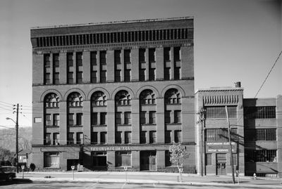
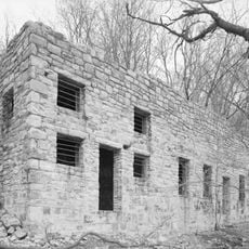
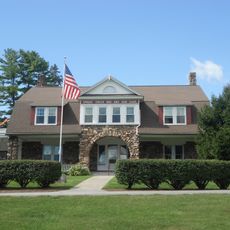
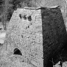
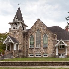
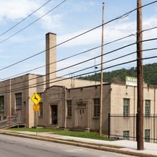
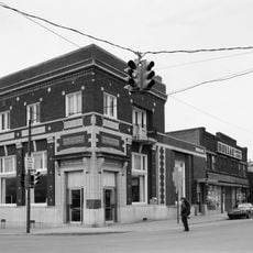
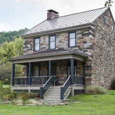
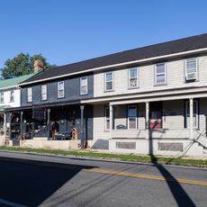
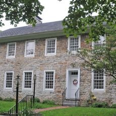
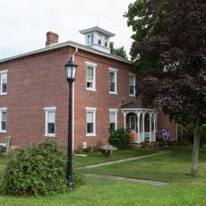
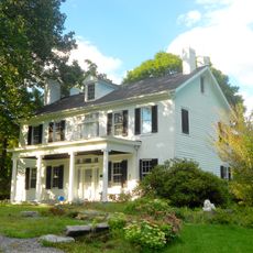
Huntingdon Borough Historic District is a neighborhood in Pennsylvania with buildings from the late 1700s through early 1900s, including an old jail, train station building, and former hotel showcasing different architectural styles. The streets are laid out for exploring the architecture and wind through well-preserved residential areas with shops and business buildings.

The district grew from Huntingdon's role as a transportation hub in the 1800s, with the railroad drawing new buildings and businesses. It was officially listed for protection in 1986 to preserve this period of local development.

The district reveals how local builders and residents shaped these structures over generations, with many buildings still serving as shops and residences in their original form. The variety of styles reflects how the community evolved and prospered as people lived and worked in this area.

The area is easiest to explore by starting at the top and gradually moving through the streets between Moore, Second, Allegheny, and Ninth. It helps to walk slowly and examine the details of facades and entrances, as many buildings have kept their original features.

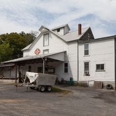
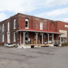
Two notable store buildings from the mid to late 1800s show how retail businesses looked and operated in this transportation-friendly town. These structures still display their iron storefronts and remain windows into the local commercial past.

The community of curious travelers

AroundUs brings together thousands of curated places, local tips, and hidden gems, enriched daily by 60,000 contributors worldwide.

Start exploring
Location
GPS coordinates
40.48611,-78.01139
Latest update
December 14, 2025 18:41
Around this place
Raystown Lake
United States of America

Raystown Lake

5.9 km
Harbison-Walker Refractories Company
United States of America

Harbison-Walker Refractories Company

15.2 km
Tytoona Cave
United States of America

Tytoona Cave

21.1 km
Trough Creek State Park
United States of America

Trough Creek State Park

20.3 km
Pulpit Rocks
United States of America

Pulpit Rocks

4.7 km
Warrior Ridge Dam and Hydroelectric Plant
United States of America

Warrior Ridge Dam and Hydroelectric Plant

6.2 km
Spruce Creek Rod and Gun Club
United States of America

Spruce Creek Rod and Gun Club

21.2 km
Pennsylvania Railroad Old Bridge over Standing Stone Creek
United States of America

Pennsylvania Railroad Old Bridge over Standing Stone Creek

831 m
Etna Furnace
United States of America

Etna Furnace

15.5 km
Williamsburg Historic District
United States of America

Williamsburg Historic District

16.5 km
Brumbaugh Homestead
United States of America

Brumbaugh Homestead

15.1 km
Corbin Bridge
United States of America

Corbin Bridge

4.2 km
H.O. Andrews Feed Mill
United States of America

H.O. Andrews Feed Mill

11.7 km
Huntingdon Armory
United States of America

Huntingdon Armory

1.5 km
Barree Forge and Furnace
United States of America

Barree Forge and Furnace

8.9 km
Mount Union Historic District
United States of America

Mount Union Historic District

17.9 km
Lewis Smalley Homestead
United States of America

Lewis Smalley Homestead

20.7 km
Marklesburg Historic District
United States of America

Marklesburg Historic District

17.9 km
Pennsylvania Railroad District
United States of America

Pennsylvania Railroad District

18.5 km
Juniata Iron Works
United States of America

Juniata Iron Works

8.9 km
Jacob Isett House and Store
United States of America

Jacob Isett House and Store

21.1 km
Robb Farm
United States of America

Robb Farm

6.8 km
Pennsylvania Railroad Bridge over Shavers Creek
United States of America

Pennsylvania Railroad Bridge over Shavers Creek

9.5 km
Colerain Forges Mansion
United States of America

Colerain Forges Mansion

18.6 km
Lloyd and Henry Warehouse
United States of America

Lloyd and Henry Warehouse

569 m
Swigart Museum
United States of America

Swigart Museum

7.2 km
Huntingdon Furnace
United States of America

Huntingdon Furnace

21.1 km
Harpster Covered Bridge
United States of America

Harpster Covered Bridge

19.1 km
Show the full map
« Huntingdon Borough Historic District - Historic district in Huntingdon, Pennsylvania, United States » is provided by Around Us (aroundus.com). Images and texts are derived from Wikimedia project under a Creative Commons license. You are allowed to copy, distribute, and modify copies of this page, under the conditions set by the license, as long as this note is clearly visible.

Discover hidden gems everywhere you go!

From secret cafés to breathtaking viewpoints, skip the crowded tourist spots and find places that match your style. Our app makes it easy with voice search, smart filtering, route optimization, and insider tips from travelers worldwide. Download now for the complete mobile experience.

Around Us App Screenshot

A unique approach to discovering new places

Le Figaro

All the places worth exploring

France Info

A tailor-made excursion in just a few clicks

20 Minutes

Around Us
Travel Guide & Maps
Download

Send to your phone

QR Code
1

Open the camera app on your mobile.

2

Point at the QR code with your camera. A notification will appear.

3

Tap the notification to open the link.