Enable Location

We need your location to show you interesting places around you

Discover nearby places

Find interesting locations and hidden gems around you

Precise directions

Get accurate directions and distances to places

Your location is never shared with other users. It's only used when you tap the location button.

Spruce Creek Rod and Gun Club

Log in to your account

Start exploring — it's free

Trusted by 63,237 travelers worldwide

Continue with Google
Continue with Apple
or

We will send you a code to connect

By continuing, you accept our Terms and Conditions and our Privacy Policy

Check your inbox

We've sent a pincode in your inbox. Please enter the code below.

Discussion Reviews 1 Photos
1.3k Popularity

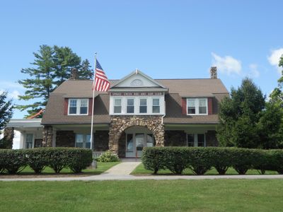
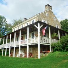
Spruce Creek Rod and Gun Club, Historic clubhouse in Franklin Township, Pennsylvania, US.

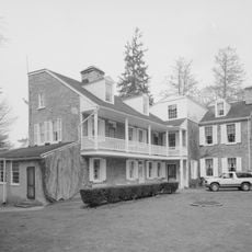
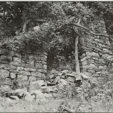
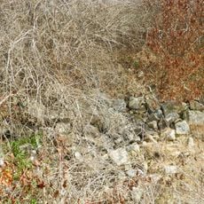
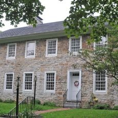
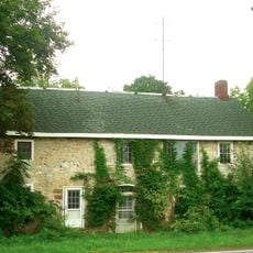
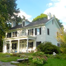
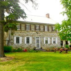
The Spruce Creek Rod and Gun Club is a clubhouse with Colonial Revival design in Franklin Township, built with fieldstone walls, gambrel roofs, and multiple dormers across its structure. The two-and-a-half story building sits on a large property that includes a generator building, ice house, and carriage house.

The clubhouse was founded in 1905 by businessmen from Altoona and later added to the National Register of Historic Places in 1991. The recognition honored its architectural significance in the development of the local community.

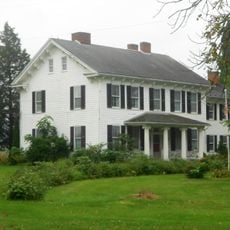
The clubhouse has long served as a gathering place where people from the region come together to enjoy outdoor pursuits. It represents a local tradition of recreational life that has been passed down through generations.

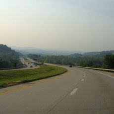
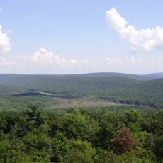
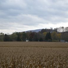
The location on Clubhouse Lane offers easy access to the surroundings with spacious outdoor areas to explore. Visitors should wear comfortable clothing to fully enjoy the grounds and the surrounding valley landscape.

The building was ahead of its time, installing early telephones, indoor plumbing, and electricity before such conveniences were common in the rural area. This shows how the club brought modern upgrades to an isolated valley.

The community of curious travelers

AroundUs brings together thousands of curated places, local tips, and hidden gems, enriched daily by 60,000 contributors worldwide.

Start exploring
Location
GPS coordinates
40.67444,-78.04778
Latest update
December 14, 2025 17:40
Around this place
Interstate 99
United States of America

Interstate 99

18.9 km
Rothrock State Forest
United States of America

Rothrock State Forest

19.8 km
Tytoona Cave
United States of America

Tytoona Cave

15.3 km
Whipple Dam State Park
United States of America

Whipple Dam State Park

15.6 km
Garfield Thomas Water Tunnel
United States of America

Garfield Thomas Water Tunnel

20.1 km
Pennsylvania Furnace Mansion
United States of America

Pennsylvania Furnace Mansion

4.4 km
Pulpit Rocks
United States of America

Pulpit Rocks

17.3 km
Warrior Ridge Dam and Hydroelectric Plant
United States of America

Warrior Ridge Dam and Hydroelectric Plant

15.1 km
St. John's Evangelical Lutheran Church
United States of America

St. John's Evangelical Lutheran Church

19.3 km
Birmingham Bridge
United States of America

Birmingham Bridge

13.1 km
John Gray House
United States of America

John Gray House

17.8 km
College Heights Historic District
United States of America

College Heights Historic District

20.2 km
Barree Forge and Furnace
United States of America

Barree Forge and Furnace

15.1 km
Monroe Furnace
United States of America

Monroe Furnace

13.1 km
Pennsylvania Railroad District
United States of America

Pennsylvania Railroad District

11.1 km
Tyrone Borough Historic District
United States of America

Tyrone Borough Historic District

16.3 km
Juniata Iron Works
United States of America

Juniata Iron Works

15.1 km
Jacob Isett House and Store
United States of America

Jacob Isett House and Store

15.5 km
Bucher Ayres Farm
United States of America

Bucher Ayres Farm

8.8 km
Abraham Elder Stone House
United States of America

Abraham Elder Stone House

13.8 km
Pennsylvania Railroad Bridge over Shavers Creek
United States of America

Pennsylvania Railroad Bridge over Shavers Creek

12 km
Colerain Forges Mansion
United States of America

Colerain Forges Mansion

5.9 km
George Wilson Homestead
United States of America

George Wilson Homestead

9.2 km
Церковь Святой Троицы
United States of America

Церковь Святой Троицы

19.8 km
Discovery Space
United States of America

Discovery Space

19.9 km
Whipple Dam State Park Day Use District
United States of America

Whipple Dam State Park Day Use District

15.4 km
Huntingdon Furnace
United States of America

Huntingdon Furnace

6.1 km
Harpster Covered Bridge
United States of America

Harpster Covered Bridge

3.9 km
Show the full map
Reviews
Share your experience

No review yet

Discussions
Start a discussion...

No discussion yet

« Spruce Creek Rod and Gun Club - Historic clubhouse in Franklin Township, Pennsylvania, US » is provided by Around Us (aroundus.com). Images and texts are derived from Wikimedia project under a Creative Commons license. You are allowed to copy, distribute, and modify copies of this page, under the conditions set by the license, as long as this note is clearly visible.

Discover hidden gems everywhere you go!

From secret cafés to breathtaking viewpoints, skip the crowded tourist spots and find places that match your style. Our app makes it easy with voice search, smart filtering, route optimization, and insider tips from travelers worldwide. Download now for the complete mobile experience.

Around Us App Screenshot

A unique approach to discovering new places

Le Figaro

All the places worth exploring

France Info

A tailor-made excursion in just a few clicks

20 Minutes

Around Us
Travel Guide & Maps
Download

Send to your phone

QR Code
1

Open the camera app on your mobile.

2

Point at the QR code with your camera. A notification will appear.

3

Tap the notification to open the link.