Enable Location

We need your location to show you interesting places around you

Discover nearby places

Find interesting locations and hidden gems around you

Precise directions

Get accurate directions and distances to places

Your location is never shared with other users. It's only used when you tap the location button.

Rothrock State Forest

Log in to your account

Start exploring — it's free

Trusted by 61,771 travelers worldwide

Continue with Google
Continue with Apple
or

We will send you a code to connect

By continuing, you accept our Terms and Conditions and our Privacy Policy

Check your inbox

We've sent a pincode in your inbox. Please enter the code below.

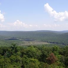
Rothrock State Forest, State forest in Central Pennsylvania, United States.

Description

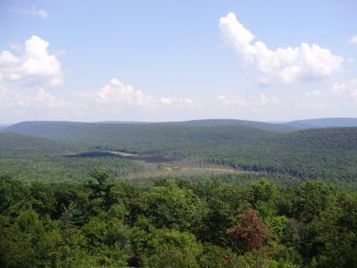
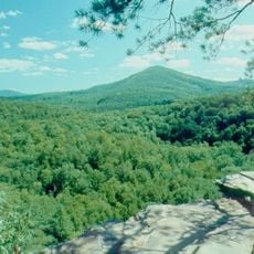
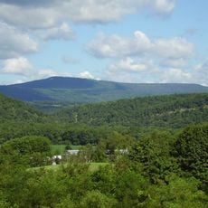
Rothrock State Forest is a large state forest in central Pennsylvania spanning three counties with dense woodlands, mountain ridges, and numerous hiking trails throughout the region. The terrain includes open meadows, thick forest stands, and several camping areas accessible throughout the year.

History

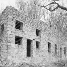
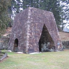
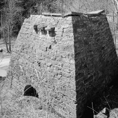
The land was completely cleared in 1903 for charcoal production serving iron furnaces, prompting Dr. Joseph Rothrock to acquire thousands of acres for reforestation. This forest reclamation effort marked the beginning of conservation work in the region.

Culture

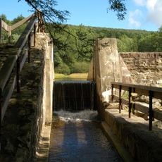
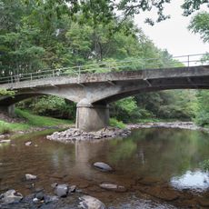
The forest serves as a popular destination for outdoor recreation and wildlife observation among local and visiting communities. This widespread use reflects how the place functions as a gathering space for people seeking contact with nature.

Practical

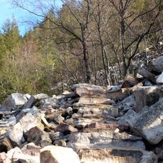
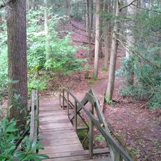
Visitors can choose from over 300 miles of marked trails and find camping areas distributed throughout the forest. The terrain is accessible year-round, with each season offering different conditions for outdoor activities.

Did you know?

The area contains Bear Meadows, an 890-acre wetland that formed during the last ice age with rare plant species growing there. Visitors walking through this natural area can observe plants found in few other locations in the region.

Location
Operator
Pennsylvania Bureau of Forestry
GPS coordinates
40.71000,-77.81830
Latest update
December 9, 2025 18:47

AroundUs brings together thousands of curated places, local tips, and hidden gems, enriched daily by 60,000 contributors worldwide. Discover all places nearby (Pennsylvania).

Around this place
Raystown Lake
United States of America

Raystown Lake

34.6 km
Harbison-Walker Refractories Company
United States of America

Harbison-Walker Refractories Company

36.6 km
Greenwood Furnace State Park
United States of America

Greenwood Furnace State Park

8.5 km
Tytoona Cave
United States of America

Tytoona Cave

34.6 km
Trough Creek State Park
United States of America

Trough Creek State Park

50 km
Whipple Dam State Park
United States of America

Whipple Dam State Park

4.6 km
Rockhill Trolley Museum
United States of America

Rockhill Trolley Museum

52.7 km
Standing Stone Trail
United States of America

Standing Stone Trail

11.1 km
Pennsylvania Military Museum
United States of America

Pennsylvania Military Museum

8.2 km
Penn-Roosevelt State Park
United States of America

Penn-Roosevelt State Park

9.9 km
Bear Meadows Natural Area
United States of America

Bear Meadows Natural Area

5.1 km
Boal Mansion
United States of America

Boal Mansion

7.8 km
Minersville Coke Ovens
United States of America

Minersville Coke Ovens

63.1 km
Pennsylvania Furnace Mansion
United States of America

Pennsylvania Furnace Mansion

16.5 km
Butler Knob
United States of America

Butler Knob

48 km
Pulpit Rocks
United States of America

Pulpit Rocks

28.6 km
Baker Bridge
United States of America

Baker Bridge

53.7 km
Alan Seeger Natural Area
United States of America

Alan Seeger Natural Area

5.8 km
Warrior Ridge Dam and Hydroelectric Plant
United States of America

Warrior Ridge Dam and Hydroelectric Plant

26.3 km
Spruce Creek Rod and Gun Club
United States of America

Spruce Creek Rod and Gun Club

19.8 km
Pennsylvania Railroad Old Bridge over Standing Stone Creek
United States of America

Pennsylvania Railroad Old Bridge over Standing Stone Creek

30 km
Woodvale Historic District
United States of America

Woodvale Historic District

66.2 km
Huntingdon Borough Historic District
United States of America

Huntingdon Borough Historic District

29.8 km
St. Mary's Covered Bridge
United States of America

St. Mary's Covered Bridge

56.4 km
Etna Furnace
United States of America

Etna Furnace

37.2 km
Williamsburg Historic District
United States of America

Williamsburg Historic District

42.8 km
Shade Gap Feed and Flour Mill
United States of America

Shade Gap Feed and Flour Mill

58.4 km
Brumbaugh Homestead
United States of America

Brumbaugh Homestead

44.6 km
Show the full map
« Rothrock State Forest - State forest in Central Pennsylvania, United States » is provided by Around Us (aroundus.com). Images and texts are derived from Wikimedia project under a Creative Commons license. You are allowed to copy, distribute, and modify copies of this page, under the conditions set by the license, as long as this note is clearly visible.

Discover hidden gems everywhere you go!

From secret cafés to breathtaking viewpoints, skip the crowded tourist spots and find places that match your style. Our app makes it easy with voice search, smart filtering, route optimization, and insider tips from travelers worldwide. Download now for the complete mobile experience.

Around Us App Screenshot

A unique approach to discovering new places

Le Figaro

All the places worth exploring

France Info

A tailor-made excursion in just a few clicks

20 Minutes

Around Us
Travel Guide & Maps
Download

Send to your phone

QR Code
1

Open the camera app on your mobile.

2

Point at the QR code with your camera. A notification will appear.

3

Tap the notification to open the link.