Butler Knob, Mountain summit in south central Pennsylvania, United States.
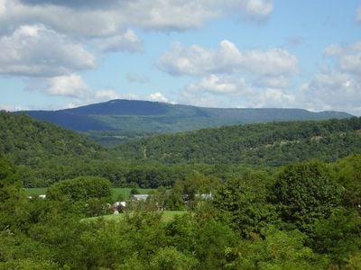
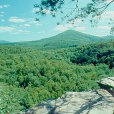
Butler Knob is a mountain summit in Rothrock State Forest in south central Pennsylvania, rising to about 2,320 feet above sea level. The peak is defined by a weather-resistant quartzite formation and marked by a closed fire tower and monitoring equipment.
The summit's geological structure formed during the Silurian period as part of the Tuscarora Formation, which shapes much of the Appalachian range. These ancient rock layers were uplifted by tectonic forces that built the mountain system over deep time.
The Standing Stone Trail connects this summit to other peaks in a regional hiking network used by local outdoor enthusiasts. The mountain draws visitors interested in exploring the Appalachian landscape and experiencing its natural heritage.
Visitors need a sturdy vehicle to access this summit via an unpaved road that can be rough in wet conditions. The clearest views and easiest access occur during dry weather when conditions are more manageable.
From the scree slopes at the peak, visitors can spot several neighboring mountains including Big Mountain, Sideling Hill, and Blue Knob spread across the horizon. This vantage point lets hikers grasp the scale of the surrounding Appalachian terrain and identify distant summits.
The community of curious travelers
AroundUs brings together thousands of curated places, local tips, and hidden gems, enriched daily by 60,000 contributors worldwide.