Chest opened
+${chestReward.xp} XP
Explorer
NOUVEAU ×${chestReward.collectible.quantity}
tapez pour fermer

See the monuments around you in AR Open chests in the app

Around Us is built for your phone — point your camera at the streets and discover the monuments and places around you in augmented reality. Around Us is built for your phone — chests unlock when you walk, explore and capture nearby places.

Enable Location

We need your location to show you interesting places around you

Discover nearby places

Find interesting locations and hidden gems around you

Precise directions

Get accurate directions and distances to places

Your location is never shared with other users. It's only used when you tap the location button.

Standing Stone Trail

Log in to your account

Start exploring — it's free

Trusted by 86,806 travelers worldwide

Continue with Google
Continue with Apple
or

We will send you a code to connect

By continuing, you accept our Terms and Conditions and our Privacy Policy

Check your inbox

We've sent a pincode in your inbox. Please enter the code below.

Standing Stone Trail
Discussion Reviews 1 Photos
3.7k Popularity

Standing Stone Trail, Long-distance trail in Fulton County, US

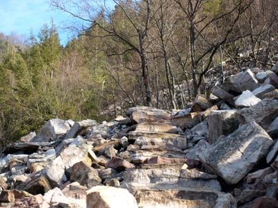
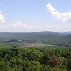
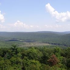
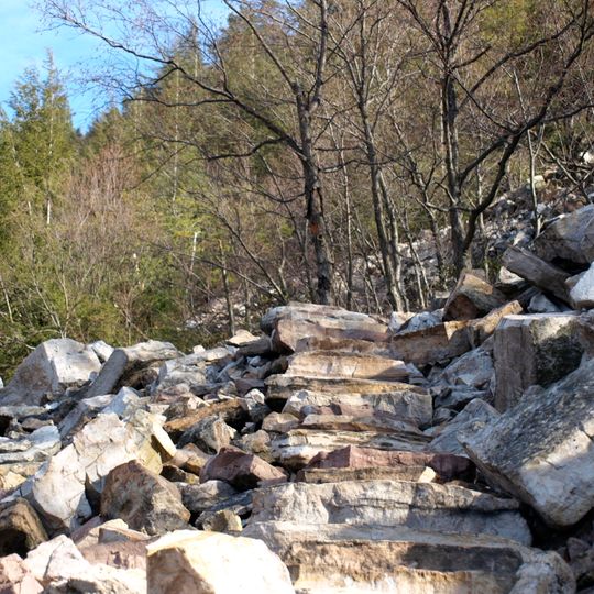
The Standing Stone Trail is a hiking route spanning 84 miles that winds through Pennsylvania mountains and connects the Tuscarora Trail with the Mid State Trail. The path travels through forests and across ridges, offering continuous natural scenery and varied landscapes throughout.

The route began in the 1970s as a connector path and was renamed in 2007 to honor Native American landmark marking practices in the mountains. This change reflected a shift toward deeper recognition of the region's cultural significance.

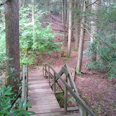
The Thousand Steps section features a staircase built by railroad workers in 1936 that reflects the labor history of this region. This structure tells the story of the people who worked here and shaped the landscape.

The route passes through multiple protected areas, game lands, and nature reserves, providing regular access points and water sources. Visitors should prepare for variable terrain and longer hiking sections.

The Vanderbilt's Folly section contains an incomplete 1880s railroad grade with abandoned tunnels left behind after the project's bankruptcy. These remains tell the story of a failed rail venture that permanently altered the landscape.

The community of curious travelers

AroundUs brings together thousands of curated places, local tips, and hidden gems, enriched daily by 60,000 contributors worldwide.

Start exploring
Location
GPS coordinates
40.61454,-77.78074
Latest update
September 12, 2026 08:47
Around this place
Rothrock State Forest
United States of America

Rothrock State Forest

5.7 mi
Greenwood Furnace State Park
United States of America

Greenwood Furnace State Park

2.3 mi
Whipple Dam State Park
United States of America

Whipple Dam State Park

6.6 mi
Pennsylvania Military Museum
United States of America

Pennsylvania Military Museum

11.6 mi
Penn-Roosevelt State Park
United States of America

Penn-Roosevelt State Park

8.7 mi
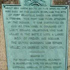
Fort Granville
United States of America

Fort Granville

9.6 mi
Bear Meadows Natural Area
United States of America

Bear Meadows Natural Area

8 mi
Boal Mansion
United States of America

Boal Mansion

11.4 mi
Alan Seeger Natural Area
United States of America

Alan Seeger Natural Area

5.6 mi
Old Stone Arch Bridge
United States of America

Old Stone Arch Bridge

12 mi
Montgomery Ward Building
United States of America

Montgomery Ward Building

10.9 mi
Oak Hall Historic District
United States of America

Oak Hall Historic District

12.5 mi
Camelot
United States of America

Camelot

12.7 mi
Embassy Theatre
United States of America

Embassy Theatre

10.9 mi
Mifflin County Courthouse
United States of America

Mifflin County Courthouse

10.8 mi
Boalsburg Historic District
United States of America

Boalsburg Historic District

11.2 mi
Hill House
United States of America

Hill House

11 mi
Monroe Furnace
United States of America

Monroe Furnace

8.2 mi
Holmes-Foster-Highlands Historic District
United States of America

Holmes-Foster-Highlands Historic District

13 mi
Bucher Ayres Farm
United States of America

Bucher Ayres Farm

12.2 mi
Wollner Building
United States of America

Wollner Building

10.9 mi
Gen. John Thompson House
United States of America

Gen. John Thompson House

12.5 mi
Церковь Святой Троицы
United States of America

Церковь Святой Троицы

12.9 mi
Whipple Dam State Park Day Use District
United States of America

Whipple Dam State Park Day Use District

6.6 mi
Boal Mansion Museum
United States of America

Boal Mansion Museum

11.4 mi
Miller Cinemas 6
United States of America

Miller Cinemas 6

10.9 mi
McCoy House
United States of America

McCoy House

10.8 mi
Linden Hall Historic District
United States of America

Linden Hall Historic District

12.7 mi
Show the full map
Reviews
Share your experience

No review yet

Discussions
Start a discussion...

No discussion yet

« Standing Stone Trail - Long-distance trail in Fulton County, US » is provided by Around Us (aroundus.com). Images and texts are derived from Wikimedia project under a Creative Commons license. You are allowed to copy, distribute, and modify copies of this page, under the conditions set by the license, as long as this note is clearly visible.

Discover hidden gems everywhere you go!

From secret cafés to breathtaking viewpoints, skip the crowded tourist spots and find places that match your style. Our app makes it easy with voice search, smart filtering, route optimization, and insider tips from travelers worldwide. Download now for the complete mobile experience.

Around Us App Screenshot

A unique approach to discovering new places

Le Figaro

All the places worth exploring

France Info

A tailor-made excursion in just a few clicks

20 Minutes

Around Us
Travel Guide & Maps
Download

Send to your phone

QR Code
1

Open the camera app on your mobile.

2

Point at the QR code with your camera. A notification will appear.

3

Tap the notification to open the link.