Enable Location

We need your location to show you interesting places around you

Discover nearby places

Find interesting locations and hidden gems around you

Precise directions

Get accurate directions and distances to places

Your location is never shared with other users. It's only used when you tap the location button.

Fulton County

Log in to your account

Start exploring — it's free

Trusted by 61,786 travelers worldwide

Continue with Google
Continue with Apple
or

We will send you a code to connect

By continuing, you accept our Terms and Conditions and our Privacy Policy

Check your inbox

We've sent a pincode in your inbox. Please enter the code below.

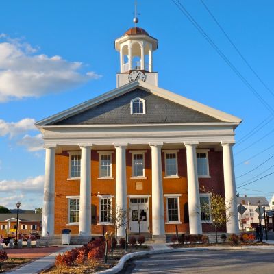
Fulton County, Administrative division in Pennsylvania, United States

Description

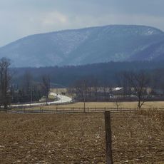
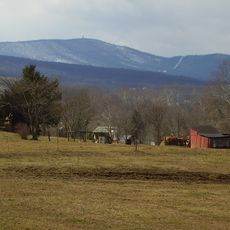
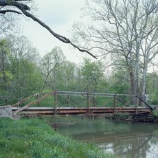
Fulton County is a county in Pennsylvania, located in the south-central part of the state with McConnellsburg as its administrative hub. The area consists of rolling countryside dotted with small towns and agricultural land.

History

The county was established in 1850 when the Pennsylvania General Assembly separated it from Bedford County. It was named after inventor Robert Fulton to honor his technological contributions.

Culture

The county maintains three separate K-12 school districts: Central Fulton, Forbes Road, and Southern Fulton, serving the educational needs of local communities.

Practical

The main roads through the county are Pennsylvania Routes 16 and 26, along with US Highway 30 and Interstate 70. Visitors should expect longer travel times between towns, as the area is sparsely populated.

Did you know?

With 14,556 residents according to the 2020 census, Fulton County ranks as Pennsylvania's fourth least populated county.

Location
Inception
April 19, 1850
Capital city
McConnellsburg
Shares border with
Huntingdon County, Franklin County, Washington County, Allegany County, Bedford County
GPS coordinates
39.92000,-78.11000
Latest update
December 20, 2025 14:06

AroundUs brings together thousands of curated places, local tips, and hidden gems, enriched daily by 60,000 contributors worldwide. Discover all places nearby (Pennsylvania).

Around this place
United States of America

Mercersburg Academy

20.9 km
Rays Hill Tunnel
United States of America

Rays Hill Tunnel

13.5 km
Cowans Gap State Park
United States of America

Cowans Gap State Park

18.4 km
Buchanan's Birthplace State Park
United States of America

Buchanan's Birthplace State Park

14.4 km
Big Mountain
United States of America

Big Mountain

15.1 km
Cross Mountain
United States of America

Cross Mountain

23.6 km
Lane House
United States of America

Lane House

20.3 km
Rock Hill Farm
United States of America

Rock Hill Farm

27.8 km
United States of America

State Game Lands Number 49

20.2 km
United States of America

State Game Lands Number 73

31.4 km
Fulton House
United States of America

Fulton House

9.6 km
United States of America

State Game Lands Number 261

25.6 km
Jacksons Mill Covered Bridge
United States of America

Jacksons Mill Covered Bridge

14.9 km
Carrick Furnace
United States of America

Carrick Furnace

22.7 km
Halls Mill Covered Bridge
United States of America

Halls Mill Covered Bridge

28.8 km
Mercersburg Historic District
United States of America

Mercersburg Historic District

20.5 km
Feltons Mill Covered Bridge
United States of America

Feltons Mill Covered Bridge

16.3 km
Mt. Pleasant Iron Works House
United States of America

Mt. Pleasant Iron Works House

18.6 km
Millmont Farm
United States of America

Millmont Farm

24 km
Burnt Cabins Gristmill Property
United States of America

Burnt Cabins Gristmill Property

25.8 km
Everett Historic District
United States of America

Everett Historic District

24.6 km
Yeakle's Mill Bridge
United States of America

Yeakle's Mill Bridge

21.6 km
Cold Spring Farm
United States of America

Cold Spring Farm

10.6 km
United States of America

Fort Piper

29.9 km
Widow Donaldson Place
United States of America

Widow Donaldson Place

18.3 km
Findlay Farm
United States of America

Findlay Farm

23.2 km
Frehn Bridge
United States of America

Frehn Bridge

25.8 km
United States of America

Col. John Work House

19.9 km
Show the full map
« Fulton County - Administrative division in Pennsylvania, United States » is provided by Around Us (aroundus.com). Images and texts are derived from Wikimedia project under a Creative Commons license. You are allowed to copy, distribute, and modify copies of this page, under the conditions set by the license, as long as this note is clearly visible.

Discover hidden gems everywhere you go!

From secret cafés to breathtaking viewpoints, skip the crowded tourist spots and find places that match your style. Our app makes it easy with voice search, smart filtering, route optimization, and insider tips from travelers worldwide. Download now for the complete mobile experience.

Around Us App Screenshot

A unique approach to discovering new places

Le Figaro

All the places worth exploring

France Info

A tailor-made excursion in just a few clicks

20 Minutes

Around Us
Travel Guide & Maps
Download

Send to your phone

QR Code
1

Open the camera app on your mobile.

2

Point at the QR code with your camera. A notification will appear.

3

Tap the notification to open the link.