Cowans Gap State Park

Log in to your account

AroundUs is a community-driven map of interesting places, built by curious explorers like you. It grows with every review, story, and photo you share.
Connect to save your favorite spots, contribute locations, and create personalized routes.
Continue with Google
Continue with Apple
Continue with X
Continue with Facebook
Continue with email
By continuing, you accept our Terms and Conditions and our Privacy Policy
Create an account
Add to collection
Map
Suggest a change
Share

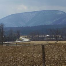
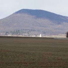
Cowans Gap State Park, State park in Fulton County and Franklin County, United States.

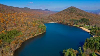
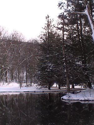
Cowans Gap State Park is a protected nature reserve containing a 42-acre lake surrounded by forest, spanning approximately 1,085 acres of land. The property features numerous trails that remain accessible throughout all four seasons.

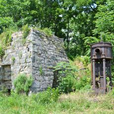
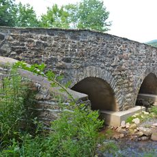
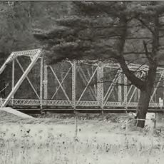
During the Great Depression in the 1930s, the Civilian Conservation Corps constructed the dam, roads, and bridges that shaped this park. This development was part of broader efforts to recover the regional economy through public works.

The park amphitheater hosts musical performances and community gatherings where locals and visitors connect over seasonal concerts. These events shape the social fabric of the region and bring together people from surrounding areas.

Camping facilities operate from mid-April through mid-December with modern restrooms and accommodation for both tents and recreational vehicles. Visitors should check conditions before arrival, as seasons affect trail accessibility and general site conditions.

The park features an electric vehicle charging station near the office, supporting sustainable transportation for visitors to the property. This amenity remains uncommon in rural protected areas across the region.

Location: Fulton County

Location: Franklin County

Inception: 1937

Operator: Pennsylvania Bureau of State Parks

Website: http://dcnr.state.pa.us/stateparks/parks/cowansgap.aspx

GPS coordinates: 40.00330,-77.92390

Latest update: December 8, 2025 19:58

Photos
Around this place
Rays Hill Tunnel
United States of America

Rays Hill Tunnel

23.9 km
Buchanan's Birthplace State Park
United States of America

Buchanan's Birthplace State Park

15 km
Big Mountain
United States of America

Big Mountain

6.1 km
Lane House
United States of America

Lane House

19.5 km
Rocky Spring Presbyterian Church
United States of America

Rocky Spring Presbyterian Church

21.2 km
Zion Reformed Church
United States of America

Zion Reformed Church

23.6 km
Mansfield
United States of America

Mansfield

24 km
Fulton House
United States of America

Fulton House

10.2 km
Parnell Knob
United States of America

Parnell Knob

11 km
Carrick Furnace
United States of America

Carrick Furnace

4.4 km
Horse Valley Bridge
United States of America

Horse Valley Bridge

15.7 km
Mercersburg Historic District
United States of America

Mercersburg Historic District

19.7 km
Mt. Pleasant Iron Works House
United States of America

Mt. Pleasant Iron Works House

4.8 km
Millmont Farm
United States of America

Millmont Farm

22.6 km
Hays Bridge Historic District
United States of America

Hays Bridge Historic District

24.6 km
Townhouse Row
United States of America

Townhouse Row

23.5 km
Burnt Cabins Gristmill Property
United States of America

Burnt Cabins Gristmill Property

8.8 km
Chambersburg and Bedford Turnpike Road Company Toll House
United States of America

Chambersburg and Bedford Turnpike Road Company Toll House

13.7 km
Bridge between Guilford and Hamilton Townships
United States of America

Bridge between Guilford and Hamilton Townships

22.2 km
Bridge in Metal Township
United States of America

Bridge in Metal Township

18.1 km
Franklin Furnace Historic District
United States of America

Franklin Furnace Historic District

10 km
Church Hill Farm
United States of America

Church Hill Farm

19.2 km
Cold Spring Farm
United States of America

Cold Spring Farm

9.2 km
Widow Donaldson Place
United States of America

Widow Donaldson Place

10.3 km
Findlay Farm
United States of America

Findlay Farm

19.9 km
Frehn Bridge
United States of America

Frehn Bridge

15.6 km
Woodland
United States of America

Woodland

14.3 km
McCoy-Shoemaker Farm
United States of America

McCoy-Shoemaker Farm

24.3 km
Show the full map
Reviews

Visited this place? Tap the stars to rate it and share your experience / photos with the community! Try now! You can cancel it anytime.

« Cowans Gap State Park - State park in Fulton County and Franklin County, United States » is provided by Around Us (aroundus.com). Images and texts are derived from Wikimedia project under a Creative Commons license. You are allowed to copy, distribute, and modify copies of this page, under the conditions set by the license, as long as this note is clearly visible.

Discover hidden gems everywhere you go!

From secret cafés to breathtaking viewpoints, skip the crowded tourist spots and find places that match your style. Our app makes it easy with voice search, smart filtering, route optimization, and insider tips from travelers worldwide. Download now for the complete mobile experience.

Around Us App Screenshot

A unique approach to discovering new places

Le Figaro

All the places worth exploring

France Info

A tailor-made excursion in just a few clicks

20 Minutes