Enable Location

We need your location to show you interesting places around you

Discover nearby places

Find interesting locations and hidden gems around you

Precise directions

Get accurate directions and distances to places

Your location is never shared with other users. It's only used when you tap the location button.

Swann's Point Plantation

Log in to your account

Start exploring — it's free

Trusted by travelers worldwide

Continue with Google
Continue with Apple
or

We will send you a code to connect

By continuing, you accept our Terms and Conditions and our Privacy Policy

Check your inbox

We've sent a pincode in your inbox. Please enter the code below.

Swann's Point Plantation, Colonial plantation in Surry County, United States.

Description

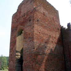
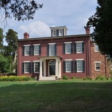
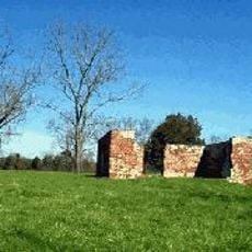
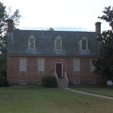
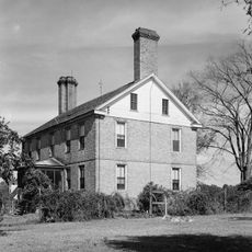
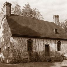
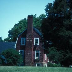
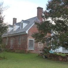
Swann's Point Plantation is an excavated colonial site in Surry County, Virginia, located along the James River. Archaeological work has exposed two brick foundations measuring approximately 60 feet by 20 feet, along with numerous colonial artifacts scattered across the area.

History

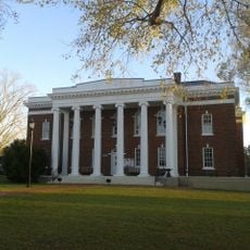
William Swann received a land patent in 1635 for approximately 485 hectares and established the plantation at this river location. The property expanded to about 665 hectares under his son Thomas Swann and remained a significant landholding across several generations.

Culture

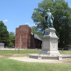
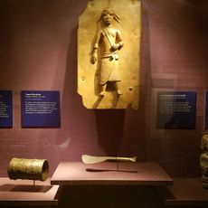
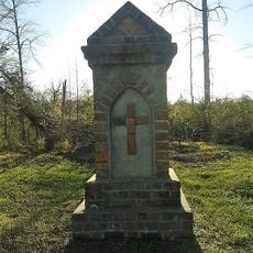
The burial ground displays a marked grave of Thomas Swann with his coat of arms, reflecting how prominent colonial families marked their social position in early Virginia. These visible symbols of wealth and status reveal the hierarchy that shaped community life along the river.

Practical

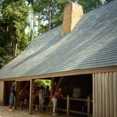
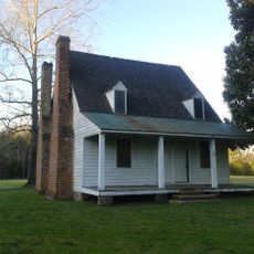
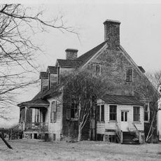
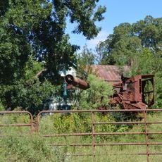
The site sits on a riverbank location and visitors should note the water edge for safe navigation and awareness of ground conditions. Taking time to examine the exposed foundations and scattered artifacts against the landscape provides better insight into how the plantation was organized spatially.

Did you know?

In 1677, the property served as a meeting place for royal commissioners investigating Bacon's Rebellion. This riverside location had become prominent enough to host official fact-finding missions at a pivotal moment in colonial Virginia's history.

Location
GPS coordinates
37.19709,-76.81913
Latest update
December 12, 2025 17:45

AroundUs brings together thousands of curated places, local tips, and hidden gems, enriched daily by 60,000 contributors worldwide. Discover all places nearby (Surry County).

Around this place
Jamestown
United States of America

Jamestown

3.9 km
Jamestown Settlement
United States of America

Jamestown Settlement

4.4 km
Jamestown Church
United States of America

Jamestown Church

3.8 km
Colonial National Historical Park
United States of America

Colonial National Historical Park

5.8 km
Jamestown Settlement
United States of America

Jamestown Settlement

4.4 km
Chippokes Plantation State Park
United States of America

Chippokes Plantation State Park

10.5 km
Green Spring Plantation
United States of America

Green Spring Plantation

6.9 km
Lake Matoaka
United States of America

Lake Matoaka

11.5 km
Muscarelle Museum of Art
United States of America

Muscarelle Museum of Art

12.1 km
United States of America

Phi Beta Kappa Memorial Hall

12.2 km
Jamestown Glasshouse
United States of America

Jamestown Glasshouse

4 km
Smith's Fort Plantation
United States of America

Smith's Fort Plantation

3.7 km
Alan B. Miller Hall
United States of America

Alan B. Miller Hall

11.8 km
Dancing Point
United States of America

Dancing Point

9.7 km
Enos House
United States of America

Enos House

8.4 km
Pleasant Point
United States of America

Pleasant Point

4.7 km
Powhatan
United States of America

Powhatan

8.6 km
Pinewoods
United States of America

Pinewoods

8.3 km
Amblers
United States of America

Amblers

4.4 km
Walnut Valley (Highgate, Virginia)
United States of America

Walnut Valley (Highgate, Virginia)

10.9 km
Glebe House of Southwark Parish
United States of America

Glebe House of Southwark Parish

9.8 km
Rich Neck Farm
United States of America

Rich Neck Farm

10 km
Surry County Courthouse Complex
United States of America

Surry County Courthouse Complex

6.8 km
Second Southwark Church Archeological Site
United States of America

Second Southwark Church Archeological Site

9.2 km
Melville
United States of America

Melville

6.7 km
Chippokes Farm and Forestry Museum
United States of America

Chippokes Farm and Forestry Museum

10.2 km
Voorhees Archaearium Archaeology Museum
United States of America

Voorhees Archaearium Archaeology Museum

3.8 km
Lake Matoaka Amphitheatre
United States of America

Lake Matoaka Amphitheatre

11.5 km
Show the full map
« Swann's Point Plantation - Colonial plantation in Surry County, United States » is provided by Around Us (aroundus.com). Images and texts are derived from Wikimedia project under a Creative Commons license. You are allowed to copy, distribute, and modify copies of this page, under the conditions set by the license, as long as this note is clearly visible.

Discover hidden gems everywhere you go!

From secret cafés to breathtaking viewpoints, skip the crowded tourist spots and find places that match your style. Our app makes it easy with voice search, smart filtering, route optimization, and insider tips from travelers worldwide. Download now for the complete mobile experience.

Around Us App Screenshot

A unique approach to discovering new places

Le Figaro

All the places worth exploring

France Info

A tailor-made excursion in just a few clicks

20 Minutes

Around Us
Travel Guide & Maps
Download

Send to your phone

QR Code
1

Open the camera app on your mobile.

2

Point at the QR code with your camera. A notification will appear.

3

Tap the notification to open the link.