Camel Bluff, cliff in Lincoln County, Washington, United States of America
Location: Lincoln County
GPS coordinates: 47.89889,-118.74306
Latest update: November 21, 2025 11:02

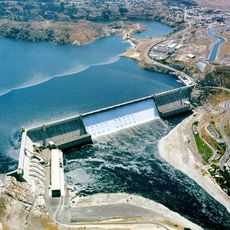
Grand Coulee Dam
18.9 km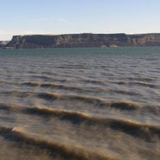
Banks Lake
33.1 km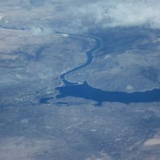
Franklin D. Roosevelt Lake
18.8 km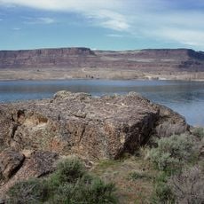
Steamboat Rock State Park
29.4 km
Fort Spokane
32.6 km
North Dam
21 km
Grand Coulee Bridge
19.3 km
Halverson Canyon
18.7 km
Mitchell Point
31.9 km
Spokane River Bridge at Fort Spokane
31.8 km
Equilibrium Rapids
30.1 km
China Bluff
5 km
The Slide
33.5 km
Castle Rock Natural Area Preserve
24.4 km
Dodge Point
26.5 km
Big Bend Wildlife Area
32.6 km
Crown Point State Park
19.8 km
Big Bend Golf & Country Club
14.9 km
Banks Lake Golf & Country Club
24 km
3rd Powerhouse
19.4 km
Franklin D Roosevelt
19.3 km
Crown Point Vista
19.8 km
Scenic viewpoint
25.6 km
Scenic viewpoint
29.4 km
Scenic viewpoint
30.4 km
Scenic viewpoint
22.2 km
Wilson Creek Falls
30.5 km
Waterfall
28.8 kmReviews
Visited this place? Tap the stars to rate it and share your experience / photos with the community! Try now! You can cancel it anytime.
Discover hidden gems everywhere you go!
From secret cafés to breathtaking viewpoints, skip the crowded tourist spots and find places that match your style. Our app makes it easy with voice search, smart filtering, route optimization, and insider tips from travelers worldwide. Download now for the complete mobile experience.

A unique approach to discovering new places❞
— Le Figaro
All the places worth exploring❞
— France Info
A tailor-made excursion in just a few clicks❞
— 20 Minutes