Enable Location

We need your location to show you interesting places around you

Discover nearby places

Find interesting locations and hidden gems around you

Precise directions

Get accurate directions and distances to places

Your location is never shared with other users. It's only used when you tap the location button.

Log in to your account

Start exploring — it's free

Trusted by 68,073 travelers worldwide

Continue with Google
Continue with Apple
or

We will send you a code to connect

By continuing, you accept our Terms and Conditions and our Privacy Policy

Check your inbox

We've sent a pincode in your inbox. Please enter the code below.

State Game Lands Number 182
Discussion Reviews Photo
1.3k Popularity

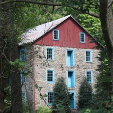
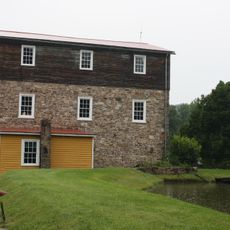
State Game Lands Number 182, Public hunting grounds in Berks County, Pennsylvania.

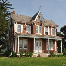
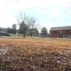
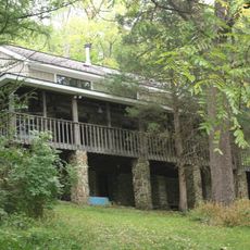
State Game Lands Number 182 is a protected public hunting area in Berks County spanning approximately 273 acres of mixed habitats. The property includes forests, wetlands, and Sacony Creek, with elevation varying between 360 and 620 feet across different zones.

The Pennsylvania Game Commission created this protected area in the 20th century to preserve natural habitats and support wildlife populations in the region. Its establishment was part of the state's broader effort to conserve game species and promote sustainable use of public lands.

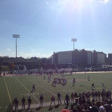
Local hunters and outdoor enthusiasts use these grounds during hunting seasons while respecting regulations designed for sustainable wildlife management. The place reflects the community's connection to hunting traditions and its commitment to protecting natural resources.

The grounds are accessible via U.S. Route 222, Pennsylvania Route 737, and Pennsylvania Route 143, with designated parking areas for visitors. Maps and information materials are available on-site to help navigate the different sections of the property.

The property supports diverse wildlife including deer, rabbits, pheasants, squirrels, and turkeys distributed across multiple ecological zones within the boundaries. This mix of species reflects the varied habitats created by forests, wetlands, and water features on the land.

The community of curious travelers

AroundUs brings together thousands of curated places, local tips, and hidden gems, enriched daily by 60,000 contributors worldwide.

Start exploring
Location
Location
GPS coordinates
40.52889,-75.81750
Latest update
December 14, 2025 18:12
Around this place
Crystal Cave
United States of America

Crystal Cave

2.2 km
University Field
United States of America

University Field

3.8 km
Keim Homestead
United States of America

Keim Homestead

14.5 km
Hamburg Public Library
United States of America

Hamburg Public Library

14.4 km
Siegfried's Dale Farm
United States of America

Siegfried's Dale Farm

8.3 km
Kutz's Mill Bridge
United States of America

Kutz's Mill Bridge

1.2 km
Dreibelbis Station Bridge
United States of America

Dreibelbis Station Bridge

6 km
Christian Schlegel Farm
United States of America

Christian Schlegel Farm

7.8 km
Hamburg Historic District
United States of America

Hamburg Historic District

14.2 km
Sally Ann Furnace Complex
United States of America

Sally Ann Furnace Complex

10.2 km
Lenhart Farm
United States of America

Lenhart Farm

7.9 km
Hamburg Armory
United States of America

Hamburg Armory

14.2 km
Kutztown 1892 Public School Building
United States of America

Kutztown 1892 Public School Building

3.9 km
Hottenstein Mansion
United States of America

Hottenstein Mansion

6.3 km
Boyer-Mertz Farm
United States of America

Boyer-Mertz Farm

5.6 km
Mary Ann Furnace Historic District
United States of America

Mary Ann Furnace Historic District

15.1 km
First National Bank in Fleetwood
United States of America

First National Bank in Fleetwood

8.2 km
Daniel Berk Log House
United States of America

Daniel Berk Log House

9.6 km
Old Main at the Lutheran Home at Topton
United States of America

Old Main at the Lutheran Home at Topton

10.7 km
Kutz Mill
United States of America

Kutz Mill

1.2 km
Guldin Mill
United States of America

Guldin Mill

11.6 km
Trexler Historic District
United States of America

Trexler Historic District

12.3 km
Bridge in Albany Township
United States of America

Bridge in Albany Township

12.3 km
Merkel Mill Complex
United States of America

Merkel Mill Complex

4.2 km
Stein Mill
United States of America

Stein Mill

3 km
Arboreto de la universidad Kutztown
United States of America

Arboreto de la universidad Kutztown

3.5 km
Mill at Lobachsville
United States of America

Mill at Lobachsville

15 km
H.K. Deisher Knitting Mill
United States of America

H.K. Deisher Knitting Mill

3.7 km
Show the full map
Reviews
Share your experience

No review yet

Discussions
Start a discussion...

No discussion yet

« State Game Lands Number 182 - Public hunting grounds in Berks County, Pennsylvania » is provided by Around Us (aroundus.com). Images and texts are derived from Wikimedia project under a Creative Commons license. You are allowed to copy, distribute, and modify copies of this page, under the conditions set by the license, as long as this note is clearly visible.

Discover hidden gems everywhere you go!

From secret cafés to breathtaking viewpoints, skip the crowded tourist spots and find places that match your style. Our app makes it easy with voice search, smart filtering, route optimization, and insider tips from travelers worldwide. Download now for the complete mobile experience.

Around Us App Screenshot

A unique approach to discovering new places

Le Figaro

All the places worth exploring

France Info

A tailor-made excursion in just a few clicks

20 Minutes

Around Us
Travel Guide & Maps
Download

Send to your phone

QR Code
1

Open the camera app on your mobile.

2

Point at the QR code with your camera. A notification will appear.

3

Tap the notification to open the link.