Chest opened
+${chestReward.xp} XP
Explorer
NOUVEAU ×${chestReward.collectible.quantity}
tapez pour fermer
Chest locked

Open chests in the app

Around Us is built for your phone — chests unlock when you walk, explore and capture nearby places.

Enable Location

We need your location to show you interesting places around you

Discover nearby places

Find interesting locations and hidden gems around you

Precise directions

Get accurate directions and distances to places

Your location is never shared with other users. It's only used when you tap the location button.

Log in to your account

Start exploring — it's free

Trusted by 72,995 travelers worldwide

Continue with Google
Continue with Apple
or

We will send you a code to connect

By continuing, you accept our Terms and Conditions and our Privacy Policy

Check your inbox

We've sent a pincode in your inbox. Please enter the code below.

State Game Lands Number 24
Discussion Reviews Photo
1.4k Popularity

State Game Lands Number 24, Public hunting grounds in Forest County, United States

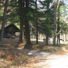
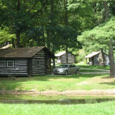
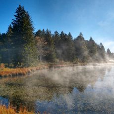
State Game Lands Number 24 is a public hunting area in Forest County, Pennsylvania, covering 8,500 acres of forested landscape. The property ranges in elevation from 1,280 to 1,681 feet (390 to 512 meters) and features multiple entry points marked with yellow signs along Routes 66 and 36.

The Pennsylvania Game Commission established these lands to help preserve wildlife populations and natural habitats across the state. This creation was part of a larger effort to protect and manage wild areas for long-term conservation and public outdoor use.

Local hunters and nature watchers come here throughout the year to pursue outdoor activities that are deeply rooted in this region's traditions. The lands reflect how people use wild spaces as places for hunting, exploration, and observing wildlife in their natural settings.

The grounds are accessible via Pennsylvania Route 66 and Route 36, with multiple entry points clearly marked by yellow signs. Visitors should prepare for varied terrain and bring appropriate clothing and footwear for different weather conditions.

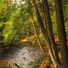
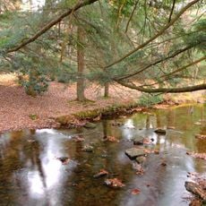
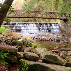
Three named waterways - Big Weaver Run, Coon Creek, and Wolf Run - flow through the property and shape its character and ecology. These streams drain into the Allegheny River watershed system and serve as useful landmarks for navigating the terrain.

The community of curious travelers

AroundUs brings together thousands of curated places, local tips, and hidden gems, enriched daily by 60,000 contributors worldwide.

Start exploring
Location
Location
GPS coordinates
41.43667,-79.28417
Latest update
December 14, 2025 16:44
Around this place
Cook Forest State Park
United States of America

Cook Forest State Park

16.1 km
Clear Creek State Park
United States of America

Clear Creek State Park

20.2 km
United States of America

Baker Trail

13.1 km
West Hickory Bridge
United States of America

West Hickory Bridge

18 km
Anthony Wayne Cook Mansion
United States of America

Anthony Wayne Cook Mansion

13.5 km
United States of America

No-Name Island

16.2 km
Cook Forest State Park River Cabin District
United States of America

Cook Forest State Park River Cabin District

14.5 km
Cook Forest State Park Indian Cabin District
United States of America

Cook Forest State Park Indian Cabin District

13 km
Clear Creek State Park Day Use District
United States of America

Clear Creek State Park Day Use District

21.3 km
Clear Creek State Park Family Cabin District
United States of America

Clear Creek State Park Family Cabin District

19 km
United States of America

State Game Lands Number 283

15.4 km
Beaver Meadows Lake
United States of America

Beaver Meadows Lake

17.5 km
United States of America

Stony Point

10.2 km
United States of America

Clear Creek State Forest Maple Creek Tract

8.6 km
Cook Forest Tower
United States of America

Cook Forest Tower

14.3 km
United States of America

Beaver Meadows Hiking Trail & Day Use Area

17.2 km
United States of America

Cook Forest Fire Tower #9

14.3 km
United States of America

Loleta Recreation Area

17.5 km
United States of America

Ridge Campground At Cook Forest

11.9 km
United States of America

Kalyumet Camping & Cabins

14.2 km
United States of America

Deer Meadow Campground

9.3 km
United States of America

Spirit of the North

17.9 km
United States of America

Camper's Paradise

21.5 km
United States of America

Rock Overlook

10.5 km
United States of America

Statue, Work of art

15.5 km
United States of America

Seneca Point Overlook

14.3 km
United States of America

Scenic viewpoint

14.1 km
United States of America

Scenic viewpoint

18.6 km
Show the full map
Reviews
Share your experience

No review yet

Discussions
Start a discussion...

No discussion yet

« State Game Lands Number 24 - Public hunting grounds in Forest County, United States » is provided by Around Us (aroundus.com). Images and texts are derived from Wikimedia project under a Creative Commons license. You are allowed to copy, distribute, and modify copies of this page, under the conditions set by the license, as long as this note is clearly visible.

Discover hidden gems everywhere you go!

From secret cafés to breathtaking viewpoints, skip the crowded tourist spots and find places that match your style. Our app makes it easy with voice search, smart filtering, route optimization, and insider tips from travelers worldwide. Download now for the complete mobile experience.

Around Us App Screenshot

A unique approach to discovering new places

Le Figaro

All the places worth exploring

France Info

A tailor-made excursion in just a few clicks

20 Minutes

Around Us
Travel Guide & Maps
Download

Send to your phone

QR Code
1

Open the camera app on your mobile.

2

Point at the QR code with your camera. A notification will appear.

3

Tap the notification to open the link.