Enable Location

We need your location to show you interesting places around you

Discover nearby places

Find interesting locations and hidden gems around you

Precise directions

Get accurate directions and distances to places

Your location is never shared with other users. It's only used when you tap the location button.

Cook Forest State Park

Log in to your account

Start exploring — it's free

Trusted by 61,759 travelers worldwide

Continue with Google
Continue with Apple
or

We will send you a code to connect

By continuing, you accept our Terms and Conditions and our Privacy Policy

Check your inbox

We've sent a pincode in your inbox. Please enter the code below.

Cook Forest State Park, National natural landmark and state park in northwestern Pennsylvania, US.

Description

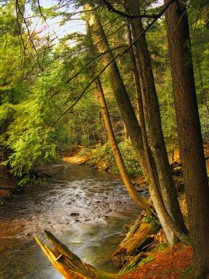
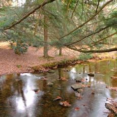
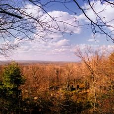
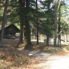
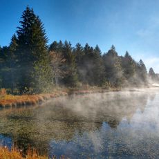
Cook Forest State Park is a natural landmark in northwestern Pennsylvania covering 8,500 acres of old-growth forest with ancient white pines and hemlocks. The land stretches along the Clarion River valley and contains the Forest Cathedral Natural Area where trees tower well above 180 feet.

History

The park was established in 1927 and protected a significant stretch of old-growth forest from logging. Creating this state park helped preserve one of the region's rare remaining ancient woodlands for the future.

Culture

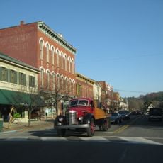
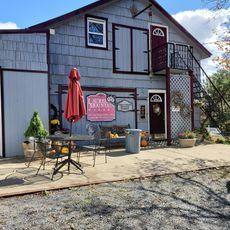
The Sawmill Center for the Arts presents craft traditions and theater performances that connect visitors to the region's heritage. You can watch local artisans demonstrate skills passed down through generations.

Practical

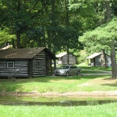
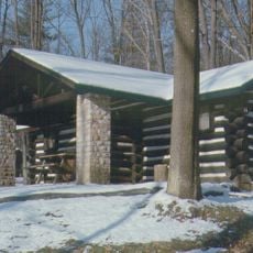
The park offers camping, cabins, and activity areas available for advance reservation. The park office can help with bookings and provide advice about the best times to visit for hiking and wildlife viewing.

Did you know?

Fire Tower Number 9 is a historic lookout tower open for climbing that reveals views stretching across miles of forest. Climbing through the old wooden structure shows how fire watchers once monitored the landscape.

Location
Location
Inception
1927
Operator
Pennsylvania Bureau of State Parks
GPS coordinates
41.32360,-79.16390
Latest update
December 7, 2025 19:32

AroundUs brings together thousands of curated places, local tips, and hidden gems, enriched daily by 60,000 contributors worldwide. Discover all places nearby (Forest County).

Around this place
Clear Creek State Park
United States of America

Clear Creek State Park

6.2 km
Gomez Mill House
United States of America

Gomez Mill House

33 km
Allegheny National Recreation Area
United States of America

Allegheny National Recreation Area

39.1 km
Clear Creek State Forest
United States of America

Clear Creek State Forest

9 km
United States of America

Tanbark Trail

39.5 km
Brookville Historic District
United States of America

Brookville Historic District

19.4 km
Brookville Presbyterian Church and Manse
United States of America

Brookville Presbyterian Church and Manse

19.3 km
Sutton-Ditz House
United States of America

Sutton-Ditz House

22.2 km
O.B. Grant House
United States of America

O.B. Grant House

36.3 km
Pithole Stone Arch Bridge
United States of America

Pithole Stone Arch Bridge

40.3 km
Clarion County Courthouse and Jail
United States of America

Clarion County Courthouse and Jail

22.1 km
West Hickory Bridge
United States of America

West Hickory Bridge

34 km
Ridgway Historic District
United States of America

Ridgway Historic District

38 km
Phillip Taylor House
United States of America

Phillip Taylor House

20.5 km
Buchanan Furnace
United States of America

Buchanan Furnace

39.4 km
Joseph E. Hall House
United States of America

Joseph E. Hall House

19.3 km
Anthony Wayne Cook Mansion
United States of America

Anthony Wayne Cook Mansion

3.6 km
Gray-Taylor House
United States of America

Gray-Taylor House

19.1 km
Bonifels
United States of America

Bonifels

35.8 km
Redferd Segers House
United States of America

Redferd Segers House

34.2 km
Cook Forest State Park River Cabin District
United States of America

Cook Forest State Park River Cabin District

2.3 km
Cook Forest State Park Indian Cabin District
United States of America

Cook Forest State Park Indian Cabin District

4 km
Clear Creek State Park Day Use District
United States of America

Clear Creek State Park Day Use District

7.1 km
Clear Creek State Park Family Cabin District
United States of America

Clear Creek State Park Family Cabin District

5.3 km
Laurel Mountain Winery
United States of America

Laurel Mountain Winery

33.3 km
Beaver Meadows Lake
United States of America

Beaver Meadows Lake

22.5 km
Clarion County Fairgrounds
United States of America

Clarion County Fairgrounds

35.9 km
Elk County Courthouse
United States of America

Elk County Courthouse

37.9 km
Show the full map
« Cook Forest State Park - National natural landmark and state park in northwestern Pennsylvania, US » is provided by Around Us (aroundus.com). Images and texts are derived from Wikimedia project under a Creative Commons license. You are allowed to copy, distribute, and modify copies of this page, under the conditions set by the license, as long as this note is clearly visible.

Discover hidden gems everywhere you go!

From secret cafés to breathtaking viewpoints, skip the crowded tourist spots and find places that match your style. Our app makes it easy with voice search, smart filtering, route optimization, and insider tips from travelers worldwide. Download now for the complete mobile experience.

Around Us App Screenshot

A unique approach to discovering new places

Le Figaro

All the places worth exploring

France Info

A tailor-made excursion in just a few clicks

20 Minutes

Around Us
Travel Guide & Maps
Download

Send to your phone

QR Code
1

Open the camera app on your mobile.

2

Point at the QR code with your camera. A notification will appear.

3

Tap the notification to open the link.