Brookville Historic District

Log in to your account

AroundUs is a community-driven map of interesting places, built by curious explorers like you. It grows with every review, story, and photo you share.
Connect to save your favorite spots, contribute locations, and create personalized routes.
By continuing, you accept our Terms and Conditions and our Privacy Policy
Add to collection
Map
Suggest a change
Share

Brookville Historic District, Historic district in Brookville, Pennsylvania

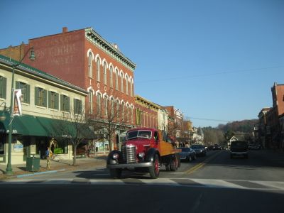
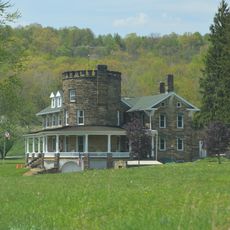
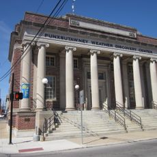
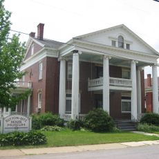
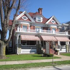
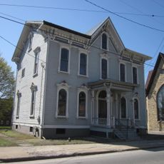
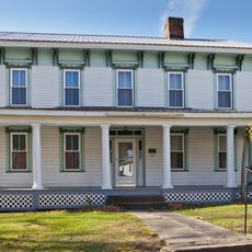
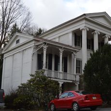
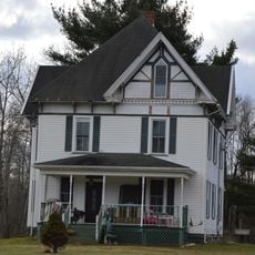
Brookville Historic District contains around 263 buildings across approximately 90 acres throughout the downtown core and residential neighborhoods, predominantly featuring Greek Revival architectural design. The structures form a cohesive composition of 19th-century construction methods, materials, and planning that stretch from the commercial core into family housing areas.

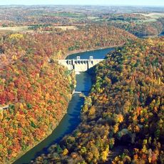
The district took shape as a settlement in the early 1800s and developed its character through early railroad expansion. Key structures like the Judge Elijah Heath House from 1836 and the Railroad House Hotel from 1851 mark the period of initial settlement and economic growth in the region.

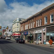
The Columbia Theater and Marlin Opera House served as gathering places where residents came together for entertainment and community events. These buildings continue to shape how the downtown feels today and reflect the importance of the arts in local life.

The district is best explored on foot and is bounded by railroad tracks, Franklin Avenue, Church Street, and Main Street. Walking through the area gives good views of the different architectural styles and the mix of commercial and residential buildings throughout the neighborhood.

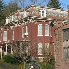
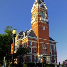
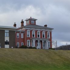
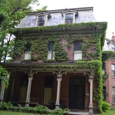
The district is home to the Jefferson County Courthouse built in 1867 and the Blood Block built in 1875, both showing Late Victorian stylistic details. These buildings stand out for their ornate facade work and create a striking contrast with the simpler Greek Revival structures found throughout the rest of the area.

Location: Brookville

Architectural style: Greek Revival architecture

GPS coordinates: 41.16028,-79.08278

Latest update: December 14, 2025 14:24

Photos
Around this place
Cook Forest State Park
United States of America

Cook Forest State Park

19.4 km
Clear Creek State Park
United States of America

Clear Creek State Park

18.7 km
Clear Creek State Forest
United States of America

Clear Creek State Forest

18 km
Mahoning Creek Dam
United States of America

Mahoning Creek Dam

31.2 km
Brookville Presbyterian Church and Manse
United States of America

Brookville Presbyterian Church and Manse

104 m
John B. McCormick House
United States of America

John B. McCormick House

35.9 km
United States Post Office
United States of America

United States Post Office

25.7 km
Sutton-Ditz House
United States of America

Sutton-Ditz House

26.1 km
Clarion County Courthouse and Jail
United States of America

Clarion County Courthouse and Jail

26.1 km
T. M. Kurtz House
United States of America

T. M. Kurtz House

25.9 km
Christian Miller House
United States of America

Christian Miller House

25.9 km
DuBois Historic District
United States of America

DuBois Historic District

27.2 km
Phillip Taylor House
United States of America

Phillip Taylor House

1.1 km
Thomas Marshall House
United States of America

Thomas Marshall House

33.9 km
Joseph E. Hall House
United States of America

Joseph E. Hall House

171 m
Anthony Wayne Cook Mansion
United States of America

Anthony Wayne Cook Mansion

21.6 km
Gray-Taylor House
United States of America

Gray-Taylor House

296 m
Colwell Cut Viaduct
United States of America

Colwell Cut Viaduct

34.2 km
Redferd Segers House
United States of America

Redferd Segers House

28.1 km
DuBois Lanes
United States of America

DuBois Lanes

29 km
Cook Forest State Park River Cabin District
United States of America

Cook Forest State Park River Cabin District

20.6 km
Cook Forest State Park Indian Cabin District
United States of America

Cook Forest State Park Indian Cabin District

22.1 km
Clear Creek State Park Day Use District
United States of America

Clear Creek State Park Day Use District

18.2 km
Clear Creek State Park Family Cabin District
United States of America

Clear Creek State Park Family Cabin District

19.4 km
Punxsutawney Weather Discovery Center
United States of America

Punxsutawney Weather Discovery Center

25.8 km
Groundhog Lanes
United States of America

Groundhog Lanes

25.7 km
Laurel Mountain Winery
United States of America

Laurel Mountain Winery

23.3 km
Clarion County Fairgrounds
United States of America

Clarion County Fairgrounds

23.8 km
Show the full map
Reviews

Visited this place? Tap the stars to rate it and share your experience / photos with the community! Try now! You can cancel it anytime.

« Brookville Historic District - Historic district in Brookville, Pennsylvania » is provided by Around Us (aroundus.com). Images and texts are derived from Wikimedia project under a Creative Commons license. You are allowed to copy, distribute, and modify copies of this page, under the conditions set by the license, as long as this note is clearly visible.

Discover hidden gems everywhere you go!

From secret cafés to breathtaking viewpoints, skip the crowded tourist spots and find places that match your style. Our app makes it easy with voice search, smart filtering, route optimization, and insider tips from travelers worldwide. Download now for the complete mobile experience.

Around Us App Screenshot

A unique approach to discovering new places

Le Figaro

All the places worth exploring

France Info

A tailor-made excursion in just a few clicks

20 Minutes