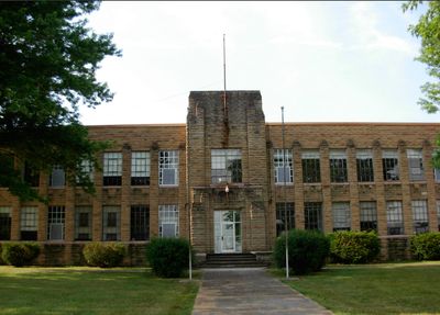
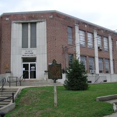
Old Wayne County High School
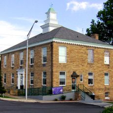
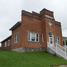
The Old Wayne County High School is a school building in Monticello, Kentucky, designed in the Art Deco style. The structure features symmetrical shapes, geometric patterns on its walls, regularly spaced windows, and solid brick construction with clean lines and decorative details throughout.
The building was constructed in 1941 with funding from the Works Progress Administration, a government program created during the Great Depression. It replaced four separate high schools in the area and was added to the National Register of Historic Places in 2013.
The school served for decades as a gathering place where students and families came together. It remains a symbol of the community's commitment to education and the connections that a shared school building created.
The building is easy to locate in Monticello and serves as a visible landmark in the town. Visitors can view the exterior architecture and overall design from the outside and learn about its construction and role in local education history.
The building was known by different names throughout its history and was also called A.J. Lloyd Middle School, reflecting its long presence in the community. Its sturdy brick construction and symmetrical design give it a timeless appearance despite its age.
The community of curious travelers
AroundUs brings together thousands of curated places, local tips, and hidden gems, enriched daily by 60,000 contributors worldwide.