Blagden Alley-Naylor Court Historic District

Log in to your account

AroundUs is a community-driven map of interesting places, built by curious explorers like you. It grows with every review, story, and photo you share.
Connect to save your favorite spots, contribute locations, and create personalized routes.
Continue with Google
Continue with Apple
Continue with X
Continue with Facebook
Continue with email
By continuing, you accept our Terms and Conditions and our Privacy Policy
Create an account
Add to collection
Map
Suggest a change
Share

Blagden Alley-Naylor Court Historic District, Historic district in Shaw, Washington, D.C.

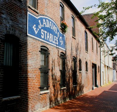
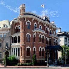
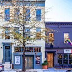
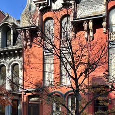
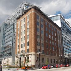
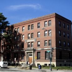
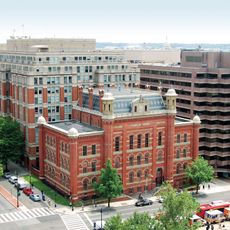
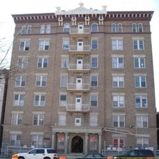
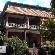
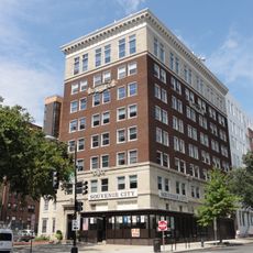
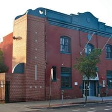
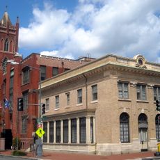
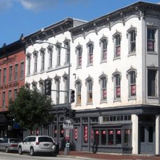
Blagden Alley-Naylor Court Historic District is a neighborhood area in Shaw that encompasses two internal alleyways located between 9th and 10th Streets and between M and O Streets. It contains 156 contributing buildings constructed between 1833 and 1941, ranging from stately rowhouses to modest residential structures.

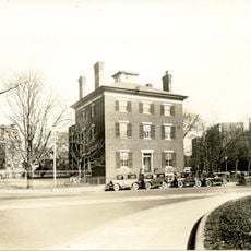
The area began taking shape in the 1830s when initial houses were constructed, later developing into a mixed residential neighborhood housing different social classes. The district maintained its historic architecture for over a century, making it a significant record of Washington's urban development.

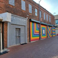
The walls throughout the area display colorful artworks created as part of a 2015 artistic initiative to showcase local artistic expression. As you walk through the narrow passages, you encounter pieces that reflect the creative spirit of the community.

The area is easy to explore on foot since it forms a small, contained neighborhood with narrow passages separated from vehicle traffic. Visitors should wear comfortable shoes and allow time to observe the many architectural and artistic details visible throughout the alleyways.

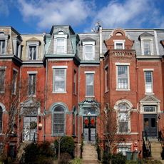
One of the most striking features is the contrasting architecture where large elegant houses face the main streets while more modest dwellings hide behind them in the alleyways. This layout reveals how different economic classes lived side by side yet distinctly separated during the 1800s.

Location: Washington, D.C.

GPS coordinates: 38.90632,-77.02483

Latest update: December 12, 2025 16:41

Photos
Around this place
Carnegie Library of Washington D.C.
United States of America

Carnegie Library of Washington D.C.

447 m
Franklin School
United States of America

Franklin School

623 m
Washington Marriott Marquis
United States of America

Washington Marriott Marquis

303 m
Old Korean Legation Museum
United States of America

Old Korean Legation Museum

624 m
Samuel Gompers Memorial
United States of America

Samuel Gompers Memorial

296 m
Major General John A. Logan
United States of America

Major General John A. Logan

556 m
Major General George Henry Thomas
United States of America

Major General George Henry Thomas

621 m
901 New York Avenue
United States of America

901 New York Avenue

462 m
Statue of Edmund Burke
United States of America

Statue of Edmund Burke

353 m
Carter G. Woodson Home National Historic Site
United States of America

Carter G. Woodson Home National Historic Site

503 m
Luther Place Memorial Church
United States of America

Luther Place Memorial Church

592 m
Martin Luther Monument
United States of America

Martin Luther Monument

596 m
Blanche K. Bruce House
United States of America

Blanche K. Bruce House

57 m
American Federation of Labor Building
United States of America

American Federation of Labor Building

335 m
Asbury United Methodist Church
United States of America

Asbury United Methodist Church

512 m
Phyllis Wheatley YWCA
United States of America

Phyllis Wheatley YWCA

596 m
Planet Word
United States of America

Planet Word

609 m
The Plymouth
United States of America

The Plymouth

231 m
Morrison and Clark Houses
United States of America

Morrison and Clark Houses

302 m
United Brotherhood of Carpenters and Joiners-Local 132 building
United States of America

United Brotherhood of Carpenters and Joiners-Local 132 building

445 m
Fourteenth Street Historic District
United States of America

Fourteenth Street Historic District

479 m
Wylie Mansion
United States of America

Wylie Mansion

520 m
George M. Barker Company Warehouse
United States of America

George M. Barker Company Warehouse

506 m
Seventh Street Savings Bank
United States of America

Seventh Street Savings Bank

247 m
Buildings at 1000 Block of Seventh Street, and 649–651 New York Avenue NW
United States of America

Buildings at 1000 Block of Seventh Street, and 649–651 New York Avenue NW

422 m
Planet Word
United States of America

Planet Word

598 m
Renaissance Washington DC Hotel
United States of America

Renaissance Washington DC Hotel

564 m
D.C. Alley Museum
United States of America

D.C. Alley Museum

23 m
Show the full map
Reviews

Visited this place? Tap the stars to rate it and share your experience / photos with the community! Try now! You can cancel it anytime.

« Blagden Alley-Naylor Court Historic District - Historic district in Shaw, Washington, D.C » is provided by Around Us (aroundus.com). Images and texts are derived from Wikimedia project under a Creative Commons license. You are allowed to copy, distribute, and modify copies of this page, under the conditions set by the license, as long as this note is clearly visible.

Discover hidden gems everywhere you go!

From secret cafés to breathtaking viewpoints, skip the crowded tourist spots and find places that match your style. Our app makes it easy with voice search, smart filtering, route optimization, and insider tips from travelers worldwide. Download now for the complete mobile experience.

Around Us App Screenshot

A unique approach to discovering new places

Le Figaro

All the places worth exploring

France Info

A tailor-made excursion in just a few clicks

20 Minutes