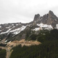
Lucky Jim Bluff, cliff in Okanogan County, Washington, United States of America
Location: Okanogan County
GPS coordinates: 48.53611,-120.35944
Latest update: October 30, 2024 16:03

Washington pass
21.8 km
Pearrygin Lake State Park
16.8 km
Lake Chelan-Sawtooth Wilderness
24.1 km
Early Winters Spires
22.2 km
Pearrygin Lake
16.4 km
Early Winters Ranger Station Work Center
8.3 km
Washington Pass Overlook Trail
21.3 km
Goat Wall
11.4 km
Abernathy Peak
13.8 km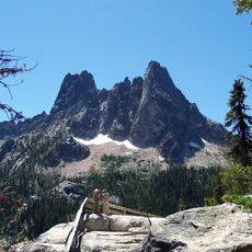
Washington Pass Overlook
21.3 km
Early Winters Wildlife Area
13.8 km
Rendezvous Wildlife Area
10.1 km
Homestream Park
15.2 km
Big Buck Wildlife Area
19.8 km
Bowen Mountain
20.2 km
Blue Buck Mountain
23.3 km
Moccasin Lake
17.2 km
Big Valley Wildlife Area
6.1 km
Davis Lake
20.7 km
Public Swimming Hole
11.9 km
Washington Pass Overlook
21.2 km
Waterfall
21.1 km
Falls creek trailhead
18.5 km
Wings of the West Wind
15 km
Okanogan County Electric Cooperative
14.6 km
Waterfall
22.7 km
Cedar Falls
9.3 km
Sagebrush Overlook
8 kmReviews
Visited this place? Tap the stars to rate it and share your experience / photos with the community! Try now! You can cancel it anytime.
Discover hidden gems everywhere you go!
From secret cafés to breathtaking viewpoints, skip the crowded tourist spots and find places that match your style. Our app makes it easy with voice search, smart filtering, route optimization, and insider tips from travelers worldwide. Download now for the complete mobile experience.

A unique approach to discovering new places❞
— Le Figaro
All the places worth exploring❞
— France Info
A tailor-made excursion in just a few clicks❞
— 20 Minutes