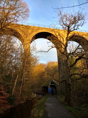
Camps Viaduct, Railway viaduct in West Lothian, Scotland.
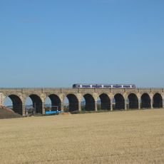
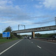
Camps Viaduct is a nine-span railway bridge in West Lothian that crosses the River Almond gorge and features brick arches supported by stone piers with a rough-faced finish. The structure measures about 108 meters in length and was built between 1865 and 1867 to carry mineral trains from quarries to an ironworks.
Built by J. & A. Granger, the viaduct connected quarries to an ironworks and carried mineral trains for several decades before closing in 1959. After the railway ceased operation, the structure was preserved as part of the landscape rather than demolished.
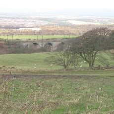
The structure stands as a landmark where walkers and cyclists pass on the former railway route, creating a direct link to the industrial past. People today use this path to move through the valley, connecting them to the era when trains carried minerals through this landscape.
The viaduct is now part of a walking and cycling route and is easily accessible on foot within a public country park. Visitors should wear sturdy footwear as the path conditions vary with the seasons and the ground can be uneven in places.
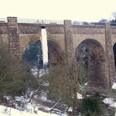
A serious railway accident in 1880 caused significant damage when loaded wagons derailed and fell from the high structure, requiring extensive repairs that took months to complete. This incident remains largely forgotten by visitors today, even though it shows how the Victorian engineers built the viaduct to survive such impacts.
The community of curious travelers
AroundUs brings together thousands of curated places, local tips, and hidden gems, enriched daily by 60,000 contributors worldwide.