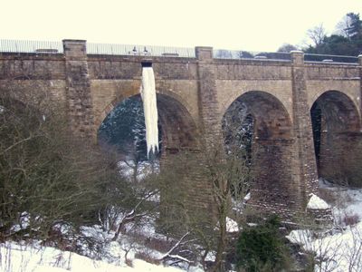
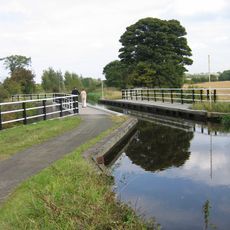
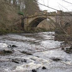
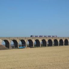
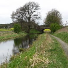
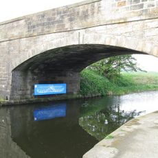
Almond Aqueduct, Stone navigable aqueduct in Kirkliston, Scotland
The Almond Aqueduct is a stone bridge carrying the Union Canal across the River Almond using an iron trough system. The structure combines masonry construction with an integrated channel to transport water safely over the valley below.
Hugh Baird designed the structure with advice from Thomas Telford, and it was completed in 1822. The aqueduct was built as part of the Union Canal project to overcome the river crossing challenge.
The structure received Category A listing status in 1971, marking its recognition as one of Scotland's most important architectural and engineering achievements.
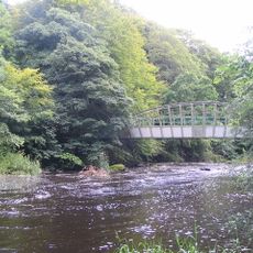
Access is available through a vehicle track and a towpath alongside the Union Canal, which connects to wider walking and cycling paths. The area is easy to navigate for visitors of different fitness levels interested in canal walks.
The aqueduct features an innovative iron trough system embedded within the stonework, an engineering solution that became influential for later canal construction projects. This approach proved that iron could reliably contain water while reducing the weight demands on the masonry structure.
Location: City of Edinburgh
Location: Edinburgh
Location: Kirkliston
Inception: 1822
Part of: Union Canal, Fountainbridge to River Almond
GPS coordinates: 55.92030,-3.43398
Latest update: December 6, 2025 17:44
Jupiter Artland
1.7 km
Bonnington House
1.7 km
Hatton House
3.1 km
Newliston
3 km
Almondell and Calderwood Country Park
2.7 km
Newbridge chariot
2.5 km
Illieston Castle
750 m
Camps Viaduct
2.9 km
Newbridge Inn
2.7 km
Jupiter Artland
2.3 km
Huly Hill, cairn & stone circle SW of Newbridge roundabout
2.7 km
Bonnington Aqueduct
1.3 km
Almondell Bridge
2.4 km
Almond Valley Viaduct
1.7 km
Almondell Aqueduct
2.8 km
Broxburn Viaduct
1.9 km
Birdsmill railway bridge
655 m
Kirknewton Parish Church
3.6 km
Bridge No. 30, Niddry, Union Canal
3.7 km
Tormain Hill,cup & ring marked rocks 700m NE of Bonnington Mains
2.6 km
20 Main Street, Kirknewton
3.8 km
54 Main Street, Ratho
3.4 km
Bridge Inn, 27 Baird Road, Ratho, Union Canal
3.5 km
Lochend Farm, standing stone 100m WNW of
3 km
Depot And Bridge No. 23, Drumshoreland, Union Canal
2.2 km
Union Canal, Ratho, Baird Road, Bridge No. 15
3.5 km
Ratho, Baird Road, Ratho Parish Church And Lady's Well
3.4 km
Broxburn, West Main Street, St John Cantius And St Nicholas R C Church, Shrine
3 kmVisited this place? Tap the stars to rate it and share your experience / photos with the community! Try now! You can cancel it anytime.
Discover hidden gems everywhere you go!
From secret cafés to breathtaking viewpoints, skip the crowded tourist spots and find places that match your style. Our app makes it easy with voice search, smart filtering, route optimization, and insider tips from travelers worldwide. Download now for the complete mobile experience.
A unique approach to discovering new places❞
— Le Figaro
All the places worth exploring❞
— France Info
A tailor-made excursion in just a few clicks❞
— 20 Minutes