
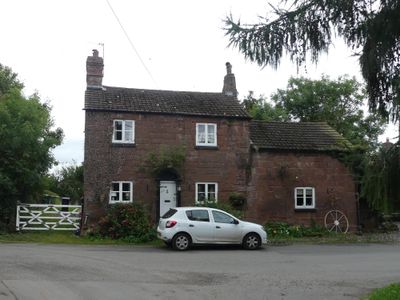
Stone Cottage and attached outbuilding and boundary wall
Stone Cottage and attached outbuilding and boundary wall, Grade II listed cottage in Shotwick, Cheshire West and Chester, Cheshire, UK

RAF Sealand
1.9 km
Shotwick Castle
1.8 km
Shotwick House
2.5 km
St Michael's Church, Shotwick
130 m
Shotwick Hall
213 m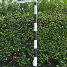
Footpath Guidepost At Junction With Parkgate Road
2.4 km
Gates, gatepiers and churchyard wall along north side of Shotwick Lane
149 m
Front garden walls and gatepiers at Shotwick Hall
212 m
Tombchest of Robert and Martha Ellison, 10 metres southwest of south corner of tower of Church of St Michael
160 m
Manor Farmhouse
23 m
L-shaped ranges of farm buildings 60 metres north of Shotwick Hall
284 m
Footpath Guidepost At Junction Of Pipers Lane Opposite The White House
1.9 km
Granary 30 metres east of Shotwicklodge Farmhouse
1.4 km
Sundial in the churchyard of St Michael
152 m
Greyhound Farmhouse
36 m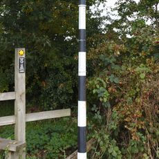
Footpath guidepost 50m east of Heath farmhouse
2.5 km
Tombchest of James Phillips, 2 metres south of the sundial in the Churchyard of St Michael
154 m
Former kitchen or bakehouse attached to north east corner of Shotwick Hall
231 m
Tombchest of Rev M Reay and 4 children, 8 metres south of south porch of Church of St Michael
145 m
Tombchest of John Nevett Bennett, 5 metres west of south porch of St Michael's Church
148 m
Tombchest of William Briscoe (died 1723) and others, 4 metres west of priest's door to St Michael's Church
136 m
Vicarage Farmhouse
79 m
Footpath Guidepost 5 Metres North Of Top Lodge
1.7 km
Barn 70 metres north east of Shotwicklodge Farmhouse
1.4 km
Tombchest of William Briscoe (died 1704) and others, 5 metres southwest of priest's door to St Michael's Church
136 m
North Pair of Aircraft Hangars
1.6 km
South Pair of Aircraft Hangars
1.7 km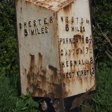
Milepost, Parkgate Road, Woodbank
2.2 kmReviews
Visited this place? Tap the stars to rate it and share your experience / photos with the community! Try now! You can cancel it anytime.
Discover hidden gems everywhere you go!
From secret cafés to breathtaking viewpoints, skip the crowded tourist spots and find places that match your style. Our app makes it easy with voice search, smart filtering, route optimization, and insider tips from travelers worldwide. Download now for the complete mobile experience.

A unique approach to discovering new places❞
— Le Figaro
All the places worth exploring❞
— France Info
A tailor-made excursion in just a few clicks❞
— 20 Minutes