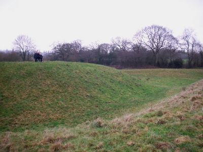
Shotwick Castle, Medieval motte-and-bailey castle in Shotwick Park, Great Britain.
Shotwick Castle is a Norman motte-and-bailey fortification in Shotwick Park that sits on a steep escarpment above the River Dee. The mound has a hexagonal shape at its summit, and beneath the turf lie the buried remains of a stone keep.
Hugh Lupus, Earl of Chester, built the fortification in 1093 to defend the border against Wales. It remained an important military position until peace with Wales was secured in 1281.
The shift from military stronghold to royal hunting ground after 1327 shows how noble purposes changed over time. People began to see the location as a retreat for sport rather than as a defensive need.
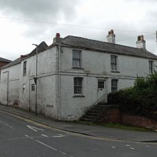
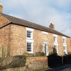
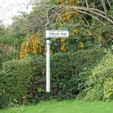
The site is difficult to reach and sits within private grounds with limited access. Visitors should inquire beforehand, as the remains blend naturally into the landscape and can be easy to miss.
Two steep watercourses flank the mound on its north and south sides and helped protect it. These channels were flooded by the river during high tides, creating an extra water barrier for defense.
Location: Shotwick Park
Location: Saughall and Shotwick Park
Inception: 1093
GPS coordinates: 53.22720,-2.97608
Latest update: December 8, 2025 21:07
RAF Sealand
1.6 km
Shotwick House
883 m
St Michael's Church, Shotwick
1.8 km
Shotwick Hall
2 km
All Saints Church, Great Saughall
1.4 km
St Bartholomew's Church, Sealand
1.6 km
Churchyard boundary wall, Church of St Bartholomew
1.7 km
The Old Swinging Gate Inn
1.2 km
Bridge Farmhouse
1.1 km
Gates, gatepiers and churchyard wall along north side of Shotwick Lane
1.8 km
Front garden walls and gatepiers at Shotwick Hall
2 km
Tombchest of Robert and Martha Ellison, 10 metres southwest of south corner of tower of Church of St Michael
1.8 km
Manor Farmhouse
1.8 km
Tombchest of John Nevett Bennett, 5 metres west of south porch of St Michael's Church
1.8 km
Former kitchen or bakehouse attached to north east corner of Shotwick Hall
2 km
Sundial in the churchyard of St Michael
1.8 km
Greyhound Farmhouse
1.8 km
Tombchest of James Phillips, 2 metres south of the sundial in the Churchyard of St Michael
1.8 km
Granary 30 metres east of Shotwicklodge Farmhouse
941 m
L-shaped ranges of farm buildings 60 metres north of Shotwick Hall
2 km
Tombchest of Rev M Reay and 4 children, 8 metres south of south porch of Church of St Michael
1.8 km
Aldersey House
1.2 km
Tombchest of William Briscoe (died 1723) and others, 4 metres west of priest's door to St Michael's Church
1.8 km
Vicarage Farmhouse
1.8 km
North Pair of Aircraft Hangars
1.5 km
Tombchest of William Briscoe (died 1704) and others, 5 metres southwest of priest's door to St Michael's Church
1.8 km
South Pair of Aircraft Hangars
1.6 km
Footpath guidepost 25 metres south west of Bridge Farmhouse
1.2 kmVisited this place? Tap the stars to rate it and share your experience / photos with the community! Try now! You can cancel it anytime.
Discover hidden gems everywhere you go!
From secret cafés to breathtaking viewpoints, skip the crowded tourist spots and find places that match your style. Our app makes it easy with voice search, smart filtering, route optimization, and insider tips from travelers worldwide. Download now for the complete mobile experience.
A unique approach to discovering new places❞
— Le Figaro
All the places worth exploring❞
— France Info
A tailor-made excursion in just a few clicks❞
— 20 Minutes